![](/images/other/stat-length.png)
Hoves : ses paysages ouverts et ses fermes anciennes
Commissariat général au Tourisme
Randonnées du CGT GUIDE+
![Longueur](/images/other/stat-length.png)
![Altitude max](https://static1.geolcdn.com/siteimages/upload/files/1508320355ic_sort_altitude_max_24dp.png)
![Dénivelé positif](https://static1.geolcdn.com/siteimages/upload/files/1508320355ic_sort_den_pos_24dp.png)
![Km-Effort](/images/other/stat-length.png)
![Altitude min](https://static1.geolcdn.com/siteimages/upload/files/1508320355ic_sort_altitude_min_24dp.png)
![Dénivelé négatif](https://static1.geolcdn.com/siteimages/upload/files/1508320355ic_sort_den_neg_24dp.png)
![Boucle](https://static1.geolcdn.com/siteimages/upload/files/16400158638029165_repeat_loop_refresh_sync_direction_icon.png)
![A pied](https://static1.geolcdn.com/sitytour/trail-icons/100.png)
2h35
Difficulté : Facile
![Scannez ce code QR pour ouvrir la randonnée dans l'application SityTrail](https://capi.geolives.com/qq0zvz2zws4bq2lad0pu/sitytour/trails/3081458/qr.png?size=200)
Application GPS de randonnée GRATUITE
À propos
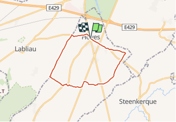
Randonnée A pied de 10,5 km à découvrir à Wallonie, Hainaut, Silly. Cette randonnée est proposée par Commissariat général au Tourisme.
Description
Randonnée créée par Wallonie Picarde (Antenne Tournai) .
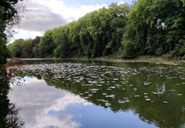
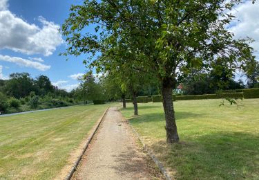
Réputée pour sa brasserie et ses produits de terroir, Silly est aussi reconnue pour son patrimoine rural et sa superbe campagne vallonnée.
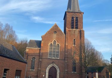
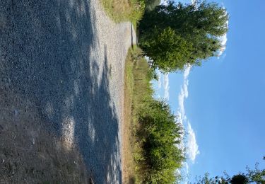
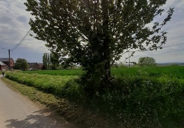
Exclusivement sur petites routes de campagne asphaltées, ce parcours fait la part belle aux paysages ouverts. Par beau temps, vous pouvez apercevoir les faubourgs de Bruxelles. De nombreuses chapelles et grosses fermes jalonnent le circuit, témoignant d’un passé pas si lointain où agriculture et croyances religieuses rythmaient la vie des campagnes.
Site web: https://organismes.tourismewallonie.be/details/ITB-02-000JSK&type=8/
Localisation
Commentaires
Randonnées à proximité
![Randonnée Marche Silly - Graty - bois d’Enghien - Graty - Photo](https://media.geolcdn.com/t/375/260/7271ef7d-a5b1-459f-b9eb-91dd19972deb.jpg&format=jpg&maxdim=2)
![Marche Marche](https://static1.geolcdn.com/sitytour/trail-icons/101.png)
Marche
![](/images/other/stat-length.png)
![](https://static1.geolcdn.com/siteimages/upload/files/16400158638029165_repeat_loop_refresh_sync_direction_icon.png)
![Randonnée Marche Enghien - Le Parc d’Enghien - Photo](https://media.geolcdn.com/t/375/260/ext.jpg?maxdim=2&url=https%3A%2F%2Fservices.sitytrail.com%2FGeolivesWS%2FDownloadMedia.ashx%3FTrailID%3D501132%26Media%3De0531d5f-1ab8-4612-bd80-c928c88660d4.jpg)
![Marche Marche](https://static1.geolcdn.com/sitytour/trail-icons/101.png)
Marche
![](/images/other/stat-length.png)
![](https://static1.geolcdn.com/siteimages/upload/files/16400158638029165_repeat_loop_refresh_sync_direction_icon.png)
![Randonnée A pied Enghien - Circuit du parc d'Enghien - Photo](https://media.geolcdn.com/t/375/260/ext.jpg?maxdim=2&url=https%3A%2F%2Fpivotmedia.tourismewallonie.be%2FANX-02-03VN-002T%2FANX-02-03VN-002T.jpg)
![A pied A pied](https://static1.geolcdn.com/sitytour/trail-icons/100.png)
A pied
![](/images/other/stat-length.png)
![](https://static1.geolcdn.com/siteimages/upload/files/16400158638029165_repeat_loop_refresh_sync_direction_icon.png)
![Randonnée Marche Enghien - Enghien 13,7 km - Photo](https://media.geolcdn.com/t/375/260/f899f7dd-351f-4b76-bec1-f27e50387409.jpg&format=jpg&maxdim=2)
![Marche Marche](https://static1.geolcdn.com/sitytour/trail-icons/101.png)
Marche
![](/images/other/stat-length.png)
![](https://static1.geolcdn.com/siteimages/upload/files/16400158638029165_repeat_loop_refresh_sync_direction_icon.png)
![Randonnée Marche Enghien - Le Parc d'Enghien et ses jardins exceptionnels - Photo](https://media.geolcdn.com/t/375/260/d8c2dbbe-d3f0-467e-98a7-de93a9d0d48a.jpg&format=jpg&maxdim=2)
![Marche Marche](https://static1.geolcdn.com/sitytour/trail-icons/101.png)
Marche
![](/images/other/stat-length.png)
![](https://static1.geolcdn.com/siteimages/upload/files/16400158638029165_repeat_loop_refresh_sync_direction_icon.png)
![Randonnée Marche Enghien - Enghien parc 14,5 km - Photo](https://media.geolcdn.com/t/375/260/0620becf-8313-41b0-9d67-de9eb7314d61.jpg&format=jpg&maxdim=2)
![Marche Marche](https://static1.geolcdn.com/sitytour/trail-icons/101.png)
Marche
![](/images/other/stat-length.png)
![](https://static1.geolcdn.com/siteimages/upload/files/16400158638029165_repeat_loop_refresh_sync_direction_icon.png)
![Randonnée A pied Soignies - balade du Pont Wazon - Photo](https://media.geolcdn.com/t/375/260/1e67ae7d-584c-41b3-a9df-b2b447d671d2.jpg&format=jpg&maxdim=2)
![A pied A pied](https://static1.geolcdn.com/sitytour/trail-icons/100.png)
A pied
![](/images/other/stat-length.png)
![](https://static1.geolcdn.com/siteimages/upload/files/16400158638029165_repeat_loop_refresh_sync_direction_icon.png)
![Randonnée Marche Enghien - Ligne 123 - Photo](https://media.geolcdn.com/t/375/260/ea55530d-e2f1-4c5a-a0c2-1a45a6f7aaf4.jpg&format=jpg&maxdim=2)
![Marche Marche](https://static1.geolcdn.com/sitytour/trail-icons/101.png)
![Randonnée Marche Enghien - Enghien Steenkerke 25 km - Photo](https://media.geolcdn.com/t/375/260/f0ea2609-7172-4745-9683-8c587faa69f8.jpg&format=jpg&maxdim=2)
![Marche Marche](https://static1.geolcdn.com/sitytour/trail-icons/101.png)
Marche
![](/images/other/stat-length.png)
![](https://static1.geolcdn.com/siteimages/upload/files/16400158638029165_repeat_loop_refresh_sync_direction_icon.png)