![](/images/other/stat-length.png)
![Randonnée A pied Froidchapelle - Petite promenade des Lacs - Photo](https://media.geolcdn.com/t/1900/400/ext.pjpeg?maxdim=2&url=https%3A%2F%2Fpivotmedia.tourismewallonie.be%2FOTH-A0-004D-0GR4%2FOTH-A0-004D-0GR4.jpg)
Petite promenade des Lacs
Commissariat général au Tourisme
Randonnées du CGT GUIDE+
![Longueur](/images/other/stat-length.png)
![Altitude max](https://static1.geolcdn.com/siteimages/upload/files/1508320355ic_sort_altitude_max_24dp.png)
![Dénivelé positif](https://static1.geolcdn.com/siteimages/upload/files/1508320355ic_sort_den_pos_24dp.png)
![Km-Effort](/images/other/stat-length.png)
![Altitude min](https://static1.geolcdn.com/siteimages/upload/files/1508320355ic_sort_altitude_min_24dp.png)
![Dénivelé négatif](https://static1.geolcdn.com/siteimages/upload/files/1508320355ic_sort_den_neg_24dp.png)
![Boucle](https://static1.geolcdn.com/siteimages/upload/files/16400158638029165_repeat_loop_refresh_sync_direction_icon.png)
![A pied](https://static1.geolcdn.com/sitytour/trail-icons/100.png)
2h47
Difficulté : Facile
![Scannez ce code QR pour ouvrir la randonnée dans l'application SityTrail](https://capi.geolives.com/qq0zvz2zws4bq2lad0pu/sitytour/trails/3080883/qr.png?size=200)
Application GPS de randonnée GRATUITE
À propos
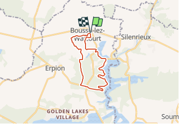
Randonnée A pied de 10,5 km à découvrir à Wallonie, Hainaut, Froidchapelle. Cette randonnée est proposée par Commissariat général au Tourisme.
Description
Randonnée créée par Pays des Lacs.
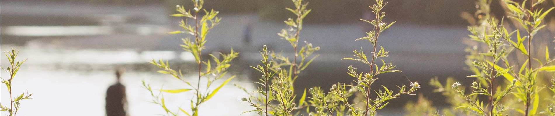
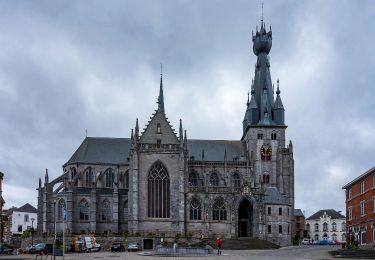
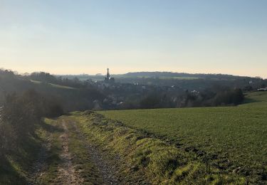
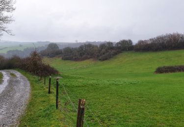
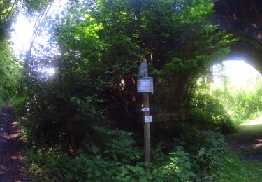
Dans les petites rues du village de Boussu-lez-Walcourt, vous remarquerez à l'intérieur d'une propriété emmuraillée de la rue du Paradis, un château composé d'un long corps de bâtiment groupant un logis, d'anciennes étables, et un ancien charril central surmonté d'une importante tour-colombier en briques. Quelque peu après le départ, vous pourrez déjà faire une halte sur la zone de délassement aménagée sur le site de l'ancienne carrière et, pourquoi pas, y organiser un pique-nique ou un barbecue en famille. Nous vous invitons à poursuivre la promenade au gré des sentiers asphaltés qui ceinturent les lacs et en profiter pour admirer les magnifiques vues qui vous sont offertes sur les lacs de Féronval et de l'eau d'Heure. Avant de retourner vers le village, et pour clôturer cette promenade en beauté, profitez de votre passage devant la Ruchette pour y déguster un petit verre d’Hydromel.
Site web: https://organismes.tourismewallonie.be/details/ITB-01-000AC0&type=8/
Localisation
Commentaires
Randonnées à proximité
![Randonnée Marche Walcourt - RL-GG-17_Walcourt_Philippeville - Photo](https://media.geolcdn.com/t/375/260/0ead20f8-4d85-41da-a61f-64e7e946f31c.jpg&format=jpg&maxdim=2)
![Marche Marche](https://static1.geolcdn.com/sitytour/trail-icons/101.png)
Marche
![](/images/other/stat-length.png)
![](https://static1.geolcdn.com/siteimages/upload/files/16400158638029165_repeat_loop_refresh_sync_direction_icon.png)
![Randonnée Marche Cerfontaine - La balade du Ballonnet - Photo](https://media.geolcdn.com/t/375/260/ext.jpg?maxdim=2&url=https%3A%2F%2Fservices.sitytrail.com%2FGeolivesWS%2FDownloadMedia.ashx%3FTrailID%3D661211%26Media%3Df8ef018a-8a4e-43e9-8982-4175f97a626c.jpg)
![Marche Marche](https://static1.geolcdn.com/sitytour/trail-icons/101.png)
Marche
![](/images/other/stat-length.png)
![](https://static1.geolcdn.com/siteimages/upload/files/16400158638029165_repeat_loop_refresh_sync_direction_icon.png)
![Randonnée Marche Froidchapelle - Du Lac de l'Eau d'Heure au Lac du Ry Jaune - Photo](https://media.geolcdn.com/t/375/260/ext.jpg?maxdim=2&url=https%3A%2F%2Fservices.sitytrail.com%2FGeolivesWS%2FDownloadMedia.ashx%3FTrailID%3D379812%26Media%3Dd36c7a2e-70fd-44ad-a77a-7190af56fd8b.JPG)
![Marche Marche](https://static1.geolcdn.com/sitytour/trail-icons/101.png)
Marche
![](/images/other/stat-length.png)
![](https://static1.geolcdn.com/siteimages/upload/files/16400158638029165_repeat_loop_refresh_sync_direction_icon.png)
![Randonnée Marche Froidchapelle - Marche ADEPS à Boussu-lez-Walcourt - Photo](https://media.geolcdn.com/t/375/260/ext.jpg?maxdim=2&url=https%3A%2F%2Fservices.sitytrail.com%2FGeolivesWS%2FDownloadMedia.ashx%3FTrailID%3D251033%26Media%3D06de1a7a-a6bd-4c9d-b2ff-1e6fcd4fa4cd.JPG)
![Marche Marche](https://static1.geolcdn.com/sitytour/trail-icons/101.png)
Marche
![](/images/other/stat-length.png)
![](https://static1.geolcdn.com/siteimages/upload/files/16400158638029165_repeat_loop_refresh_sync_direction_icon.png)
![Randonnée Marche Walcourt - Randonnée autour de Walcourt - Photo](https://media.geolcdn.com/t/375/260/a37238d0-f00c-4fff-8a56-6d6b6e8a9220.jpg&format=jpg&maxdim=2)
![Marche Marche](https://static1.geolcdn.com/sitytour/trail-icons/101.png)
Marche
![](/images/other/stat-length.png)
![](https://static1.geolcdn.com/siteimages/upload/files/16400158638029165_repeat_loop_refresh_sync_direction_icon.png)
![Randonnée Marche Froidchapelle - Le Tour du lac de la Plate Taille - Photo](https://media.geolcdn.com/t/375/260/ext.jpg?maxdim=2&url=https%3A%2F%2Fstatic1.geolcdn.com%2Fsiteimages%2Fupload%2Ffiles%2F1553511878bg_sport_marche.png)
![Marche Marche](https://static1.geolcdn.com/sitytour/trail-icons/101.png)
Marche
![](/images/other/stat-length.png)
![](https://static1.geolcdn.com/siteimages/upload/files/16400158638029165_repeat_loop_refresh_sync_direction_icon.png)
![Randonnée Marche Froidchapelle - Du lac de l'Eau d'Heure vers la Plate Taille - Photo](https://media.geolcdn.com/t/375/260/ext.jpg?maxdim=2&url=https%3A%2F%2Fstatic1.geolcdn.com%2Fsiteimages%2Fupload%2Ffiles%2F1553511878bg_sport_marche.png)
![Marche Marche](https://static1.geolcdn.com/sitytour/trail-icons/101.png)
Marche
![](/images/other/stat-length.png)
![](https://static1.geolcdn.com/siteimages/upload/files/16400158638029165_repeat_loop_refresh_sync_direction_icon.png)
![Randonnée Marche Walcourt - Balade à Walcourt - Photo](https://media.geolcdn.com/t/375/260/cc15b3fa-e158-4d51-b096-71bef2cb45f1.jpeg&format=jpg&maxdim=2)
![Marche Marche](https://static1.geolcdn.com/sitytour/trail-icons/101.png)
Marche
![](/images/other/stat-length.png)
![](https://static1.geolcdn.com/siteimages/upload/files/16400158638029165_repeat_loop_refresh_sync_direction_icon.png)
![V.T.T. V.T.T.](https://static1.geolcdn.com/sitytour/trail-icons/202.png)
V.T.T.
![](/images/other/stat-length.png)
![](https://static1.geolcdn.com/siteimages/upload/files/16400158638029165_repeat_loop_refresh_sync_direction_icon.png)