![](/images/other/stat-length.png)
Ferrières- 7- Promenade des tailles à Ville
Commissariat général au Tourisme
Randonnées du CGT GUIDE+
![Longueur](/images/other/stat-length.png)
Longueur
6,7 km
![Altitude max](https://static1.geolcdn.com/siteimages/upload/files/1508320355ic_sort_altitude_max_24dp.png)
Altitude max
344 m
![Dénivelé positif](https://static1.geolcdn.com/siteimages/upload/files/1508320355ic_sort_den_pos_24dp.png)
Dénivelé positif
113 m
![Km-Effort](/images/other/stat-length.png)
Km-Effort
8,2 km
![Altitude min](https://static1.geolcdn.com/siteimages/upload/files/1508320355ic_sort_altitude_min_24dp.png)
Altitude min
262 m
![Dénivelé négatif](https://static1.geolcdn.com/siteimages/upload/files/1508320355ic_sort_den_neg_24dp.png)
Dénivelé négatif
112 m
![Boucle](https://static1.geolcdn.com/siteimages/upload/files/16400158638029165_repeat_loop_refresh_sync_direction_icon.png)
Boucle
Oui
Date de création :
2022-02-08 11:29:33.436
Dernière modification :
2022-02-21 10:10:58.088
![A pied](https://static1.geolcdn.com/sitytour/trail-icons/100.png)
1h52
Difficulté : Facile
![Scannez ce code QR pour ouvrir la randonnée dans l'application SityTrail](https://capi.geolives.com/qq0zvz2zws4bq2lad0pu/sitytour/trails/3080855/qr.png?size=200)
Application GPS de randonnée GRATUITE
À propos
Randonnée A pied de 6,7 km à découvrir à Wallonie, Liège, Ferrières. Cette randonnée est proposée par Commissariat général au Tourisme.
Description
Randonnée créée par Ourthe Vesdre Amblève.
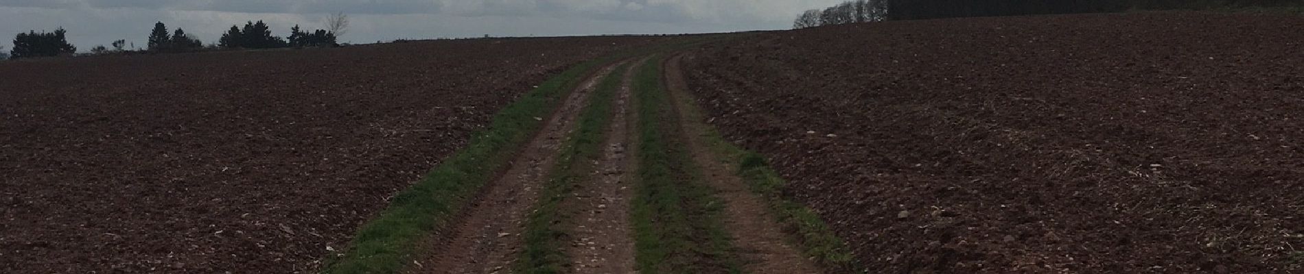
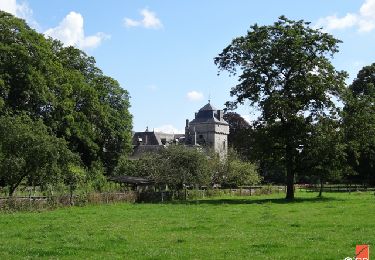
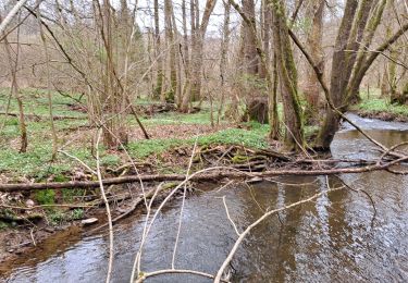
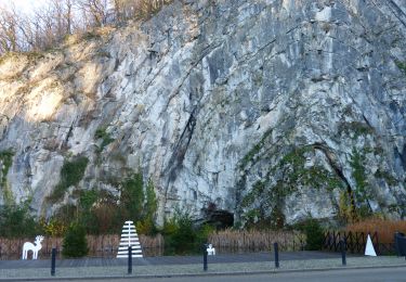
Un parcours agréable, le long des champs et bois, qui offre de beaux panoramas de la région.
Site web: https://ovatourisme.be/details/ITB-01-000ABC&type=8/
Localisation
Pays :
Belgique
Région :
Wallonie
Département/Province :
Liège
Commune :
Ferrières
Localité :
Unknown
Départ:(Dec)
Départ:(UTM)
683577 ; 5588195 (31U) N.
Commentaires
Randonnées à proximité
![Randonnée Marche Hamoir - RB-Lg-19_Hamoir - Photo](https://media.geolcdn.com/t/375/260/ext.jpg?maxdim=2&url=https%3A%2F%2Fservices.sitytrail.com%2FGeolivesWS%2FDownloadMedia.ashx%3FTrailID%3D400602%26Media%3Dc0745639-8ded-479e-9345-a8c68cd61e6a.jpg)
![Marche Marche](https://static1.geolcdn.com/sitytour/trail-icons/101.png)
RB-Lg-19_Hamoir
Marche
Très difficile
(6)
Hamoir,
Wallonie,
Liège,
Belgique
![](/images/other/stat-length.png)
22 km | 28 km-effort
6h 18min
![](https://static1.geolcdn.com/siteimages/upload/files/16400158638029165_repeat_loop_refresh_sync_direction_icon.png)
Oui
![Randonnée Marche Ferrières - Rouge-Minière. Natura 2000, des sites qui valent le détour ! Lg 3 - Photo](https://media.geolcdn.com/t/375/260/ext.jpg?maxdim=2&url=https%3A%2F%2Fservices.sitytrail.com%2FGeolivesWS%2FDownloadMedia.ashx%3FTrailID%3D142641%26Media%3Dc08233b4-27a6-486a-be6b-e1cb0ee623d1.JPG)
![Marche Marche](https://static1.geolcdn.com/sitytour/trail-icons/101.png)
Rouge-Minière. Natura 2000, des sites qui valent le détour ! Lg 3
Marche
Facile
(17)
Ferrières,
Wallonie,
Liège,
Belgique
![](/images/other/stat-length.png)
6,8 km | 8,9 km-effort
Inconnu
![](https://static1.geolcdn.com/siteimages/upload/files/16400158638029165_repeat_loop_refresh_sync_direction_icon.png)
Oui
![Randonnée Marche Durbuy - Balade à Bomal sur Ourthe - Photo](https://media.geolcdn.com/t/375/260/5741dd62-7ff1-40d2-b9aa-0e0aed97da9a.jpg&format=jpg&maxdim=2)
![Marche Marche](https://static1.geolcdn.com/sitytour/trail-icons/101.png)
Balade à Bomal sur Ourthe
Marche
Facile
(4)
Durbuy,
Wallonie,
Luxembourg,
Belgique
![](/images/other/stat-length.png)
4,4 km | 5,9 km-effort
1h 20min
![](https://static1.geolcdn.com/siteimages/upload/files/16400158638029165_repeat_loop_refresh_sync_direction_icon.png)
Oui
![Randonnée Marche Hamoir - HAMOIR (Vallée du Neblon) - Photo](https://media.geolcdn.com/t/375/260/bd133f9f-5595-47e8-88c0-4d09e83d3ba8.jpg&format=jpg&maxdim=2)
![Marche Marche](https://static1.geolcdn.com/sitytour/trail-icons/101.png)
HAMOIR (Vallée du Neblon)
Marche
Moyen
(1)
Hamoir,
Wallonie,
Liège,
Belgique
![](/images/other/stat-length.png)
8,6 km | 11,4 km-effort
2h 28min
![](https://static1.geolcdn.com/siteimages/upload/files/16400158638029165_repeat_loop_refresh_sync_direction_icon.png)
Oui
![Randonnée Marche Ferrières - RL-GG-15_Sy_Barvaux - Photo](https://media.geolcdn.com/t/375/260/4cf6fb9a-77d5-4c51-bb72-4b6ca6a27202.jpg&format=jpg&maxdim=2)
![Marche Marche](https://static1.geolcdn.com/sitytour/trail-icons/101.png)
RL-GG-15_Sy_Barvaux
Marche
Très difficile
(1)
Ferrières,
Wallonie,
Liège,
Belgique
![](/images/other/stat-length.png)
18,9 km | 26 km-effort
5h 58min
![](https://static1.geolcdn.com/siteimages/upload/files/16400158638029165_repeat_loop_refresh_sync_direction_icon.png)
Non
![Randonnée Marche Ferrières - Marche ADEPS BURNONTIGE (Ferrieres) 10/04/33 - Photo](https://media.geolcdn.com/t/375/260/6e9d890b-6b68-45d8-aaec-5de6224210eb.jpg&format=jpg&maxdim=2)
![Marche Marche](https://static1.geolcdn.com/sitytour/trail-icons/101.png)
Marche ADEPS BURNONTIGE (Ferrieres) 10/04/33
Marche
Moyen
(1)
Ferrières,
Wallonie,
Liège,
Belgique
![](/images/other/stat-length.png)
15,4 km | 20 km-effort
3h 2min
![](https://static1.geolcdn.com/siteimages/upload/files/16400158638029165_repeat_loop_refresh_sync_direction_icon.png)
Oui
![Marche Marche](https://static1.geolcdn.com/sitytour/trail-icons/101.png)
RL-GG-36_Bomal_Marloie
Marche
Moyen
(2)
Durbuy,
Wallonie,
Luxembourg,
Belgique
![](/images/other/stat-length.png)
43 km | 52 km-effort
11h 51min
![](https://static1.geolcdn.com/siteimages/upload/files/16400158638029165_repeat_loop_refresh_sync_direction_icon.png)
Non
![Randonnée Marche Hamoir - Hamoir - Sy - Les Crêtes - Photo](https://media.geolcdn.com/t/375/260/2cd3e10e-e069-4884-9433-cbc8b49962aa.jpg&format=jpg&maxdim=2)
![Marche Marche](https://static1.geolcdn.com/sitytour/trail-icons/101.png)
Hamoir - Sy - Les Crêtes
Marche
Moyen
(1)
Hamoir,
Wallonie,
Liège,
Belgique
![](/images/other/stat-length.png)
13,1 km | 17,2 km-effort
3h 17min
![](https://static1.geolcdn.com/siteimages/upload/files/16400158638029165_repeat_loop_refresh_sync_direction_icon.png)
Oui
![Randonnée V.T.T. Ferrières - st-roch - Photo](https://media.geolcdn.com/t/375/260/ext.jpg?maxdim=2&url=https%3A%2F%2Fservices.sitytrail.com%2FGeolivesWS%2FDownloadMedia.ashx%3FTrailID%3D639793%26Media%3Dfix__20161002141250.jpg)
![V.T.T. V.T.T.](https://static1.geolcdn.com/sitytour/trail-icons/202.png)