![](/images/other/stat-length.png)
![Randonnée V.T.T. Havelange - Balade Tour du Grand Tige - Photo](https://media.geolcdn.com/t/1900/400/ext.pjpeg?maxdim=2&url=https%3A%2F%2Fpivotmedia.tourismewallonie.be%2FOTH-A0-001Q-0YLJ%2FOTH-A0-001Q-0YLJ.jpg)
Balade Tour du Grand Tige
Commissariat général au Tourisme
Randonnées du CGT GUIDE+
![Longueur](/images/other/stat-length.png)
Longueur
11,5 km
![Altitude max](https://static1.geolcdn.com/siteimages/upload/files/1508320355ic_sort_altitude_max_24dp.png)
Altitude max
335 m
![Dénivelé positif](https://static1.geolcdn.com/siteimages/upload/files/1508320355ic_sort_den_pos_24dp.png)
Dénivelé positif
184 m
![Km-Effort](/images/other/stat-length.png)
Km-Effort
14 km
![Altitude min](https://static1.geolcdn.com/siteimages/upload/files/1508320355ic_sort_altitude_min_24dp.png)
Altitude min
276 m
![Dénivelé négatif](https://static1.geolcdn.com/siteimages/upload/files/1508320355ic_sort_den_neg_24dp.png)
Dénivelé négatif
185 m
![Boucle](https://static1.geolcdn.com/siteimages/upload/files/16400158638029165_repeat_loop_refresh_sync_direction_icon.png)
Boucle
Oui
Date de création :
2022-02-08 11:26:56.513
Dernière modification :
2022-02-21 10:08:01.368
![V.T.T.](https://static1.geolcdn.com/sitytour/trail-icons/202.png)
58m
Difficulté : Facile
![Scannez ce code QR pour ouvrir la randonnée dans l'application SityTrail](https://capi.geolives.com/qq0zvz2zws4bq2lad0pu/sitytour/trails/3080600/qr.png?size=200)
Application GPS de randonnée GRATUITE
À propos
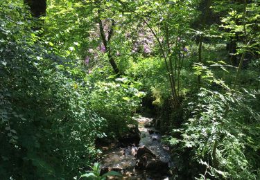
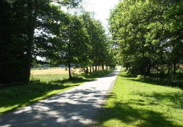
Randonnée V.T.T. de 11,5 km à découvrir à Wallonie, Namur, Havelange. Cette randonnée est proposée par Commissariat général au Tourisme.
Description
Randonnée créée par Condroz-Famenne.
Site web: https://www.valleesdessaveurs.be/details/LOD-A0-001Q-0OJO&type=8/
Localisation
Pays :
Belgique
Région :
Wallonie
Département/Province :
Namur
Commune :
Havelange
Localité :
Unknown
Départ:(Dec)
Départ:(UTM)
659495 ; 5578806 (31U) N.
Commentaires
Randonnées à proximité
![Randonnée Marche Hamois - HAMOIS- Scy (Mohiville)- Promenade du Berceau du Bocq - Photo](https://media.geolcdn.com/t/375/260/ext.jpg?maxdim=2&url=https%3A%2F%2Fservices.sitytrail.com%2FGeolivesWS%2FDownloadMedia.ashx%3FTrailID%3D250701%26Media%3D514f4968-57f7-4b3e-aef8-c121b3f2a3eb.jpg)
![Marche Marche](https://static1.geolcdn.com/sitytour/trail-icons/101.png)
HAMOIS- Scy (Mohiville)- Promenade du Berceau du Bocq
Marche
Facile
(12)
Hamois,
Wallonie,
Namur,
Belgique
![](/images/other/stat-length.png)
7,9 km | 9,8 km-effort
2h 4min
![](https://static1.geolcdn.com/siteimages/upload/files/16400158638029165_repeat_loop_refresh_sync_direction_icon.png)
Oui
![Randonnée Marche Havelange - HAVELANGE- Failon- Promenade du Chêne au Gibet - Photo](https://media.geolcdn.com/t/375/260/ext.jpg?maxdim=2&url=https%3A%2F%2Fservices.sitytrail.com%2FGeolivesWS%2FDownloadMedia.ashx%3FTrailID%3D250680%26Media%3D5b284e0f-4186-471a-9bbe-220cdacf1b74.jpg)
![Marche Marche](https://static1.geolcdn.com/sitytour/trail-icons/101.png)
HAVELANGE- Failon- Promenade du Chêne au Gibet
Marche
Très facile
(5)
Havelange,
Wallonie,
Namur,
Belgique
![](/images/other/stat-length.png)
15,8 km | 20 km-effort
4h 17min
![](https://static1.geolcdn.com/siteimages/upload/files/16400158638029165_repeat_loop_refresh_sync_direction_icon.png)
Oui
![Randonnée Marche Hamois - HAMOIS- Hamois- Promenade du Tige al Creûjette - Photo](https://media.geolcdn.com/t/375/260/ext.jpg?maxdim=2&url=https%3A%2F%2Fservices.sitytrail.com%2FGeolivesWS%2FDownloadMedia.ashx%3FTrailID%3D250668%26Media%3D2dcd42b4-7825-4c6c-b964-62af389c92a8.jpg)
![Marche Marche](https://static1.geolcdn.com/sitytour/trail-icons/101.png)
HAMOIS- Hamois- Promenade du Tige al Creûjette
Marche
Très facile
(3)
Hamois,
Wallonie,
Namur,
Belgique
![](/images/other/stat-length.png)
5,2 km | 6,3 km-effort
1h 22min
![](https://static1.geolcdn.com/siteimages/upload/files/16400158638029165_repeat_loop_refresh_sync_direction_icon.png)
Oui
![Randonnée Marche Hamois - HAMOIS- Achet- Promenade du Chapitre Saint-Paul en Tourlouette - Photo](https://media.geolcdn.com/t/375/260/ext.jpg?maxdim=2&url=https%3A%2F%2Fservices.sitytrail.com%2FGeolivesWS%2FDownloadMedia.ashx%3FTrailID%3D250667%26Media%3D711a5ab0-f1b5-4358-8e7d-16aef65342fb.jpg)
![Marche Marche](https://static1.geolcdn.com/sitytour/trail-icons/101.png)
HAMOIS- Achet- Promenade du Chapitre Saint-Paul en Tourlouette
Marche
Facile
(2)
Hamois,
Wallonie,
Namur,
Belgique
![](/images/other/stat-length.png)
7,3 km | 9 km-effort
1h 52min
![](https://static1.geolcdn.com/siteimages/upload/files/16400158638029165_repeat_loop_refresh_sync_direction_icon.png)
Oui
![Randonnée Marche Havelange - FAILON (Château-Ferme de Somal) - Photo](https://media.geolcdn.com/t/375/260/ext.jpg?maxdim=2&url=https%3A%2F%2Fservices.sitytrail.com%2FGeolivesWS%2FDownloadMedia.ashx%3FTrailID%3D1004822%26Media%3Dfix__20180712160140.jpg)
![Marche Marche](https://static1.geolcdn.com/sitytour/trail-icons/101.png)
FAILON (Château-Ferme de Somal)
Marche
Facile
(3)
Havelange,
Wallonie,
Namur,
Belgique
![](/images/other/stat-length.png)
10,7 km | 14,2 km-effort
3h 1min
![](https://static1.geolcdn.com/siteimages/upload/files/16400158638029165_repeat_loop_refresh_sync_direction_icon.png)
Oui
![Randonnée Marche Havelange - Bois, Rivière et champs - Photo](https://media.geolcdn.com/t/375/260/71798de8-0a71-47ba-81bf-636f8514053b.jpg&format=jpg&maxdim=2)
![Marche Marche](https://static1.geolcdn.com/sitytour/trail-icons/101.png)
Bois, Rivière et champs
Marche
Moyen
(3)
Havelange,
Wallonie,
Namur,
Belgique
![](/images/other/stat-length.png)
9,3 km | 12,2 km-effort
3h 8min
![](https://static1.geolcdn.com/siteimages/upload/files/16400158638029165_repeat_loop_refresh_sync_direction_icon.png)
Oui
![Randonnée Marche Havelange - HAVELANGE- Porcheresse- Promenade du Champ du Bois - Photo](https://media.geolcdn.com/t/375/260/ext.jpg?maxdim=2&url=https%3A%2F%2Fservices.sitytrail.com%2FGeolivesWS%2FDownloadMedia.ashx%3FTrailID%3D250669%26Media%3D99c045bc-d8a2-408c-89d7-93e4a625dfbf.jpg)
![Marche Marche](https://static1.geolcdn.com/sitytour/trail-icons/101.png)
HAVELANGE- Porcheresse- Promenade du Champ du Bois
Marche
Facile
(3)
Havelange,
Wallonie,
Namur,
Belgique
![](/images/other/stat-length.png)
14,8 km | 18,5 km-effort
3h 57min
![](https://static1.geolcdn.com/siteimages/upload/files/16400158638029165_repeat_loop_refresh_sync_direction_icon.png)
Oui
![Randonnée Marche Hamois - La Promenade du Berceau du Bocq - Photo](https://media.geolcdn.com/t/375/260/c1ecebef-4dce-4991-920f-3cf80ab64a6d.jpg&format=jpg&maxdim=2)
![Marche Marche](https://static1.geolcdn.com/sitytour/trail-icons/101.png)
La Promenade du Berceau du Bocq
Marche
Moyen
(1)
Hamois,
Wallonie,
Namur,
Belgique
![](/images/other/stat-length.png)
9,3 km | 11,2 km-effort
4h 41min
![](https://static1.geolcdn.com/siteimages/upload/files/16400158638029165_repeat_loop_refresh_sync_direction_icon.png)
Oui
![Randonnée A pied Havelange - Porcheresse: Promenade du Bois de Porcheresse - Photo](https://media.geolcdn.com/t/375/260/ext.jpg?maxdim=2&url=https%3A%2F%2Fpivotmedia.tourismewallonie.be%2FOTH-A0-0035-12HV%2FOTH-A0-0035-12HV.jpg)
![A pied A pied](https://static1.geolcdn.com/sitytour/trail-icons/100.png)
Porcheresse: Promenade du Bois de Porcheresse
A pied
Facile
(2)
Havelange,
Wallonie,
Namur,
Belgique
![](/images/other/stat-length.png)
7,2 km | 8,8 km-effort
2h 0min
![](https://static1.geolcdn.com/siteimages/upload/files/16400158638029165_repeat_loop_refresh_sync_direction_icon.png)
Oui