![](/images/other/stat-length.png)
![Randonnée V.T.T. Neufchâteau - Circuit des Gruserelles - Photo](https://media.geolcdn.com/t/1900/400/ext.pjpeg?maxdim=2&url=https%3A%2F%2Fpivotmedia.tourismewallonie.be%2FOTH-A0-005G-0KAJ%2FOTH-A0-005G-0KAJ.jpg)
Circuit des Gruserelles
Commissariat général au Tourisme
Randonnées du CGT GUIDE+
![Longueur](/images/other/stat-length.png)
![Altitude max](https://static1.geolcdn.com/siteimages/upload/files/1508320355ic_sort_altitude_max_24dp.png)
![Dénivelé positif](https://static1.geolcdn.com/siteimages/upload/files/1508320355ic_sort_den_pos_24dp.png)
![Km-Effort](/images/other/stat-length.png)
![Altitude min](https://static1.geolcdn.com/siteimages/upload/files/1508320355ic_sort_altitude_min_24dp.png)
![Dénivelé négatif](https://static1.geolcdn.com/siteimages/upload/files/1508320355ic_sort_den_neg_24dp.png)
![Boucle](https://static1.geolcdn.com/siteimages/upload/files/16400158638029165_repeat_loop_refresh_sync_direction_icon.png)
![V.T.T.](https://static1.geolcdn.com/sitytour/trail-icons/202.png)
2h47
Difficulté : Difficile
![Scannez ce code QR pour ouvrir la randonnée dans l'application SityTrail](https://capi.geolives.com/qq0zvz2zws4bq2lad0pu/sitytour/trails/3080431/qr.png?size=200)
Application GPS de randonnée GRATUITE
À propos
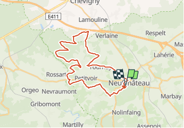
Randonnée V.T.T. de 32 km à découvrir à Wallonie, Luxembourg, Neufchâteau. Cette randonnée est proposée par Commissariat général au Tourisme.
Description
Randonnée créée par Haute-Süre Forêt d'Anlier en Ardenne.
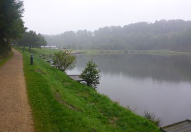
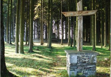
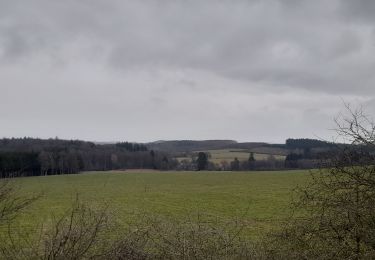
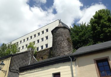
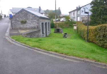
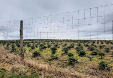
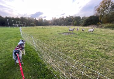
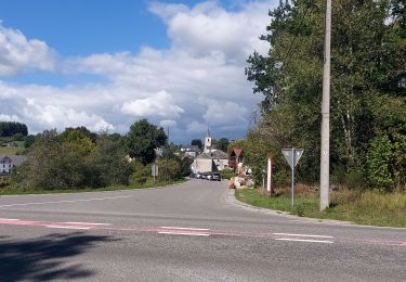
Au départ de la Vallée du lac, cette randonnées VTT vous invite à découvrir une partie du territoire chestrolais (= de Neufchâteau). Vous passez du Moulin Klepper à l’Etang Bergh de Neufchâteau pour arriver à la ferme de l’Abreuvoir de Tournay où Simon le boulanger vous propose des pains à l’épeautre. Ensuite, vous contournez la village de Grandvoir, ce dernier est connu pour son château, sa brasserie et la ferme du Grand enclos (cooperative et magasin à la ferme). Vous poursuivez votre randonnée avec un parcours “waouh” dans la forêt d’Huqueni. En fin de promenade vous traversez le village de Petitvoir avec son Musée du téléphone et vous terminez de retour au point de départ.
Site web: https://organismes.tourismewallonie.be/details/ITB-01-000AOX&type=8/
Localisation
Commentaires
Randonnées à proximité
![Marche Marche](https://static1.geolcdn.com/sitytour/trail-icons/101.png)
Marche
![](/images/other/stat-length.png)
![](https://static1.geolcdn.com/siteimages/upload/files/16400158638029165_repeat_loop_refresh_sync_direction_icon.png)
![Marche Marche](https://static1.geolcdn.com/sitytour/trail-icons/101.png)
Marche
![](/images/other/stat-length.png)
![](https://static1.geolcdn.com/siteimages/upload/files/16400158638029165_repeat_loop_refresh_sync_direction_icon.png)
![Randonnée Marche Neufchâteau - Le Sentier du Bois d'Ospôt - Photo](https://media.geolcdn.com/t/375/260/ext.jpg?maxdim=2&url=https%3A%2F%2Fservices.sitytrail.com%2FGeolivesWS%2FDownloadMedia.ashx%3FTrailID%3D314177%26Media%3Da3f0c943-b6aa-42ba-a976-375fc630bff4.jpg)
![Marche Marche](https://static1.geolcdn.com/sitytour/trail-icons/101.png)
Marche
![](/images/other/stat-length.png)
![](https://static1.geolcdn.com/siteimages/upload/files/16400158638029165_repeat_loop_refresh_sync_direction_icon.png)
![Randonnée Marche Neufchâteau - Marche ADEPS 8K500?? à (Namoussart) Neufchateau - Photo](https://media.geolcdn.com/t/375/260/394ab4a5-c5a6-43e2-b98b-c33bbaf2a33e.jpg&format=jpg&maxdim=2)
![Marche Marche](https://static1.geolcdn.com/sitytour/trail-icons/101.png)
Marche
![](/images/other/stat-length.png)
![](https://static1.geolcdn.com/siteimages/upload/files/16400158638029165_repeat_loop_refresh_sync_direction_icon.png)
![Randonnée A pied Neufchâteau - Promenade des Vannettes - Photo](https://media.geolcdn.com/t/375/260/c94cab10-49b6-4e98-8b22-803163741678.jpeg&format=jpg&maxdim=2)
![A pied A pied](https://static1.geolcdn.com/sitytour/trail-icons/100.png)
A pied
![](/images/other/stat-length.png)
![](https://static1.geolcdn.com/siteimages/upload/files/16400158638029165_repeat_loop_refresh_sync_direction_icon.png)
![Marche Marche](https://static1.geolcdn.com/sitytour/trail-icons/101.png)
Marche
![](/images/other/stat-length.png)
![](https://static1.geolcdn.com/siteimages/upload/files/16400158638029165_repeat_loop_refresh_sync_direction_icon.png)
![Randonnée Marche Neufchâteau - marche adeps Tournay - Photo](https://media.geolcdn.com/t/375/260/35c4aa2c-8320-436a-a267-b854bb22564b.jpg&format=jpg&maxdim=2)
![Marche Marche](https://static1.geolcdn.com/sitytour/trail-icons/101.png)
Marche
![](/images/other/stat-length.png)
![](https://static1.geolcdn.com/siteimages/upload/files/16400158638029165_repeat_loop_refresh_sync_direction_icon.png)
![Randonnée Marche Neufchâteau - Molinfaing observatoire - Photo](https://media.geolcdn.com/t/375/260/b919928e-52d2-473c-aa25-425059cdb9d1.jpg&format=jpg&maxdim=2)
![Marche Marche](https://static1.geolcdn.com/sitytour/trail-icons/101.png)
Marche
![](/images/other/stat-length.png)
![](https://static1.geolcdn.com/siteimages/upload/files/16400158638029165_repeat_loop_refresh_sync_direction_icon.png)
![Randonnée Marche Herbeumont - Straimont 200922 - Photo](https://media.geolcdn.com/t/375/260/b3c2a5a0-1362-451a-a26f-fc2bc2d9246e.jpg&format=jpg&maxdim=2)
![Marche Marche](https://static1.geolcdn.com/sitytour/trail-icons/101.png)
Marche
![](/images/other/stat-length.png)
![](https://static1.geolcdn.com/siteimages/upload/files/16400158638029165_repeat_loop_refresh_sync_direction_icon.png)