Randonnée A pied Saint-Hubert - Chapelle de L'Hommal - Photo

Randonnées du CGT GUIDE+

© OpenStreetMap contributors
Longueur
Longueur
6,6 km
Altitude max
Altitude max
496 m
Dénivelé positif
Dénivelé positif
79 m
Km-Effort
Km-Effort  
7,7 km
Altitude min
Altitude min
457 m
Dénivelé négatif
Dénivelé négatif
81 m
Boucle
Boucle
Oui
Date de création :
2022-02-08 11:23:48.882
Dernière modification :
2022-02-21 10:05:04.162

(1 Avis)

A pied
A pied
1h44
Difficulté : Facile

Scannez ce code QR pour ouvrir la randonnée dans l'application SityTrail

Application GPS de randonnée GRATUITE

Logo SityTrail SityTrail

IGN / Instituts géographiques

Télécharger SityTrail sur l'App Store Télécharger SityTrail sur Google Play

Logo SityTrail SityTrail World

Le monde est à vous

Télécharger SityTrail sur l'App Store Télécharger SityTrail sur Google Play Télécharger SityTrail sur Huawei AppGallery

À propos

Randonnée A pied de 6,6 km à découvrir à Wallonie, Luxembourg, Saint-Hubert. Cette randonnée est proposée par Commissariat général au Tourisme.

Description

Randonnée créée par Forêt de Saint-Hubert.


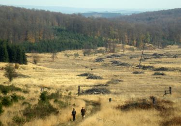
Cette balade vous offrira une vue panoramique sur le village de Vesqueville ainsi que sur la campagne qui l’entoure. Comme son nom l’indique, elle vous emmènera jusqu’à la chapelle de Lhommal, dont la source aurait des vertus curatives pour les yeux, en passant par le village de Bras.


Site web: https://www.foretdesainthubert-tourisme.be/details/LOD-A0-005L-26BB&type=8/

Profil altimétrique

Localisation

Pays :
Belgique
Région :
Wallonie
Département/Province :
Luxembourg
Commune :
Saint-Hubert
Localité :
Unknown
Départ:(Dec)
Départ:(UTM)
671686 ; 5541534 (31U) N.

Commentaires

Veuillez vous connecter pour laisser un commentaire ou une note


Randonnées à proximité

Randonnée Marche Saint-Hubert - Saint-Hubert - La Borne (SH07) - Photo
Marche
GUIDE+

Marche

Difficile
(9)
Saint-Hubert, Wallonie, Luxembourg, Belgique
13,9 km | 17,6 km-effort
3h 47min
Oui
Randonnée Marche Saint-Hubert - Hatrival - Banalbois (SH13) - Photo
Marche
GUIDE+

Marche

Moyen
(6)
Saint-Hubert, Wallonie, Luxembourg, Belgique
7,5 km | 9,5 km-effort
2h 2min
Oui
Randonnée Marche Saint-Hubert - RB-Lu-26_Saint-Hubert_via-racc-1-et-2 - Photo
Marche
PRO

Marche

Très facile
(8)
Saint-Hubert, Wallonie, Luxembourg, Belgique
14,6 km | 19,5 km-effort
4h 15min
Oui
Randonnée Marche Saint-Hubert - Vesqueville - Vesqueville (SH09) - Photo
Marche
GUIDE+

Marche

Difficile
(6)
Saint-Hubert, Wallonie, Luxembourg, Belgique
15,6 km | 19,4 km-effort
4h 9min
Oui
Randonnée Marche Saint-Hubert - Saint-Hubert - Les Gottes (SH02) - Photo
Marche
GUIDE+

Marche

Moyen
(17)
Saint-Hubert, Wallonie, Luxembourg, Belgique
6,9 km | 8,6 km-effort
1h 52min
Oui
Randonnée Marche Libramont-Chevigny - Marche ADEPS à Séviscourt. - Photo
Marche
GUIDE
Bernard Gillet

Marche

Facile
(1)
Libramont-Chevigny, Wallonie, Luxembourg, Belgique
10,3 km | 13,5 km-effort
2h 8min
Oui
Randonnée Marche Saint-Hubert - ADEPS Saint Hubert - Photo
Marche
GUIDE
Bernard Gillet

Marche

Difficile
(1)
Saint-Hubert, Wallonie, Luxembourg, Belgique
10,8 km | 13,7 km-effort
1h 57min
Oui
Randonnée Marche Saint-Hubert - RB-Lu-26_Saint-Hubert - Photo
Marche
PRO

Marche

Très facile
(7)
Saint-Hubert, Wallonie, Luxembourg, Belgique
25 km | 33 km-effort
7h 2min
Oui
Randonnée Marche Saint-Hubert - RB-Lu-26_Saint-Hubert_via-racc-2 - Photo
Marche
PRO

Marche

Très facile
(2)
Saint-Hubert, Wallonie, Luxembourg, Belgique
23 km | 30 km-effort
6h 19min
Oui


Fermer
Mes abonnements