![](/images/other/stat-length.png)
![Randonnée Marche Aucelon - Col de Pennes - Photo](https://media.geolcdn.com/t/1900/400/e2c39de6-5320-415f-8eb7-c526a1164e2d.jpg&format=pjpeg&maxdim=2)
Col de Pennes
ajd26
Utilisateur
![Longueur](/images/other/stat-length.png)
![Altitude max](https://static1.geolcdn.com/siteimages/upload/files/1508320355ic_sort_altitude_max_24dp.png)
![Dénivelé positif](https://static1.geolcdn.com/siteimages/upload/files/1508320355ic_sort_den_pos_24dp.png)
![Km-Effort](/images/other/stat-length.png)
![Altitude min](https://static1.geolcdn.com/siteimages/upload/files/1508320355ic_sort_altitude_min_24dp.png)
![Dénivelé négatif](https://static1.geolcdn.com/siteimages/upload/files/1508320355ic_sort_den_neg_24dp.png)
![Boucle](https://static1.geolcdn.com/siteimages/upload/files/16400158638029165_repeat_loop_refresh_sync_direction_icon.png)
![Marche](https://static1.geolcdn.com/sitytour/trail-icons/101.png)
4h46
Difficulté : Moyen
![Scannez ce code QR pour ouvrir la randonnée dans l'application SityTrail](https://capi.geolives.com/qq0zvz2zws4bq2lad0pu/sitytour/trails/3074928/qr.png?size=200)
Application GPS de randonnée GRATUITE
À propos
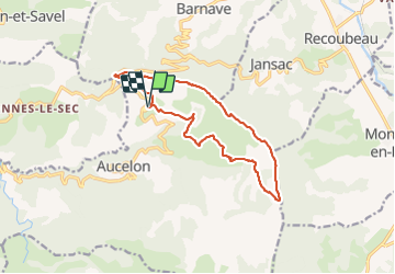
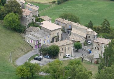
Randonnée Marche de 14,2 km à découvrir à Auvergne-Rhône-Alpes, Drôme, Aucelon. Cette randonnée est proposée par ajd26.
Description
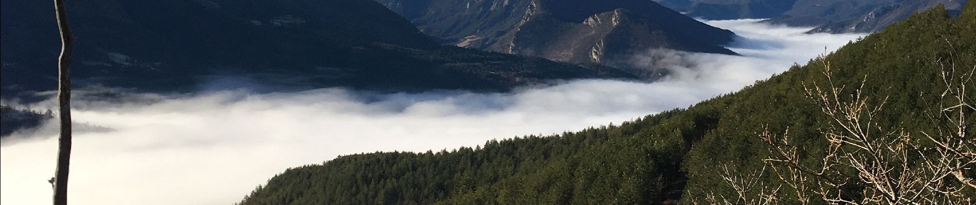
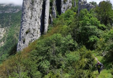
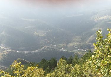
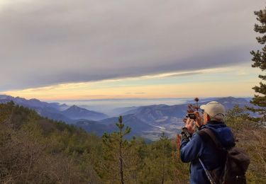
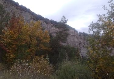
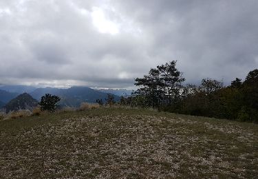
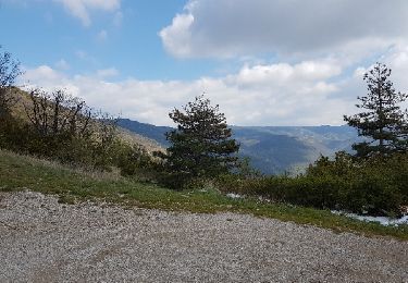
depuis le Deves, montée au col de Pennes et déambulation sur les crêtes (6km) avec de superbes panoramas sur la vallée de la Drome et le Dévoluy magnifique
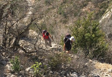
sur le retour, au km 12, possibilité de continuer par la piste car le petit sentier est un peu hasardeux sur la fin
Localisation
Commentaires
Randonnées à proximité
![Randonnée Marche Rimon-et-Savel - 26 lames de pennes savel jp - Photo](https://media.geolcdn.com/t/375/260/f2bea45a-9c65-4d39-b93d-6507c3374444.jpg&format=jpg&maxdim=2)
![Marche Marche](https://static1.geolcdn.com/sitytour/trail-icons/101.png)
Marche
![](/images/other/stat-length.png)
![](https://static1.geolcdn.com/siteimages/upload/files/16400158638029165_repeat_loop_refresh_sync_direction_icon.png)
![Randonnée Marche Rimon-et-Savel - balcons de la Roanne - Photo](https://media.geolcdn.com/t/375/260/6f529a2b-52ed-4864-b6b1-e2b0e3236399.jpg&format=jpg&maxdim=2)
![Marche Marche](https://static1.geolcdn.com/sitytour/trail-icons/101.png)
Marche
![](/images/other/stat-length.png)
![](https://static1.geolcdn.com/siteimages/upload/files/16400158638029165_repeat_loop_refresh_sync_direction_icon.png)
![Randonnée Marche Rimon-et-Savel - rimon 2/1/2022 - Photo](https://media.geolcdn.com/t/375/260/d71302a3-bf5b-468d-ad27-fcad37c90032.jpg&format=jpg&maxdim=2)
![Marche Marche](https://static1.geolcdn.com/sitytour/trail-icons/101.png)
Marche
![](/images/other/stat-length.png)
![](https://static1.geolcdn.com/siteimages/upload/files/16400158638029165_repeat_loop_refresh_sync_direction_icon.png)
![Randonnée Vélo de route Recoubeau-Jansac - col de Penne - Photo](https://media.geolcdn.com/t/375/260/47037570-c0aa-4718-9214-10ee3d6f6cd7.jpg&format=jpg&maxdim=2)
![Vélo de route Vélo de route](https://static1.geolcdn.com/sitytour/trail-icons/201.png)
Vélo de route
![](/images/other/stat-length.png)
![](https://static1.geolcdn.com/siteimages/upload/files/16400158638029165_repeat_loop_refresh_sync_direction_icon.png)
![Randonnée Marche Aucelon - la montagne d Aucelon - Photo](https://media.geolcdn.com/t/375/260/418d345f-bb1e-4446-b000-4d78372a3cd9.jpg&format=jpg&maxdim=2)
![Marche Marche](https://static1.geolcdn.com/sitytour/trail-icons/101.png)
Marche
![](/images/other/stat-length.png)
![](https://static1.geolcdn.com/siteimages/upload/files/16400158638029165_repeat_loop_refresh_sync_direction_icon.png)
![Randonnée Marche Rimon-et-Savel - Savel - La Pale - Photo](https://media.geolcdn.com/t/375/260/6ba554c1-703a-4efa-8a00-2064218d8db8.jpg&format=jpg&maxdim=2)
![Marche Marche](https://static1.geolcdn.com/sitytour/trail-icons/101.png)
Marche
![](/images/other/stat-length.png)
![](https://static1.geolcdn.com/siteimages/upload/files/16400158638029165_repeat_loop_refresh_sync_direction_icon.png)
![Marche Marche](https://static1.geolcdn.com/sitytour/trail-icons/101.png)
Marche
![](/images/other/stat-length.png)
![](https://static1.geolcdn.com/siteimages/upload/files/16400158638029165_repeat_loop_refresh_sync_direction_icon.png)
![Randonnée V.T.T. Recoubeau-Jansac - 08/05/2017 Recoubeau/Luc/Claps/ Col de Clamontard/Clpas/Recoubeau - Photo](https://media.geolcdn.com/t/375/260/ext.jpg?maxdim=2&url=https%3A%2F%2Fservices.sitytrail.com%2FGeolivesWS%2FDownloadMedia.ashx%3FTrailID%3D749284%26Media%3Dfix__20170508102853.jpg)
![V.T.T. V.T.T.](https://static1.geolcdn.com/sitytour/trail-icons/202.png)
V.T.T.
![](/images/other/stat-length.png)
![](https://static1.geolcdn.com/siteimages/upload/files/16400158638029165_repeat_loop_refresh_sync_direction_icon.png)
![Randonnée V.T.T. Recoubeau-Jansac - 28-04-2017 Recoubeau - Col de Pennes - Photo](https://media.geolcdn.com/t/375/260/ext.jpg?maxdim=2&url=https%3A%2F%2Fservices.sitytrail.com%2FGeolivesWS%2FDownloadMedia.ashx%3FTrailID%3D744501%26Media%3Dfix__20170428161817.jpg)
![V.T.T. V.T.T.](https://static1.geolcdn.com/sitytour/trail-icons/202.png)
V.T.T.
![](/images/other/stat-length.png)
![](https://static1.geolcdn.com/siteimages/upload/files/16400158638029165_repeat_loop_refresh_sync_direction_icon.png)