![](/images/other/stat-length.png)
![Randonnée Marche Sprimont - Sprimont - Promenade 5 - Photo](https://media.geolcdn.com/t/1900/400/b585215b-9fe2-469b-be14-f9bf67911937.jpg&format=pjpeg&maxdim=2)
Sprimont - Promenade 5
mumu.larandonneuse
Utilisateur GUIDE
![Longueur](/images/other/stat-length.png)
Longueur
12,5 km
![Altitude max](https://static1.geolcdn.com/siteimages/upload/files/1508320355ic_sort_altitude_max_24dp.png)
Altitude max
300 m
![Dénivelé positif](https://static1.geolcdn.com/siteimages/upload/files/1508320355ic_sort_den_pos_24dp.png)
Dénivelé positif
237 m
![Km-Effort](/images/other/stat-length.png)
Km-Effort
15,7 km
![Altitude min](https://static1.geolcdn.com/siteimages/upload/files/1508320355ic_sort_altitude_min_24dp.png)
Altitude min
183 m
![Dénivelé négatif](https://static1.geolcdn.com/siteimages/upload/files/1508320355ic_sort_den_neg_24dp.png)
Dénivelé négatif
232 m
![Boucle](https://static1.geolcdn.com/siteimages/upload/files/16400158638029165_repeat_loop_refresh_sync_direction_icon.png)
Boucle
Oui
Date de création :
2022-02-03 16:49:50.172
Dernière modification :
2022-03-20 12:40:25.397
![Marche](https://static1.geolcdn.com/sitytour/trail-icons/101.png)
3h33
Difficulté : Moyen
![Scannez ce code QR pour ouvrir la randonnée dans l'application SityTrail](https://capi.geolives.com/qq0zvz2zws4bq2lad0pu/sitytour/trails/3074782/qr.png?size=200)
Application GPS de randonnée GRATUITE
À propos
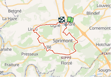
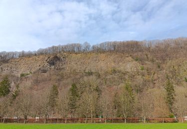
Randonnée Marche de 12,5 km à découvrir à Wallonie, Liège, Sprimont. Cette randonnée est proposée par mumu.larandonneuse.
Description
DÉTAILS DE L'ITINÉRAIRE
Difficulté: Moyen
Longueur: 12 km
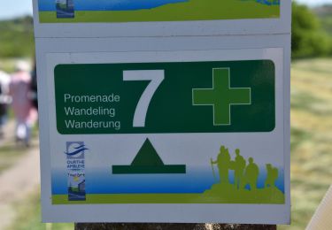
Balisage: losange bleu
📍 Pecherie du Tultay
ℹ www.ovatourisme.be
Localisation
Pays :
Belgique
Région :
Wallonie
Département/Province :
Liège
Commune :
Sprimont
Localité :
Sprimont
Départ:(Dec)
Départ:(UTM)
688964 ; 5599335 (31U) N.
Commentaires
Randonnées à proximité
![Randonnée Marche Aywaille - RB-Lg-12_Remouchamps - Photo](https://media.geolcdn.com/t/375/260/ext.jpg?maxdim=2&url=https%3A%2F%2Fservices.sitytrail.com%2FGeolivesWS%2FDownloadMedia.ashx%3FTrailID%3D179570%26Media%3D1074d230-2da3-49cf-8210-a5f6b46fd870.jpg)
![Marche Marche](https://static1.geolcdn.com/sitytour/trail-icons/101.png)
RB-Lg-12_Remouchamps
Marche
Difficile
(9)
Aywaille,
Wallonie,
Liège,
Belgique
![](/images/other/stat-length.png)
24 km | 34 km-effort
7h 39min
![](https://static1.geolcdn.com/siteimages/upload/files/16400158638029165_repeat_loop_refresh_sync_direction_icon.png)
Oui
![Randonnée Marche Aywaille - aywaille . florzé . martinrive . septroux . aywaille - Photo](https://media.geolcdn.com/t/375/260/8275975a-b8e8-47c1-9fb9-0580e1d080c9.jpg&format=jpg&maxdim=2)
![Marche Marche](https://static1.geolcdn.com/sitytour/trail-icons/101.png)
aywaille . florzé . martinrive . septroux . aywaille
Marche
Facile
(6)
Aywaille,
Wallonie,
Liège,
Belgique
![](/images/other/stat-length.png)
11,1 km | 15,4 km-effort
2h 48min
![](https://static1.geolcdn.com/siteimages/upload/files/16400158638029165_repeat_loop_refresh_sync_direction_icon.png)
Oui
![Randonnée Marche Aywaille - RB-Lg-12_Remouchamps_via-racc-1 - Photo](https://media.geolcdn.com/t/375/260/ext.jpg?maxdim=2&url=https%3A%2F%2Fservices.sitytrail.com%2FGeolivesWS%2FDownloadMedia.ashx%3FTrailID%3D209433%26Media%3D1f1ef83d-c0c7-4521-b15a-02c5e9e7c1f1.jpg)
![Marche Marche](https://static1.geolcdn.com/sitytour/trail-icons/101.png)
RB-Lg-12_Remouchamps_via-racc-1
Marche
Difficile
(6)
Aywaille,
Wallonie,
Liège,
Belgique
![](/images/other/stat-length.png)
17 km | 25 km-effort
5h 46min
![](https://static1.geolcdn.com/siteimages/upload/files/16400158638029165_repeat_loop_refresh_sync_direction_icon.png)
Oui
![Marche Marche](https://static1.geolcdn.com/sitytour/trail-icons/101.png)
20210530 - Dolembreux 8.5 Km
Marche
Moyen
(1)
Sprimont,
Wallonie,
Liège,
Belgique
![](/images/other/stat-length.png)
8,4 km | 10,8 km-effort
2h 52min
![](https://static1.geolcdn.com/siteimages/upload/files/16400158638029165_repeat_loop_refresh_sync_direction_icon.png)
Oui
![Randonnée Marche Aywaille - Aywaille - Kin - Château de Harzé - Awan - Photo](https://media.geolcdn.com/t/375/260/fc604b5e-e950-4941-952b-ecd138cbf420.jpg&format=jpg&maxdim=2)
![Marche Marche](https://static1.geolcdn.com/sitytour/trail-icons/101.png)
Aywaille - Kin - Château de Harzé - Awan
Marche
Moyen
(1)
Aywaille,
Wallonie,
Liège,
Belgique
![](/images/other/stat-length.png)
17,3 km | 24 km-effort
5h 25min
![](https://static1.geolcdn.com/siteimages/upload/files/16400158638029165_repeat_loop_refresh_sync_direction_icon.png)
Oui
![Randonnée Marche Aywaille - Remouchamps - Aywaille - Croix de Septroux - Photo](https://media.geolcdn.com/t/375/260/73151627-72a6-4506-ac77-59fc8213a179.jpg&format=jpg&maxdim=2)
![Marche Marche](https://static1.geolcdn.com/sitytour/trail-icons/101.png)
Remouchamps - Aywaille - Croix de Septroux
Marche
Moyen
(1)
Aywaille,
Wallonie,
Liège,
Belgique
![](/images/other/stat-length.png)
15,7 km | 22 km-effort
4h 53min
![](https://static1.geolcdn.com/siteimages/upload/files/16400158638029165_repeat_loop_refresh_sync_direction_icon.png)
Oui
![Randonnée Marche Aywaille - aywaille . martinrive . awan . croix septroux . aywaille - Photo](https://media.geolcdn.com/t/375/260/ext.jpg?maxdim=2&url=https%3A%2F%2Fservices.sitytrail.com%2FGeolivesWS%2FDownloadMedia.ashx%3FTrailID%3D975360%26Media%3Dfix__20180528111338.jpg)
![Marche Marche](https://static1.geolcdn.com/sitytour/trail-icons/101.png)
aywaille . martinrive . awan . croix septroux . aywaille
Marche
Facile
(2)
Aywaille,
Wallonie,
Liège,
Belgique
![](/images/other/stat-length.png)
10,9 km | 15,1 km-effort
2h 31min
![](https://static1.geolcdn.com/siteimages/upload/files/16400158638029165_repeat_loop_refresh_sync_direction_icon.png)
Oui
![Randonnée Marche Aywaille - RB-Lg-12_Remouchamps_via-racc-2 - Photo](https://media.geolcdn.com/t/375/260/ext.jpg?maxdim=2&url=https%3A%2F%2Fservices.sitytrail.com%2FGeolivesWS%2FDownloadMedia.ashx%3FTrailID%3D209432%26Media%3D1074d230-2da3-49cf-8210-a5f6b46fd870.jpg)
![Marche Marche](https://static1.geolcdn.com/sitytour/trail-icons/101.png)
RB-Lg-12_Remouchamps_via-racc-2
Marche
Difficile
(1)
Aywaille,
Wallonie,
Liège,
Belgique
![](/images/other/stat-length.png)
21 km | 31 km-effort
6h 42min
![](https://static1.geolcdn.com/siteimages/upload/files/16400158638029165_repeat_loop_refresh_sync_direction_icon.png)
Oui
![Randonnée Marche Aywaille - autour de Dieupart et Sougné sur les deux versants - Photo](https://media.geolcdn.com/t/375/260/6d29ace5-68d4-4c82-acad-a3ea752ffd24.jpg&format=jpg&maxdim=2)
![Marche Marche](https://static1.geolcdn.com/sitytour/trail-icons/101.png)
autour de Dieupart et Sougné sur les deux versants
Marche
Moyen
(1)
Aywaille,
Wallonie,
Liège,
Belgique
![](/images/other/stat-length.png)
9,9 km | 14 km-effort
3h 7min
![](https://static1.geolcdn.com/siteimages/upload/files/16400158638029165_repeat_loop_refresh_sync_direction_icon.png)
Oui
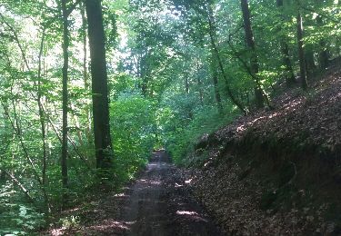
A la découverte des hameaux de Sprimont à travers les chemins et routes de campagne.