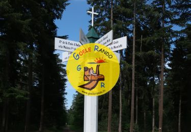
Randonnée Marche Verneuil-en-Halatte - Marche après-midi- VERNEUIL EN HALATTE  - Photo

Marche après-midi- VERNEUIL EN HALATTE

 Marc ROUSSELOT
Marc ROUSSELOT

Utilisateur

© OpenStreetMap contributors
Longueur
Longueur
10,3 km
Altitude max
Altitude max
125 m
Dénivelé positif
Dénivelé positif
139 m
Km-Effort
Km-Effort  
12 km
Altitude min
Altitude min
39 m
Dénivelé négatif
Dénivelé négatif
112 m
Boucle
Boucle
Oui
Date de création :
2022-01-29 13:06:04.697
Dernière modification :
2022-01-29 15:49:16.792

(0 Avis)

Marche
Marche
1h58
Difficulté : Difficile

Scannez ce code QR pour ouvrir la randonnée dans l'application SityTrail

Application GPS de randonnée GRATUITE

Logo SityTrail SityTrail

IGN / Instituts géographiques

Télécharger SityTrail sur l'App Store Télécharger SityTrail sur Google Play

Logo SityTrail SityTrail World

Le monde est à vous

Télécharger SityTrail sur l'App Store Télécharger SityTrail sur Google Play Télécharger SityTrail sur Huawei AppGallery

À propos

Randonnée Marche de 10,3 km à découvrir à Hauts-de-France, Oise, Verneuil-en-Halatte. Cette randonnée est proposée par Marc ROUSSELOT.

Description

Marche

Profil altimétrique

Localisation

Pays :
France
Région :
Hauts-de-France
Département/Province :
Oise
Commune :
Verneuil-en-Halatte
Localité :
Unknown
Départ:(UTM)
465526 ; 5458269 (31U) N.

Randonnées à proximité

Randonnée Marche Beaurepaire - La mare aux oiseaux - Beaurepaire - Photo
Marche
tracegps

Marche

Moyen
(1)
Beaurepaire, Hauts-de-France, Oise, France
8,4 km | 10,2 km-effort
2h 10min
Oui
Randonnée Marche Fleurines - Fleurines Grand parcours - Photo
Marche
CC.RIDER

Marche

Facile
(1)
Fleurines, Hauts-de-France, Oise, France
20 km | 24 km-effort
5h 8min
Oui
Randonnée sport Villers-Saint-Paul - Villers St Paul - Espace P.Perret - La Croix Méfroid - 11 km - 62763153 - Photo
sport
000504.a7a78dc25ee64857bf95861a7cd4d5b5.1507

sport

Très facile
(1)
Villers-Saint-Paul, Hauts-de-France, Oise, France
11 km | 0 m-effort
Inconnu
Oui
Randonnée Marche Fleurines - Fleurines_StChristophe_12,7 km_Trace GPS - Photo
Marche
Pousscailleux

Marche

Moyen
(1)
Fleurines, Hauts-de-France, Oise, France
12,7 km | 15,6 km-effort
2h 42min
Oui
Randonnée Marche Senlis - SM_FLEURINE (Poteau Belle Croix) 8.6Km - Photo
Marche

Marche

Moyen
Senlis, Hauts-de-France, Oise, France
8,6 km | 10,5 km-effort
2h 23min
Oui
Randonnée Marche Verneuil-en-Halatte - 2022-01-30 balade nous samy nouveau grand tour départ vers marronniers retour fond ste geneviève  - Photo
Marche
rolandmonjean

Marche

Facile
Verneuil-en-Halatte, Hauts-de-France, Oise, France
9,8 km | 11,8 km-effort
3h 13min
Oui
Randonnée V.T.C. Pont-Sainte-Maxence - halte menhirs d' iderolles - Photo
V.T.C.
gilbertdu60

V.T.C.

Facile
Pont-Sainte-Maxence, Hauts-de-France, Oise, France
17,1 km | 19,4 km-effort
1h 59min
Non
Randonnée Marche Rieux - Rieux - Le Roc et l'eau - Photo
Marche
tracegps

Marche

Moyen
Rieux, Hauts-de-France, Oise, France
9,7 km | 12,5 km-effort
2h 0min
Non
Randonnée sport Monchy-Saint-Éloi - 2022-09-28_13h36m37_<CAC9XJQ5buBJim13UVmX+3WM3tvG2H9PncH-espriqxQdtYHG3Q@mailgmailcom>_chedeville-9kmsgpxchedeville-9kms - Photo
sport
Marc ROUSSELOT

sport

Très facile
Monchy-Saint-Éloi, Hauts-de-France, Oise, France
8 km | 9,5 km-effort
Inconnu
Oui


Fermer
Mes abonnements