Randonnée Marche Arthémonay - Reculais - Photo
 meillon
meillon

Utilisateur

© OpenStreetMap contributors
Longueur
Longueur
7,9 km
Altitude max
Altitude max
423 m
Dénivelé positif
Dénivelé positif
204 m
Km-Effort
Km-Effort  
10,6 km
Altitude min
Altitude min
310 m
Dénivelé négatif
Dénivelé négatif
204 m
Boucle
Boucle
Oui
Date de création :
2022-01-27 14:18:52.846
Dernière modification :
2022-01-27 16:44:37.687

(0 Avis)

Marche
Marche
2h24
Difficulté : Facile

Scannez ce code QR pour ouvrir la randonnée dans l'application SityTrail

Application GPS de randonnée GRATUITE

Logo SityTrail SityTrail

IGN / Instituts géographiques

Télécharger SityTrail sur l'App Store Télécharger SityTrail sur Google Play

Logo SityTrail SityTrail World

Le monde est à vous

Télécharger SityTrail sur l'App Store Télécharger SityTrail sur Google Play Télécharger SityTrail sur Huawei AppGallery

À propos

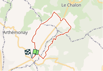
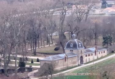
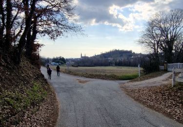
Randonnée Marche de 7,9 km à découvrir à Auvergne-Rhône-Alpes, Drôme, Arthémonay. Cette randonnée est proposée par meillon.

Description

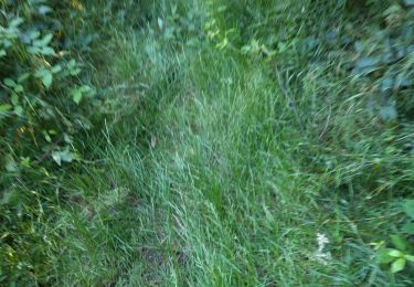
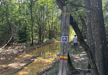
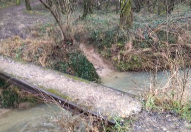
boucle passant par un gué du Chalon et à travers bois et fermes...

Profil altimétrique

Localisation

Pays :
France
Région :
Auvergne-Rhône-Alpes
Département/Province :
Drôme
Commune :
Arthémonay
Localité :
Unknown
Départ:(UTM)
662359 ; 4999675 (31T) N.

Randonnées à proximité

Randonnée Marche Geyssans - Geyssans - Photo
Marche
OscarMa

Marche

Très facile
(3)
Geyssans, Auvergne-Rhône-Alpes, Drôme, France
8 km | 10 km-effort
2h 8min
Oui
Randonnée Marche Arthémonay - Reculais 06 2024 - Photo
Marche
alinetpierre

Marche

Difficile
Arthémonay, Auvergne-Rhône-Alpes, Drôme, France
11,7 km | 15,6 km-effort
3h 33min
Oui
Randonnée Marche Saint-Donat-sur-l'Herbasse - lac de champos bois de sizay - Photo
Marche
Gilbertbancilhon

Marche

Très facile
(1)
Saint-Donat-sur-l'Herbasse, Auvergne-Rhône-Alpes, Drôme, France
11,2 km | 14,6 km-effort
3h 1min
Oui
Randonnée Marche Peyrins - peyrins - Photo
Marche
CathyBB26

Marche

Très facile
(1)
Peyrins, Auvergne-Rhône-Alpes, Drôme, France
8,4 km | 11,1 km-effort
2h 53min
Oui
Randonnée Marche Crépol - 26 crepol aarthemonay pas a pas - Photo
Marche
randodyssée

Marche

Facile
Crépol, Auvergne-Rhône-Alpes, Drôme, France
13,4 km | 17,6 km-effort
4h 38min
Oui
Randonnée Marche Triors - 26 triors parnans zel - Photo
Marche
randodyssée

Marche

Facile
Triors, Auvergne-Rhône-Alpes, Drôme, France
19,8 km | 26 km-effort
6h 27min
Oui
Randonnée Marche Crépol - Crepol chapelle Saint Roch - Photo
Marche
meillon

Marche

Facile
Crépol, Auvergne-Rhône-Alpes, Drôme, France
8,3 km | 11,3 km-effort
2h 54min
Oui
Randonnée Marche Peyrins - Peyrins Saint Ange - Photo
Marche
meillon

Marche

Facile
Peyrins, Auvergne-Rhône-Alpes, Drôme, France
9 km | 12,5 km-effort
4h 7min
Oui
Randonnée Marche Peyrins - Montgrenier - Photo
Marche
meillon

Marche

Facile
Peyrins, Auvergne-Rhône-Alpes, Drôme, France
2,9 km | 3,9 km-effort
1h 5min
Oui


Fermer
Mes abonnements