![](/images/other/stat-length.png)
![Randonnée Marche Beersel - Dworp 0122 - Photo](https://media.geolcdn.com/t/1900/400/506de341-88d0-4b24-9b2d-e779325b21a2.jpg&format=pjpeg&maxdim=2)
Dworp 0122
calofrancis
Utilisateur
![Longueur](/images/other/stat-length.png)
Longueur
10,7 km
![Altitude max](https://static1.geolcdn.com/siteimages/upload/files/1508320355ic_sort_altitude_max_24dp.png)
Altitude max
136 m
![Dénivelé positif](https://static1.geolcdn.com/siteimages/upload/files/1508320355ic_sort_den_pos_24dp.png)
Dénivelé positif
162 m
![Km-Effort](/images/other/stat-length.png)
Km-Effort
12,8 km
![Altitude min](https://static1.geolcdn.com/siteimages/upload/files/1508320355ic_sort_altitude_min_24dp.png)
Altitude min
44 m
![Dénivelé négatif](https://static1.geolcdn.com/siteimages/upload/files/1508320355ic_sort_den_neg_24dp.png)
Dénivelé négatif
161 m
![Boucle](https://static1.geolcdn.com/siteimages/upload/files/16400158638029165_repeat_loop_refresh_sync_direction_icon.png)
Boucle
Oui
Date de création :
2022-01-18 12:57:39.601
Dernière modification :
2022-01-19 13:09:59.29
![Marche](https://static1.geolcdn.com/sitytour/trail-icons/101.png)
2h29
Difficulté : Difficile
![Scannez ce code QR pour ouvrir la randonnée dans l'application SityTrail](https://capi.geolives.com/qq0zvz2zws4bq2lad0pu/sitytour/trails/3055778/qr.png?size=200)
Application GPS de randonnée GRATUITE
À propos
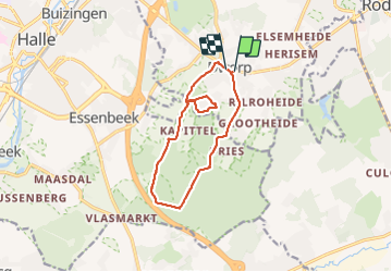
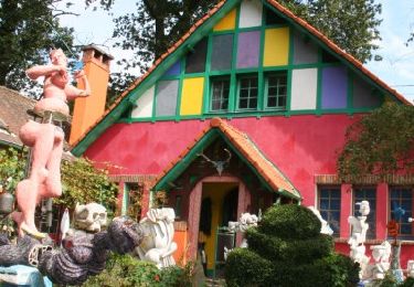
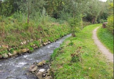
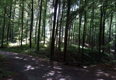
Randonnée Marche de 10,7 km à découvrir à Flandre, Brabant flamand, Beersel. Cette randonnée est proposée par calofrancis.
Description
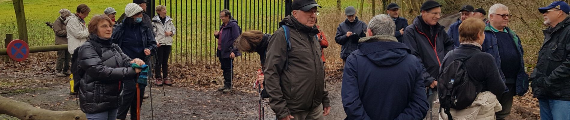
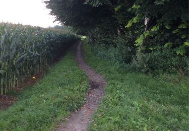
Au départ de l'église de Dworp, parcours relativement épargné par la boue .... pssage dans le bois de Hal, très agréable et peu fréquenté en cette saison.
Localisation
Pays :
Belgique
Région :
Flandre
Département/Province :
Brabant flamand
Commune :
Beersel
Localité :
Tourneppe
Départ:(Dec)
Départ:(UTM)
591750 ; 5620544 (31U) N.
Commentaires
Randonnées à proximité
![Randonnée Marche Linkebeek - Linkebeek Perkhoeve en Peter Pan - 8 km RT - Photo](https://media.geolcdn.com/t/375/260/ext.jpg?maxdim=2&url=https%3A%2F%2Fstatic1.geolcdn.com%2Fsiteimages%2Fupload%2Ffiles%2F1553511878bg_sport_marche.png)
![Marche Marche](https://static1.geolcdn.com/sitytour/trail-icons/101.png)
Linkebeek Perkhoeve en Peter Pan - 8 km RT
Marche
Très facile
(5)
Linkebeek,
Flandre,
Brabant flamand,
Belgique
![](/images/other/stat-length.png)
7,6 km | 9,3 km-effort
Inconnu
![](https://static1.geolcdn.com/siteimages/upload/files/16400158638029165_repeat_loop_refresh_sync_direction_icon.png)
Oui
![Randonnée Marche Beersel - RL-GG-24_Beersel_Hennuyères - Photo](https://media.geolcdn.com/t/375/260/102ff410-776a-4c59-ae38-58c43777bc8a.jpg&format=jpg&maxdim=2)
![Marche Marche](https://static1.geolcdn.com/sitytour/trail-icons/101.png)
RL-GG-24_Beersel_Hennuyères
Marche
Moyen
(2)
Beersel,
Flandre,
Brabant flamand,
Belgique
![](/images/other/stat-length.png)
37 km | 47 km-effort
10h 44min
![](https://static1.geolcdn.com/siteimages/upload/files/16400158638029165_repeat_loop_refresh_sync_direction_icon.png)
Non
![Randonnée Marche Hal - Balade dans le Bois de Halle - Photo](https://media.geolcdn.com/t/375/260/ext.jpg?maxdim=2&url=https%3A%2F%2Fservices.sitytrail.com%2FGeolivesWS%2FDownloadMedia.ashx%3FTrailID%3D411974%26Media%3D4cfcce27-edaf-4211-9dbe-1277fff36f47.JPG)
![Marche Marche](https://static1.geolcdn.com/sitytour/trail-icons/101.png)
Balade dans le Bois de Halle
Marche
Facile
(2)
Hal,
Flandre,
Brabant flamand,
Belgique
![](/images/other/stat-length.png)
8,6 km | 10,5 km-effort
2h 14min
![](https://static1.geolcdn.com/siteimages/upload/files/16400158638029165_repeat_loop_refresh_sync_direction_icon.png)
Oui
![Randonnée Marche Beersel - Beersel 10km - Photo](https://media.geolcdn.com/t/375/260/4be021b0-0611-495b-8c11-6bedba66a35d.jpg&format=jpg&maxdim=2)
![Marche Marche](https://static1.geolcdn.com/sitytour/trail-icons/101.png)
Beersel 10km
Marche
Moyen
(2)
Beersel,
Flandre,
Brabant flamand,
Belgique
![](/images/other/stat-length.png)
10,5 km | 13,1 km-effort
2h 34min
![](https://static1.geolcdn.com/siteimages/upload/files/16400158638029165_repeat_loop_refresh_sync_direction_icon.png)
Oui
![Randonnée Marche Beersel - 2019-01-10 Boucle Huizingen 22 km - Photo](https://media.geolcdn.com/t/375/260/8543774e-ca92-454e-9fd7-9ac7878ef135.jpg&format=jpg&maxdim=2)
![Marche Marche](https://static1.geolcdn.com/sitytour/trail-icons/101.png)
2019-01-10 Boucle Huizingen 22 km
Marche
Très facile
(1)
Beersel,
Flandre,
Brabant flamand,
Belgique
![](/images/other/stat-length.png)
22 km | 27 km-effort
4h 38min
![](https://static1.geolcdn.com/siteimages/upload/files/16400158638029165_repeat_loop_refresh_sync_direction_icon.png)
Oui
![Randonnée Marche Braine-l'Alleud - Entre l'Ermite et Odeghien - Photo](https://media.geolcdn.com/t/375/260/ext.jpg?maxdim=2&url=https%3A%2F%2Fservices.sitytrail.com%2FGeolivesWS%2FDownloadMedia.ashx%3FTrailID%3D338686%26Media%3D20140824140258.jpg)
![Marche Marche](https://static1.geolcdn.com/sitytour/trail-icons/101.png)
Entre l'Ermite et Odeghien
Marche
Facile
(4)
Braine-l'Alleud,
Wallonie,
Brabant wallon,
Belgique
![](/images/other/stat-length.png)
7,2 km | 8,7 km-effort
1h 52min
![](https://static1.geolcdn.com/siteimages/upload/files/16400158638029165_repeat_loop_refresh_sync_direction_icon.png)
Non
![Randonnée Marche Beersel - Entre Beersel et Dworp - Photo](https://media.geolcdn.com/t/375/260/ext.jpg?maxdim=2&url=https%3A%2F%2Fservices.sitytrail.com%2FGeolivesWS%2FDownloadMedia.ashx%3FTrailID%3D310076%26Media%3D3efa6535-4846-4e23-9c11-65c16b69488b.jpg)
![Marche Marche](https://static1.geolcdn.com/sitytour/trail-icons/101.png)
Entre Beersel et Dworp
Marche
Moyen
(1)
Beersel,
Flandre,
Brabant flamand,
Belgique
![](/images/other/stat-length.png)
10,1 km | 13 km-effort
2h 45min
![](https://static1.geolcdn.com/siteimages/upload/files/16400158638029165_repeat_loop_refresh_sync_direction_icon.png)
Oui
![Randonnée Marche Beersel - Dworp Herisemmolen vers Elsemheide - Photo](https://media.geolcdn.com/t/375/260/ext.jpg?maxdim=2&url=https%3A%2F%2Fservices.sitytrail.com%2FGeolivesWS%2FDownloadMedia.ashx%3FTrailID%3D225257%26Media%3Dfix__20131004160100.jpg)
![Marche Marche](https://static1.geolcdn.com/sitytour/trail-icons/101.png)
Dworp Herisemmolen vers Elsemheide
Marche
Facile
(2)
Beersel,
Flandre,
Brabant flamand,
Belgique
![](/images/other/stat-length.png)
5,3 km | 6,4 km-effort
1h 26min
![](https://static1.geolcdn.com/siteimages/upload/files/16400158638029165_repeat_loop_refresh_sync_direction_icon.png)
Oui
![Randonnée Marche Hal - bois de halle hallerbos - Photo](https://media.geolcdn.com/t/375/260/171c7fd8-9c79-49a4-b4c2-e78fc47fb1c7.jpg&format=jpg&maxdim=2)
![Marche Marche](https://static1.geolcdn.com/sitytour/trail-icons/101.png)
bois de halle hallerbos
Marche
Très facile
(1)
Hal,
Flandre,
Brabant flamand,
Belgique
![](/images/other/stat-length.png)
7,1 km | 8,6 km-effort
1h 35min
![](https://static1.geolcdn.com/siteimages/upload/files/16400158638029165_repeat_loop_refresh_sync_direction_icon.png)
Oui