![](/images/other/stat-length.png)
![Randonnée Vélo de route Draguignan - 20220115 vélo route - Photo](https://media.geolcdn.com/t/1900/400/ext.pjpeg?maxdim=2&url=https%3A%2F%2Fstatic1.geolcdn.com%2Fsiteimages%2Fupload%2Ffiles%2F1524743154velo.jpg)
20220115 vélo route
Sugg
Utilisateur
![Longueur](/images/other/stat-length.png)
Longueur
74 km
![Altitude max](https://static1.geolcdn.com/siteimages/upload/files/1508320355ic_sort_altitude_max_24dp.png)
Altitude max
255 m
![Dénivelé positif](https://static1.geolcdn.com/siteimages/upload/files/1508320355ic_sort_den_pos_24dp.png)
Dénivelé positif
935 m
![Km-Effort](/images/other/stat-length.png)
Km-Effort
86 km
![Altitude min](https://static1.geolcdn.com/siteimages/upload/files/1508320355ic_sort_altitude_min_24dp.png)
Altitude min
46 m
![Dénivelé négatif](https://static1.geolcdn.com/siteimages/upload/files/1508320355ic_sort_den_neg_24dp.png)
Dénivelé négatif
936 m
![Boucle](https://static1.geolcdn.com/siteimages/upload/files/16400158638029165_repeat_loop_refresh_sync_direction_icon.png)
Boucle
Oui
Date de création :
2022-01-15 11:44:23.627
Dernière modification :
2022-01-15 15:58:41.107
![Vélo de route](https://static1.geolcdn.com/sitytour/trail-icons/201.png)
3h45
Difficulté : Moyen
![Scannez ce code QR pour ouvrir la randonnée dans l'application SityTrail](https://capi.geolives.com/qq0zvz2zws4bq2lad0pu/sitytour/trails/3052398/qr.png?size=200)
Application GPS de randonnée GRATUITE
À propos
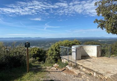
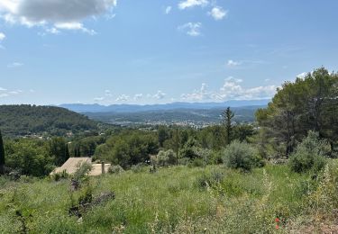
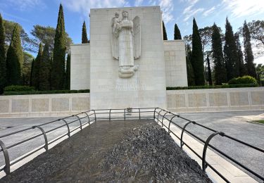
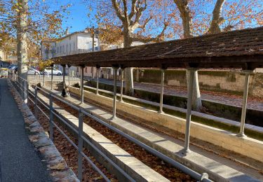
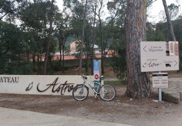
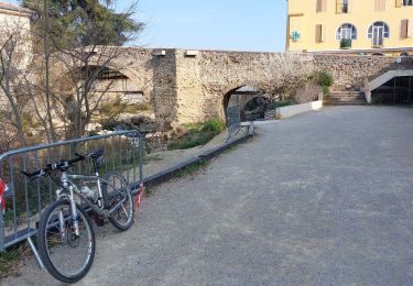
Randonnée Vélo de route de 74 km à découvrir à Provence-Alpes-Côte d'Azur, Var, Draguignan. Cette randonnée est proposée par Sugg.
Description
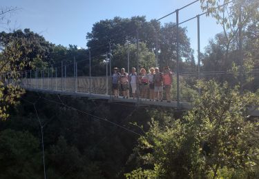
super sortie avec les Potes de la Motte......retour Draguignan rebouillon Lorgues vidauban Taradeau les Arcs Sotravie voie verte.....
Localisation
Pays :
France
Région :
Provence-Alpes-Côte d'Azur
Département/Province :
Var
Commune :
Draguignan
Localité :
Unknown
Départ:(Dec)
Départ:(UTM)
294888 ; 4823291 (32T) N.
Commentaires
Randonnées à proximité
![Randonnée Marche Draguignan - Draguignan Malmont 10 km - Photo](https://media.geolcdn.com/t/375/260/d1a2a54e-903f-461c-ac9a-777d73202ad8.jpg&format=jpg&maxdim=2)
![Marche Marche](https://static1.geolcdn.com/sitytour/trail-icons/101.png)
Draguignan Malmont 10 km
Marche
Moyen
Draguignan,
Provence-Alpes-Côte d'Azur,
Var,
France
![](/images/other/stat-length.png)
10 km | 14,7 km-effort
2h 56min
![](https://static1.geolcdn.com/siteimages/upload/files/16400158638029165_repeat_loop_refresh_sync_direction_icon.png)
Oui
![Randonnée Marche Draguignan - Draguignan Roche aux Fées Malmont 17 km - Photo](https://media.geolcdn.com/t/375/260/f159f27b-5b1e-45be-88d4-c4333d86164c.jpg&format=jpg&maxdim=2)
![Marche Marche](https://static1.geolcdn.com/sitytour/trail-icons/101.png)
Draguignan Roche aux Fées Malmont 17 km
Marche
Moyen
Draguignan,
Provence-Alpes-Côte d'Azur,
Var,
France
![](/images/other/stat-length.png)
17,2 km | 23 km-effort
5h 52min
![](https://static1.geolcdn.com/siteimages/upload/files/16400158638029165_repeat_loop_refresh_sync_direction_icon.png)
Oui
![Randonnée Marche Figanières - Figanières 01 - Photo](https://media.geolcdn.com/t/375/260/ext.jpg?maxdim=2&url=https%3A%2F%2Fstatic1.geolcdn.com%2Fsiteimages%2Fupload%2Ffiles%2F1553511878bg_sport_marche.png)
![Marche Marche](https://static1.geolcdn.com/sitytour/trail-icons/101.png)
Figanières 01
Marche
Très facile
(1)
Figanières,
Provence-Alpes-Côte d'Azur,
Var,
France
![](/images/other/stat-length.png)
8,4 km | 11,8 km-effort
2h 30min
![](https://static1.geolcdn.com/siteimages/upload/files/16400158638029165_repeat_loop_refresh_sync_direction_icon.png)
Oui
![Randonnée Marche Draguignan - Musée de l’artillerie et cimetière américain 7 km - Photo](https://media.geolcdn.com/t/375/260/778163a7-819c-4bb6-a61f-19371b647e3b.jpg&format=jpg&maxdim=2)
![Marche Marche](https://static1.geolcdn.com/sitytour/trail-icons/101.png)
Musée de l’artillerie et cimetière américain 7 km
Marche
Très facile
Draguignan,
Provence-Alpes-Côte d'Azur,
Var,
France
![](/images/other/stat-length.png)
7,3 km | 8,1 km-effort
2h 49min
![](https://static1.geolcdn.com/siteimages/upload/files/16400158638029165_repeat_loop_refresh_sync_direction_icon.png)
Oui
![Randonnée Marche Draguignan - Rebouillon le long de la Nartuby - Photo](https://media.geolcdn.com/t/375/260/5546167f-335f-4958-9f3e-7305fd054196.jpg&format=jpg&maxdim=2)
![Marche Marche](https://static1.geolcdn.com/sitytour/trail-icons/101.png)
Rebouillon le long de la Nartuby
Marche
Facile
Draguignan,
Provence-Alpes-Côte d'Azur,
Var,
France
![](/images/other/stat-length.png)
4,8 km | 5,9 km-effort
1h 33min
![](https://static1.geolcdn.com/siteimages/upload/files/16400158638029165_repeat_loop_refresh_sync_direction_icon.png)
Oui
![Randonnée Marche Draguignan - Malmont 10 km - Photo](https://media.geolcdn.com/t/375/260/da456918-fb68-4e05-ab32-80af50d67781.jpg&format=jpg&maxdim=2)
![Marche Marche](https://static1.geolcdn.com/sitytour/trail-icons/101.png)
Malmont 10 km
Marche
Moyen
Draguignan,
Provence-Alpes-Côte d'Azur,
Var,
France
![](/images/other/stat-length.png)
10,1 km | 15,2 km-effort
4h 32min
![](https://static1.geolcdn.com/siteimages/upload/files/16400158638029165_repeat_loop_refresh_sync_direction_icon.png)
Oui
![Randonnée Marche Trans-en-Provence - TRANS-Le puits aérien et la passerelle hymalayenne -MBO - Photo](https://media.geolcdn.com/t/375/260/52faf0f7-6a43-44b3-98ad-47b606885080.jpg&format=jpg&maxdim=2)
![Marche Marche](https://static1.geolcdn.com/sitytour/trail-icons/101.png)
TRANS-Le puits aérien et la passerelle hymalayenne -MBO
Marche
Facile
(2)
Trans-en-Provence,
Provence-Alpes-Côte d'Azur,
Var,
France
![](/images/other/stat-length.png)
8,1 km | 10,6 km-effort
2h 41min
![](https://static1.geolcdn.com/siteimages/upload/files/16400158638029165_repeat_loop_refresh_sync_direction_icon.png)
Oui
![Randonnée V.T.T. Draguignan - 20220308 vtt route - Photo](https://media.geolcdn.com/t/375/260/f158cf40-388a-495c-9de7-d89e468d92c8.jpg&format=jpg&maxdim=2)
![V.T.T. V.T.T.](https://static1.geolcdn.com/sitytour/trail-icons/202.png)
20220308 vtt route
V.T.T.
Très difficile
Draguignan,
Provence-Alpes-Côte d'Azur,
Var,
France
![](/images/other/stat-length.png)
53 km | 61 km-effort
3h 35min
![](https://static1.geolcdn.com/siteimages/upload/files/16400158638029165_repeat_loop_refresh_sync_direction_icon.png)
Oui
![Randonnée V.T.T. Draguignan - 20220301 vtt route - Photo](https://media.geolcdn.com/t/375/260/d0f2d217-7e6a-4760-8c6c-914bc0336dc2.jpg&format=jpg&maxdim=2)
![V.T.T. V.T.T.](https://static1.geolcdn.com/sitytour/trail-icons/202.png)
20220301 vtt route
V.T.T.
Facile
Draguignan,
Provence-Alpes-Côte d'Azur,
Var,
France
![](/images/other/stat-length.png)
30 km | 35 km-effort
2h 37min
![](https://static1.geolcdn.com/siteimages/upload/files/16400158638029165_repeat_loop_refresh_sync_direction_icon.png)
Oui