![](/images/other/stat-length.png)
![Randonnée Marche Andelot-Blancheville - Andelot, vallée du Rognon - Photo](https://media.geolcdn.com/t/1900/400/ccd3e19b-e099-4ff9-8132-1f0890aa039c.jpg&format=pjpeg&maxdim=2)
Andelot, vallée du Rognon
jeannine grandjean
Utilisateur
![Longueur](/images/other/stat-length.png)
![Altitude max](https://static1.geolcdn.com/siteimages/upload/files/1508320355ic_sort_altitude_max_24dp.png)
![Dénivelé positif](https://static1.geolcdn.com/siteimages/upload/files/1508320355ic_sort_den_pos_24dp.png)
![Km-Effort](/images/other/stat-length.png)
![Altitude min](https://static1.geolcdn.com/siteimages/upload/files/1508320355ic_sort_altitude_min_24dp.png)
![Dénivelé négatif](https://static1.geolcdn.com/siteimages/upload/files/1508320355ic_sort_den_neg_24dp.png)
![Boucle](https://static1.geolcdn.com/siteimages/upload/files/16400158638029165_repeat_loop_refresh_sync_direction_icon.png)
![Marche](https://static1.geolcdn.com/sitytour/trail-icons/101.png)
3h39
Difficulté : Facile
![Scannez ce code QR pour ouvrir la randonnée dans l'application SityTrail](https://capi.geolives.com/qq0zvz2zws4bq2lad0pu/sitytour/trails/3051298/qr.png?size=200)
Application GPS de randonnée GRATUITE
À propos
Randonnée Marche de 13,1 km à découvrir à Grand Est, Haute-Marne, Andelot-Blancheville. Cette randonnée est proposée par jeannine grandjean.
Description
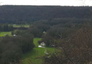
de part et d'autre de la petite rivière sinueuse du Rognon, qui serpente au fond d'une vallée bucolique et verdoyante
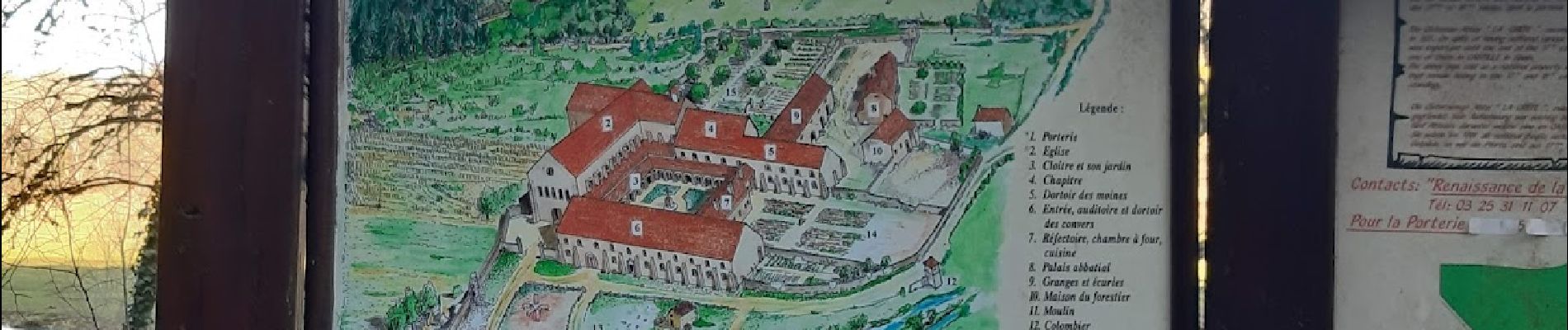
ne pas manquer les vestiges de l'ancienne abbaye cistercienne de la Crête
pour une randonnée plus longue, démarrer de la place principale d'Andelot
pour une randonnée plus courte, se rendre d'abord en voiture au château de Morteau
Localisation
Commentaires
Randonnées à proximité
![Randonnée Autre activité Chantraines - cyclo rail - Photo](https://media.geolcdn.com/t/375/260/ed0c3bb3-0957-44d6-95c1-8848537ad605.jpg&format=jpg&maxdim=2)
![Autre activité Autre activité](https://static1.geolcdn.com/sitytour/trail-icons/900.png)
Autre activité
![](/images/other/stat-length.png)
![](https://static1.geolcdn.com/siteimages/upload/files/16400158638029165_repeat_loop_refresh_sync_direction_icon.png)
![Randonnée Marche Andelot-Blancheville - Morteai - Photo](https://media.geolcdn.com/t/375/260/02dcfd78-d35f-40a2-9d23-6652bab84cf0.jpg&format=jpg&maxdim=2)
![Marche Marche](https://static1.geolcdn.com/sitytour/trail-icons/101.png)
Marche
![](/images/other/stat-length.png)
![](https://static1.geolcdn.com/siteimages/upload/files/16400158638029165_repeat_loop_refresh_sync_direction_icon.png)
![Randonnée A pied Bourdons-sur-Rognon - Bourdons-sur-rognon (1) Abbaye de la Crète - Photo](https://media.geolcdn.com/t/375/260/ext.jpg?maxdim=2&url=https%3A%2F%2Fstatic1.geolcdn.com%2Fsiteimages%2Fupload%2Ffiles%2F1545311037marcheuse_200dpi.jpg)
![A pied A pied](https://static1.geolcdn.com/sitytour/trail-icons/100.png)
A pied
![](/images/other/stat-length.png)
![](https://static1.geolcdn.com/siteimages/upload/files/16400158638029165_repeat_loop_refresh_sync_direction_icon.png)