![](/images/other/stat-length.png)
![Randonnée Marche Eupen - Promenade dans la fagne de Brackvenn - Photo](https://media.geolcdn.com/t/1900/400/ca3c954b-1bea-4dd1-a37b-78e35c0795d6.jpg&format=pjpeg&maxdim=2)
Promenade dans la fagne de Brackvenn
Au fil de nos découvertes
« L’heure de la fin des découvertes ne sonne jamais. » Colette GUIDE+
![Longueur](/images/other/stat-length.png)
![Altitude max](https://static1.geolcdn.com/siteimages/upload/files/1508320355ic_sort_altitude_max_24dp.png)
![Dénivelé positif](https://static1.geolcdn.com/siteimages/upload/files/1508320355ic_sort_den_pos_24dp.png)
![Km-Effort](/images/other/stat-length.png)
![Altitude min](https://static1.geolcdn.com/siteimages/upload/files/1508320355ic_sort_altitude_min_24dp.png)
![Dénivelé négatif](https://static1.geolcdn.com/siteimages/upload/files/1508320355ic_sort_den_neg_24dp.png)
![Boucle](https://static1.geolcdn.com/siteimages/upload/files/16400158638029165_repeat_loop_refresh_sync_direction_icon.png)
![Marche](https://static1.geolcdn.com/sitytour/trail-icons/101.png)
1h46
Difficulté : Moyen
![Scannez ce code QR pour ouvrir la randonnée dans l'application SityTrail](https://capi.geolives.com/qq0zvz2zws4bq2lad0pu/sitytour/trails/3046588/qr.png?size=200)
Application GPS de randonnée GRATUITE
À propos
Randonnée Marche de 7 km à découvrir à Wallonie, Liège, Eupen. Cette randonnée est proposée par Au fil de nos découvertes.
Description
🅿️ Départ et Parking:
Parking du Grenzweg
Monschauer Straße,
4950 Waimes
Position GPS : 50.566290,6.188039
–> Dernier parking avant la frontière allemande
Pour commencer la promenade il vous faudra traverser la grand route.
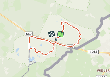
▶️ Suivre les points-noeuds : 80 – 71 – 77 – 63 – 32 – 58 – 45 – 97 – 73 – 26 – 44 – 80
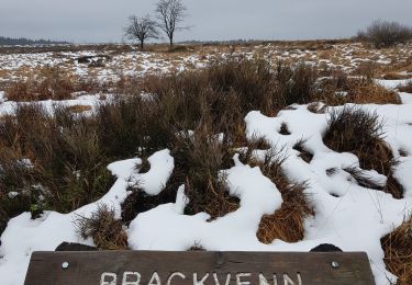
Vous aimez les paysages fagnards?
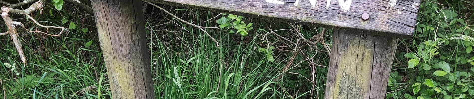
Vous raffolez des caillebotis?
Alors cette promenade devrait vous plaire!
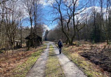
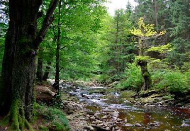
Aujourd’hui, nous vous emmenons dans la fagne de Brackvenn, proche de la frontière allemande.
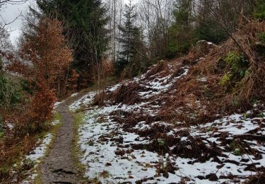
Cette balade se déroule, en forêt, dans les Fagnes, le long d’étendues d’eau,..
Les paysages sont multiples et vraiment agréables.
🌲🌳
Possibilité de pique-niquer. 🍴🥪
Les chiens ne sont pas autorisés, même en laisse, dans la réserve naturelle. 🐩🐶🐕
Convient pour les enfants. 👱👱♂️
Ne convient pas pour les poussettes et personnes à mobilité réduite. 👩🦽👶
N'hésitez pas à aller faire un tour sur notre site internet et nos réseaux :
www.aufildenosdecouvertes.com
www.facebook.com/aufildenosdecouvertes
https://www.instagram.com/au_fil_de_nos_decouvertes/
Localisation
Commentaires
Randonnées à proximité
![Randonnée Marche Montjoie - Montjoie - Ternell en ligne - Photo](https://media.geolcdn.com/t/375/260/d0229e76-e80b-4ee0-af20-8e96d215cea3.jpg&format=jpg&maxdim=2)
![Marche Marche](https://static1.geolcdn.com/sitytour/trail-icons/101.png)
Marche
![](/images/other/stat-length.png)
![](https://static1.geolcdn.com/siteimages/upload/files/16400158638029165_repeat_loop_refresh_sync_direction_icon.png)
![Randonnée Marche Eupen - Hautes Fagnes hohes Venn 20 km - Photo](https://media.geolcdn.com/t/375/260/6f1cadd0-76cd-4012-82b6-befbf33ff4a3.jpg&format=jpg&maxdim=2)
![Marche Marche](https://static1.geolcdn.com/sitytour/trail-icons/101.png)
Marche
![](/images/other/stat-length.png)
![](https://static1.geolcdn.com/siteimages/upload/files/16400158638029165_repeat_loop_refresh_sync_direction_icon.png)
![Randonnée Marche Eupen - Ternell - Circuit Natura 2000, des sites qui valent le détour - Lg12 - Photo](https://media.geolcdn.com/t/375/260/ext.jpg?maxdim=2&url=https%3A%2F%2Fservices.sitytrail.com%2FGeolivesWS%2FDownloadMedia.ashx%3FTrailID%3D182858%26Media%3D2f1c8692-9618-4581-8cd4-3bdd9e8b8b21.JPG)
![Marche Marche](https://static1.geolcdn.com/sitytour/trail-icons/101.png)
Marche
![](/images/other/stat-length.png)
![](https://static1.geolcdn.com/siteimages/upload/files/16400158638029165_repeat_loop_refresh_sync_direction_icon.png)
![Randonnée Marche Eupen - La maison forestiere de Ternell - Photo](https://media.geolcdn.com/t/375/260/ext.jpg?maxdim=2&url=https%3A%2F%2Fstatic1.geolcdn.com%2Fsiteimages%2Fupload%2Ffiles%2F1553511878bg_sport_marche.png)
![Marche Marche](https://static1.geolcdn.com/sitytour/trail-icons/101.png)
Marche
![](/images/other/stat-length.png)
![](https://static1.geolcdn.com/siteimages/upload/files/16400158638029165_repeat_loop_refresh_sync_direction_icon.png)
![Randonnée A pied Montjoie - Monschauer Nationalpark-Wanderweg](https://media.geolcdn.com/t/375/260/6ecae744-a5e1-4d67-8c65-d4bc2433654d.jpeg&format=jpg&maxdim=2)
![A pied A pied](https://static1.geolcdn.com/sitytour/trail-icons/100.png)
A pied
![](/images/other/stat-length.png)
![](https://static1.geolcdn.com/siteimages/upload/files/16400158638029165_repeat_loop_refresh_sync_direction_icon.png)
![Randonnée A pied Montjoie - Klosterroute - Photo](https://media.geolcdn.com/t/375/260/d4896ddf-a189-42c6-b0a5-59bf65f3272d.jpeg&format=jpg&maxdim=2)
![A pied A pied](https://static1.geolcdn.com/sitytour/trail-icons/100.png)
A pied
![](/images/other/stat-length.png)
![](https://static1.geolcdn.com/siteimages/upload/files/16400158638029165_repeat_loop_refresh_sync_direction_icon.png)
![Randonnée A pied Eupen - Herzogenhügel - Brackvenn - Photo](https://media.geolcdn.com/t/375/260/2603330b-7ce5-4c9d-abaf-2fa97788246c.jpeg&format=jpg&maxdim=2)
![A pied A pied](https://static1.geolcdn.com/sitytour/trail-icons/100.png)
A pied
![](/images/other/stat-length.png)
![](https://static1.geolcdn.com/siteimages/upload/files/16400158638029165_repeat_loop_refresh_sync_direction_icon.png)
![Randonnée Marche Waimes - Hautes Fagnes-Eifel - Photo](https://media.geolcdn.com/t/375/260/40133845-0120-4876-b1ba-7fe275277332.jpg&format=jpg&maxdim=2)
![Marche Marche](https://static1.geolcdn.com/sitytour/trail-icons/101.png)
Marche
![](/images/other/stat-length.png)
![](https://static1.geolcdn.com/siteimages/upload/files/16400158638029165_repeat_loop_refresh_sync_direction_icon.png)
![Randonnée Marche Montjoie - Montjoie_804 - Photo](https://media.geolcdn.com/t/375/260/d1f17d7d-8df2-4115-bdce-e0c85ad6eaa6.jpg&format=jpg&maxdim=2)
![Marche Marche](https://static1.geolcdn.com/sitytour/trail-icons/101.png)
Marche
![](/images/other/stat-length.png)
![](https://static1.geolcdn.com/siteimages/upload/files/16400158638029165_repeat_loop_refresh_sync_direction_icon.png)