![](/images/other/stat-length.png)
![Randonnée Marche Narbonne - Fontfroide (aude) Près de Narbonne - Photo](https://media.geolcdn.com/t/1900/400/740c9163-f8f4-4dac-b59d-2c6335707879.jpg&format=pjpeg&maxdim=2)
Fontfroide (aude) Près de Narbonne
MarieFrancoise
Utilisateur
![Longueur](/images/other/stat-length.png)
Longueur
17,2 km
![Altitude max](https://static1.geolcdn.com/siteimages/upload/files/1508320355ic_sort_altitude_max_24dp.png)
Altitude max
257 m
![Dénivelé positif](https://static1.geolcdn.com/siteimages/upload/files/1508320355ic_sort_den_pos_24dp.png)
Dénivelé positif
359 m
![Km-Effort](/images/other/stat-length.png)
Km-Effort
22 km
![Altitude min](https://static1.geolcdn.com/siteimages/upload/files/1508320355ic_sort_altitude_min_24dp.png)
Altitude min
96 m
![Dénivelé négatif](https://static1.geolcdn.com/siteimages/upload/files/1508320355ic_sort_den_neg_24dp.png)
Dénivelé négatif
362 m
![Boucle](https://static1.geolcdn.com/siteimages/upload/files/16400158638029165_repeat_loop_refresh_sync_direction_icon.png)
Boucle
Oui
Date de création :
2021-12-19 08:03:43.254
Dernière modification :
2022-01-11 09:08:04.252
![Marche](https://static1.geolcdn.com/sitytour/trail-icons/101.png)
5h15
Difficulté : Facile
![Scannez ce code QR pour ouvrir la randonnée dans l'application SityTrail](https://capi.geolives.com/qq0zvz2zws4bq2lad0pu/sitytour/trails/3046063/qr.png?size=200)
Application GPS de randonnée GRATUITE
À propos
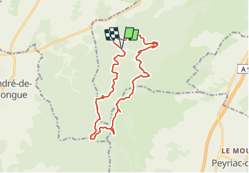
Randonnée Marche de 17,2 km à découvrir à Occitanie, Aude, Narbonne. Cette randonnée est proposée par MarieFrancoise.
Description
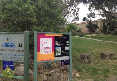
Départ du parking de l Abbaye de Fontfroide
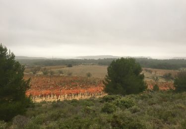
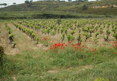
rando facile familiale puisque sans aucune difficulté dans la forêt domaniale de Fontfroide
possibilité de visiter la magnifique abbaye
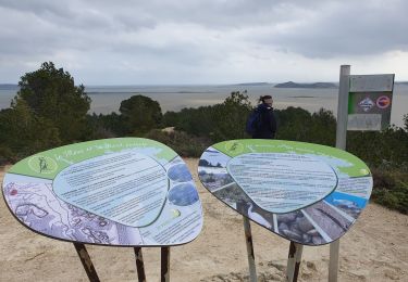
a ne pas faire en été
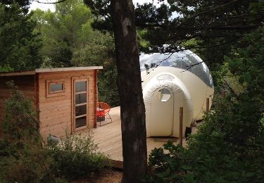
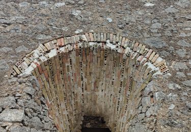
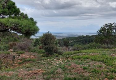
Localisation
Pays :
France
Région :
Occitanie
Département/Province :
Aude
Commune :
Narbonne
Localité :
Unknown
Départ:(Dec)
Départ:(UTM)
491667 ; 4775160 (31T) N.
Commentaires
Randonnées à proximité
![Randonnée Autre activité Bizanet - Abbaye de Fontdefroide - Photo](https://media.geolcdn.com/t/375/260/ext.jpg?maxdim=2&url=https%3A%2F%2Fservices.sitytrail.com%2FGeolivesWS%2FDownloadMedia.ashx%3FTrailID%3D458985%26Media%3D20150814175939.jpg)
![Autre activité Autre activité](https://static1.geolcdn.com/sitytour/trail-icons/900.png)
Abbaye de Fontdefroide
Autre activité
Moyen
(3)
Bizanet,
Occitanie,
Aude,
France
![](/images/other/stat-length.png)
20 km | 26 km-effort
2h 13min
![](https://static1.geolcdn.com/siteimages/upload/files/16400158638029165_repeat_loop_refresh_sync_direction_icon.png)
Oui
![Randonnée Marche Narbonne - bois de Fontfroide - Photo](https://media.geolcdn.com/t/375/260/04a41b67-1fb3-45d4-94a9-cff686aa19ae.jpg&format=jpg&maxdim=2)
![Marche Marche](https://static1.geolcdn.com/sitytour/trail-icons/101.png)
bois de Fontfroide
Marche
Très difficile
Narbonne,
Occitanie,
Aude,
France
![](/images/other/stat-length.png)
17,1 km | 22 km-effort
6h 59min
![](https://static1.geolcdn.com/siteimages/upload/files/16400158638029165_repeat_loop_refresh_sync_direction_icon.png)
Non
![Randonnée Marche Narbonne - L'Aragnon de Frontfroide - Photo](https://media.geolcdn.com/t/375/260/ext.jpg?maxdim=2&url=https%3A%2F%2Fstatic1.geolcdn.com%2Fsiteimages%2Fupload%2Ffiles%2F1553511878bg_sport_marche.png)
![Marche Marche](https://static1.geolcdn.com/sitytour/trail-icons/101.png)
L'Aragnon de Frontfroide
Marche
Très facile
(1)
Narbonne,
Occitanie,
Aude,
France
![](/images/other/stat-length.png)
8,7 km | 10,9 km-effort
2h 24min
![](https://static1.geolcdn.com/siteimages/upload/files/16400158638029165_repeat_loop_refresh_sync_direction_icon.png)
Oui
![Randonnée Marche Saint-André-de-Roquelongue - ACAD - TBG - Saint-Andre-de-Roquelongue reco 23 octobre - Photo](https://media.geolcdn.com/t/375/260/77fdfb1e-6863-402e-bac4-396dcd015702.jpg&format=jpg&maxdim=2)
![Marche Marche](https://static1.geolcdn.com/sitytour/trail-icons/101.png)
ACAD - TBG - Saint-Andre-de-Roquelongue reco 23 octobre
Marche
Très difficile
Saint-André-de-Roquelongue,
Occitanie,
Aude,
France
![](/images/other/stat-length.png)
19 km | 25 km-effort
5h 34min
![](https://static1.geolcdn.com/siteimages/upload/files/16400158638029165_repeat_loop_refresh_sync_direction_icon.png)
Oui
![Randonnée Marche Narbonne - La combe d'enfer en Narbonnais - Photo](https://media.geolcdn.com/t/375/260/28cc313a-8a47-482c-81b5-28081d16a224.jpg&format=jpg&maxdim=2)
![Marche Marche](https://static1.geolcdn.com/sitytour/trail-icons/101.png)
La combe d'enfer en Narbonnais
Marche
Facile
Narbonne,
Occitanie,
Aude,
France
![](/images/other/stat-length.png)
15,9 km | 21 km-effort
4h 30min
![](https://static1.geolcdn.com/siteimages/upload/files/16400158638029165_repeat_loop_refresh_sync_direction_icon.png)
Oui
![Randonnée Marche Bages - Prat-de-Cest - Abbaye de Fontfroide - Photo](https://media.geolcdn.com/t/375/260/fd3516f0-d21c-487d-b7cc-d412f56ad9ce.jpg&format=jpg&maxdim=2)
![Marche Marche](https://static1.geolcdn.com/sitytour/trail-icons/101.png)
Prat-de-Cest - Abbaye de Fontfroide
Marche
Moyen
Bages,
Occitanie,
Aude,
France
![](/images/other/stat-length.png)
14,3 km | 19,2 km-effort
4h 10min
![](https://static1.geolcdn.com/siteimages/upload/files/16400158638029165_repeat_loop_refresh_sync_direction_icon.png)
Oui
![Randonnée Marche Bizanet - Bizanet - Photo](https://media.geolcdn.com/t/375/260/ext.jpg?maxdim=2&url=https%3A%2F%2Fservices.sitytrail.com%2FGeolivesWS%2FDownloadMedia.ashx%3FTrailID%3D172253%26Media%3D8562_5.jpg)
![Marche Marche](https://static1.geolcdn.com/sitytour/trail-icons/101.png)
![Randonnée Marche Narbonne - Narbonne Etang De Jonquières - Photo](https://media.geolcdn.com/t/375/260/ext.jpg?maxdim=2&url=https%3A%2F%2Fservices.sitytrail.com%2FGeolivesWS%2FDownloadMedia.ashx%3FTrailID%3D121016%26Media%3D20120410133338.jpg)
![Marche Marche](https://static1.geolcdn.com/sitytour/trail-icons/101.png)
Narbonne Etang De Jonquières
Marche
Facile
Narbonne,
Occitanie,
Aude,
France
![](/images/other/stat-length.png)
8,1 km | 9,8 km-effort
1h 25min
![](https://static1.geolcdn.com/siteimages/upload/files/16400158638029165_repeat_loop_refresh_sync_direction_icon.png)
Oui
![Randonnée Marche Peyriac-de-Mer - Peyriac. PR des crêtes variantes - Photo](https://media.geolcdn.com/t/375/260/89c213a1-d696-400b-90d7-12f86973f904.jpg&format=jpg&maxdim=2)
![Marche Marche](https://static1.geolcdn.com/sitytour/trail-icons/101.png)
Peyriac. PR des crêtes variantes
Marche
Facile
Peyriac-de-Mer,
Occitanie,
Aude,
France
![](/images/other/stat-length.png)
6,4 km | 8 km-effort
2h 41min
![](https://static1.geolcdn.com/siteimages/upload/files/16400158638029165_repeat_loop_refresh_sync_direction_icon.png)
Oui