![](/images/other/stat-length.png)
![Randonnée Marche Vianden - Les panoramas de Vianden - Photo](https://media.geolcdn.com/t/1900/400/eea14bf8-62f0-4367-9ed4-8f55cee74d56.jpg&format=pjpeg&maxdim=2)
Les panoramas de Vianden
Ko-Rando
Utilisateur
![Longueur](/images/other/stat-length.png)
Longueur
13,5 km
![Altitude max](https://static1.geolcdn.com/siteimages/upload/files/1508320355ic_sort_altitude_max_24dp.png)
Altitude max
443 m
![Dénivelé positif](https://static1.geolcdn.com/siteimages/upload/files/1508320355ic_sort_den_pos_24dp.png)
Dénivelé positif
553 m
![Km-Effort](/images/other/stat-length.png)
Km-Effort
21 km
![Altitude min](https://static1.geolcdn.com/siteimages/upload/files/1508320355ic_sort_altitude_min_24dp.png)
Altitude min
203 m
![Dénivelé négatif](https://static1.geolcdn.com/siteimages/upload/files/1508320355ic_sort_den_neg_24dp.png)
Dénivelé négatif
554 m
![Boucle](https://static1.geolcdn.com/siteimages/upload/files/16400158638029165_repeat_loop_refresh_sync_direction_icon.png)
Boucle
Oui
Date de création :
2021-12-27 10:28:58.564
Dernière modification :
2021-12-27 14:52:11.838
![Marche](https://static1.geolcdn.com/sitytour/trail-icons/101.png)
4h06
Difficulté : Moyen
![Scannez ce code QR pour ouvrir la randonnée dans l'application SityTrail](https://capi.geolives.com/qq0zvz2zws4bq2lad0pu/sitytour/trails/3034770/qr.png?size=200)
Application GPS de randonnée GRATUITE
À propos
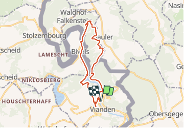
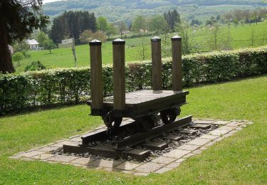
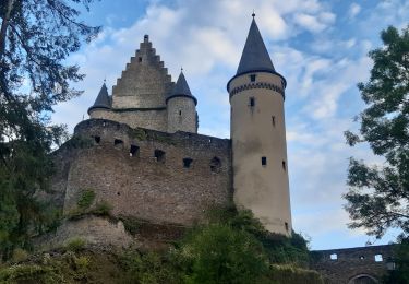
Randonnée Marche de 13,5 km à découvrir à Inconnu, Canton Vianden, Vianden. Cette randonnée est proposée par Ko-Rando.
Description
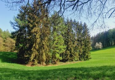
Magnifique rando, sportive avec beaucoup de panoramas 🌿
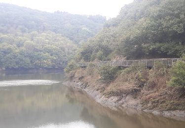
A ne pas faire si peur du vide car les derniers sentiers sont fort abrupts et sans barrières sur une partie de la descente 🥾
Localisation
Pays :
Luxembourg
Région :
Inconnu
Département/Province :
Canton Vianden
Commune :
Vianden
Localité :
Unknown
Départ:(Dec)
Départ:(UTM)
299502 ; 5535366 (32U) N.
Commentaires
Randonnées à proximité
![Randonnée Marche Vianden - Vianden : Télésiège & Château - Photo](https://media.geolcdn.com/t/375/260/d79592ef-5b36-4bc2-ad1d-709da52cc00f.jpg&format=jpg&maxdim=2)
![Marche Marche](https://static1.geolcdn.com/sitytour/trail-icons/101.png)
Vianden : Télésiège & Château
Marche
Moyen
(1)
Vianden,
Inconnu,
Canton Vianden,
Luxembourg
![](/images/other/stat-length.png)
4 km | 6,5 km-effort
1h 28min
![](https://static1.geolcdn.com/siteimages/upload/files/16400158638029165_repeat_loop_refresh_sync_direction_icon.png)
Oui
![Randonnée Marche Vianden - Eislek-pad Vianden - Photo](https://media.geolcdn.com/t/375/260/33ae7762-fc23-4c7a-b8ae-83734bad05ea.jpg&format=jpg&maxdim=2)
![Marche Marche](https://static1.geolcdn.com/sitytour/trail-icons/101.png)
Eislek-pad Vianden
Marche
Moyen
(1)
Vianden,
Inconnu,
Canton Vianden,
Luxembourg
![](/images/other/stat-length.png)
9,2 km | 15,2 km-effort
3h 27min
![](https://static1.geolcdn.com/siteimages/upload/files/16400158638029165_repeat_loop_refresh_sync_direction_icon.png)
Oui
![Randonnée Marche Vianden - Itinérant Luxembourg Jour 7: Vianden -Ettelbruck - Photo](https://media.geolcdn.com/t/375/260/928dee80-2005-4eae-8761-66de6a052544.jpg&format=jpg&maxdim=2)
![Marche Marche](https://static1.geolcdn.com/sitytour/trail-icons/101.png)
Itinérant Luxembourg Jour 7: Vianden -Ettelbruck
Marche
Très difficile
Vianden,
Inconnu,
Canton Vianden,
Luxembourg
![](/images/other/stat-length.png)
26 km | 37 km-effort
6h 8min
![](https://static1.geolcdn.com/siteimages/upload/files/16400158638029165_repeat_loop_refresh_sync_direction_icon.png)
Non
![Randonnée Marche Vianden - Itinérant Luxembourg Jour 6 : Boucle autour de Vianden - Photo](https://media.geolcdn.com/t/375/260/5b9141dd-6e04-4494-b5cf-8eec4ef7e8b3.jpg&format=jpg&maxdim=2)
![Marche Marche](https://static1.geolcdn.com/sitytour/trail-icons/101.png)
Itinérant Luxembourg Jour 6 : Boucle autour de Vianden
Marche
Très difficile
Vianden,
Inconnu,
Canton Vianden,
Luxembourg
![](/images/other/stat-length.png)
24 km | 35 km-effort
5h 46min
![](https://static1.geolcdn.com/siteimages/upload/files/16400158638029165_repeat_loop_refresh_sync_direction_icon.png)
Oui
![Randonnée Marche Tandel - Bettel - Sentier local TA 2 - Photo](https://media.geolcdn.com/t/375/260/8c005037-a9f4-4acb-88bc-4e713f695a2c.jpg&format=jpg&maxdim=2)
![Marche Marche](https://static1.geolcdn.com/sitytour/trail-icons/101.png)
Bettel - Sentier local TA 2
Marche
Moyen
Tandel,
Inconnu,
Canton Vianden,
Luxembourg
![](/images/other/stat-length.png)
6 km | 8,2 km-effort
1h 51min
![](https://static1.geolcdn.com/siteimages/upload/files/16400158638029165_repeat_loop_refresh_sync_direction_icon.png)
Oui
![Randonnée A pied Vianden - Autopedestre Bettel - Photo](https://media.geolcdn.com/t/375/260/02b2f00a-75a6-48f2-b6f0-c11bc4a34d36.jpeg&format=jpg&maxdim=2)
![A pied A pied](https://static1.geolcdn.com/sitytour/trail-icons/100.png)
Autopedestre Bettel
A pied
Facile
(1)
Vianden,
Inconnu,
Canton Vianden,
Luxembourg
![](/images/other/stat-length.png)
10,8 km | 14 km-effort
3h 10min
![](https://static1.geolcdn.com/siteimages/upload/files/16400158638029165_repeat_loop_refresh_sync_direction_icon.png)
Non
![Randonnée A pied Tandel - Autopedestre Brandenbourg - Photo](https://media.geolcdn.com/t/375/260/f773c6ce-1e62-48fa-9c88-bf2c6a499187.jpeg&format=jpg&maxdim=2)
![A pied A pied](https://static1.geolcdn.com/sitytour/trail-icons/100.png)
Autopedestre Brandenbourg
A pied
Facile
Tandel,
Inconnu,
Canton Vianden,
Luxembourg
![](/images/other/stat-length.png)
6,4 km | 9 km-effort
2h 2min
![](https://static1.geolcdn.com/siteimages/upload/files/16400158638029165_repeat_loop_refresh_sync_direction_icon.png)
Oui
![Randonnée Marche Vianden - vianden . stolzemmbour - Photo](https://media.geolcdn.com/t/375/260/04cc6bc0-b9f3-4b97-a33c-e613e3b69f69.jpg&format=jpg&maxdim=2)
![Marche Marche](https://static1.geolcdn.com/sitytour/trail-icons/101.png)
vianden . stolzemmbour
Marche
Moyen
Vianden,
Inconnu,
Canton Vianden,
Luxembourg
![](/images/other/stat-length.png)
13,7 km | 19,8 km-effort
4h 59min
![](https://static1.geolcdn.com/siteimages/upload/files/16400158638029165_repeat_loop_refresh_sync_direction_icon.png)
Non
![Randonnée Marche Vianden - vianden . bivels . vianden - Photo](https://media.geolcdn.com/t/375/260/236bfae8-9247-44a3-8dda-706d19a3b0ec.jpg&format=jpg&maxdim=2)
![Marche Marche](https://static1.geolcdn.com/sitytour/trail-icons/101.png)
vianden . bivels . vianden
Marche
Moyen
Vianden,
Inconnu,
Canton Vianden,
Luxembourg
![](/images/other/stat-length.png)
12,8 km | 19 km-effort
4h 40min
![](https://static1.geolcdn.com/siteimages/upload/files/16400158638029165_repeat_loop_refresh_sync_direction_icon.png)
Oui