![](/images/other/stat-length.png)
![Randonnée Marche Presles - Presles, Saint Martin, Viarmes, Noisy sur Oise - Photo](https://media.geolcdn.com/t/1900/400/ext.pjpeg?maxdim=2&url=https%3A%2F%2Fstatic1.geolcdn.com%2Fsiteimages%2Fupload%2Ffiles%2F1553511878bg_sport_marche.png)
Presles, Saint Martin, Viarmes, Noisy sur Oise
philberard95
Utilisateur
![Longueur](/images/other/stat-length.png)
Longueur
15,8 km
![Altitude max](https://static1.geolcdn.com/siteimages/upload/files/1508320355ic_sort_altitude_max_24dp.png)
Altitude max
213 m
![Dénivelé positif](https://static1.geolcdn.com/siteimages/upload/files/1508320355ic_sort_den_pos_24dp.png)
Dénivelé positif
391 m
![Km-Effort](/images/other/stat-length.png)
Km-Effort
21 km
![Altitude min](https://static1.geolcdn.com/siteimages/upload/files/1508320355ic_sort_altitude_min_24dp.png)
Altitude min
48 m
![Dénivelé négatif](https://static1.geolcdn.com/siteimages/upload/files/1508320355ic_sort_den_neg_24dp.png)
Dénivelé négatif
389 m
![Boucle](https://static1.geolcdn.com/siteimages/upload/files/16400158638029165_repeat_loop_refresh_sync_direction_icon.png)
Boucle
Oui
Date de création :
2021-12-23 14:06:57.843
Dernière modification :
2023-01-11 10:32:20.087
![Marche](https://static1.geolcdn.com/sitytour/trail-icons/101.png)
4h46
Difficulté : Très difficile
![Scannez ce code QR pour ouvrir la randonnée dans l'application SityTrail](https://capi.geolives.com/qq0zvz2zws4bq2lad0pu/sitytour/trails/3032664/qr.png?size=200)
Application GPS de randonnée GRATUITE
À propos
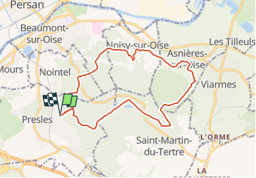
Randonnée Marche de 15,8 km à découvrir à Île-de-France, Val-d'Oise, Presles. Cette randonnée est proposée par philberard95.
Description
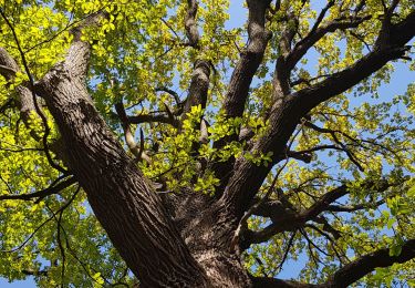
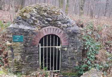
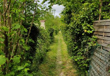
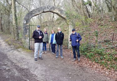
Randonnée de 17 km et de 483 m de dénivelé. Étang bleu et petit étang. Pierre Turquaise. Noisy sur Oise. Asnières sur Oise possibilité de hors sac au café tabac sur la place de l'église au milieu du parcours.
Localisation
Pays :
France
Région :
Île-de-France
Département/Province :
Val-d'Oise
Commune :
Presles
Localité :
Unknown
Départ:(Dec)
Départ:(UTM)
448380 ; 5440550 (31U) N.
Commentaires
Randonnées à proximité
![Randonnée Marche Presles - autour de Presles - Photo](https://media.geolcdn.com/t/375/260/ext.jpg?maxdim=2&url=https%3A%2F%2Fservices.sitytrail.com%2FGeolivesWS%2FDownloadMedia.ashx%3FTrailID%3D263831%26Media%3D20140406161403.jpg)
![Marche Marche](https://static1.geolcdn.com/sitytour/trail-icons/101.png)
autour de Presles
Marche
Facile
(2)
Presles,
Île-de-France,
Val-d'Oise,
France
![](/images/other/stat-length.png)
9 km | 10,4 km-effort
1h 48min
![](https://static1.geolcdn.com/siteimages/upload/files/16400158638029165_repeat_loop_refresh_sync_direction_icon.png)
Oui
![Randonnée Marche Beaumont-sur-Oise - Rando Beaumont-Carnelle - Photo](https://media.geolcdn.com/t/375/260/ext.jpg?maxdim=2&url=https%3A%2F%2Fstatic1.geolcdn.com%2Fsiteimages%2Fupload%2Ffiles%2F1553511878bg_sport_marche.png)
![Marche Marche](https://static1.geolcdn.com/sitytour/trail-icons/101.png)
Rando Beaumont-Carnelle
Marche
Moyen
(2)
Beaumont-sur-Oise,
Île-de-France,
Val-d'Oise,
France
![](/images/other/stat-length.png)
12,9 km | 16,4 km-effort
3h 31min
![](https://static1.geolcdn.com/siteimages/upload/files/16400158638029165_repeat_loop_refresh_sync_direction_icon.png)
Oui
![Randonnée Marche Nerville-la-Forêt - nerville la forêt - Photo](https://media.geolcdn.com/t/375/260/ext.jpg?maxdim=2&url=https%3A%2F%2Fstatic1.geolcdn.com%2Fsiteimages%2Fupload%2Ffiles%2F1553511878bg_sport_marche.png)
![Marche Marche](https://static1.geolcdn.com/sitytour/trail-icons/101.png)
nerville la forêt
Marche
Moyen
(2)
Nerville-la-Forêt,
Île-de-France,
Val-d'Oise,
France
![](/images/other/stat-length.png)
9,9 km | 12,6 km-effort
2h 43min
![](https://static1.geolcdn.com/siteimages/upload/files/16400158638029165_repeat_loop_refresh_sync_direction_icon.png)
Oui
![Randonnée Marche Beaumont-sur-Oise - Beaumont Noisy Asnieres - Photo](https://media.geolcdn.com/t/375/260/2d5753c2-c132-43d7-bbc8-de8d7b24df51.jpg&format=jpg&maxdim=2)
![Marche Marche](https://static1.geolcdn.com/sitytour/trail-icons/101.png)
Beaumont Noisy Asnieres
Marche
Moyen
Beaumont-sur-Oise,
Île-de-France,
Val-d'Oise,
France
![](/images/other/stat-length.png)
13,2 km | 15,2 km-effort
2h 59min
![](https://static1.geolcdn.com/siteimages/upload/files/16400158638029165_repeat_loop_refresh_sync_direction_icon.png)
Oui
![Randonnée Marche Nerville-la-Forêt - Rhododendron - Photo](https://media.geolcdn.com/t/375/260/75c2f839-66bc-4201-88ea-c526c5ecbfdc.jpg&format=jpg&maxdim=2)
![Marche Marche](https://static1.geolcdn.com/sitytour/trail-icons/101.png)
Rhododendron
Marche
Très facile
Nerville-la-Forêt,
Île-de-France,
Val-d'Oise,
France
![](/images/other/stat-length.png)
8,9 km | 10,7 km-effort
2h 7min
![](https://static1.geolcdn.com/siteimages/upload/files/16400158638029165_repeat_loop_refresh_sync_direction_icon.png)
Non
![Randonnée Marche Beaumont-sur-Oise - Beaumont sur oise Noisy sur oise - Photo](https://media.geolcdn.com/t/375/260/6ac51007-0034-4683-b03e-81d6f9e3780c.jpg&format=jpg&maxdim=2)
![Marche Marche](https://static1.geolcdn.com/sitytour/trail-icons/101.png)
Beaumont sur oise Noisy sur oise
Marche
Facile
Beaumont-sur-Oise,
Île-de-France,
Val-d'Oise,
France
![](/images/other/stat-length.png)
11,6 km | 15,6 km-effort
2h 46min
![](https://static1.geolcdn.com/siteimages/upload/files/16400158638029165_repeat_loop_refresh_sync_direction_icon.png)
Oui
![Randonnée Marche Nerville-la-Forêt - Maison forestière Merville le foret - Photo](https://media.geolcdn.com/t/375/260/f0bf1d4c-cae4-4521-aea1-14b47553720b.jpg&format=jpg&maxdim=2)
![Marche Marche](https://static1.geolcdn.com/sitytour/trail-icons/101.png)
Maison forestière Merville le foret
Marche
Difficile
Nerville-la-Forêt,
Île-de-France,
Val-d'Oise,
France
![](/images/other/stat-length.png)
10,8 km | 13,2 km-effort
2h 41min
![](https://static1.geolcdn.com/siteimages/upload/files/16400158638029165_repeat_loop_refresh_sync_direction_icon.png)
Non
![Randonnée Marche Noisy-sur-Oise - forêt de carnelle - Photo](https://media.geolcdn.com/t/375/260/1d38ae56-1525-4792-8527-98abbf8f2f7b.jpg&format=jpg&maxdim=2)
![Marche Marche](https://static1.geolcdn.com/sitytour/trail-icons/101.png)
forêt de carnelle
Marche
Moyen
Noisy-sur-Oise,
Île-de-France,
Val-d'Oise,
France
![](/images/other/stat-length.png)
11,1 km | 14,4 km-effort
2h 49min
![](https://static1.geolcdn.com/siteimages/upload/files/16400158638029165_repeat_loop_refresh_sync_direction_icon.png)
Oui
![Randonnée Marche Champagne-sur-Oise - gare de Champagne Ronquerolle - Photo](https://media.geolcdn.com/t/375/260/0221b71e-795c-41da-839b-f9a359faf2a0.jpg&format=jpg&maxdim=2)
![Marche Marche](https://static1.geolcdn.com/sitytour/trail-icons/101.png)
gare de Champagne Ronquerolle
Marche
Difficile
Champagne-sur-Oise,
Île-de-France,
Val-d'Oise,
France
![](/images/other/stat-length.png)
12,9 km | 16,4 km-effort
3h 5min
![](https://static1.geolcdn.com/siteimages/upload/files/16400158638029165_repeat_loop_refresh_sync_direction_icon.png)
Oui