Randonnée V.T.T. Virton - A la frontière de Sommethonne II  -  Balade_VTT_20kms - Photo

A la frontière de Sommethonne II - Balade_VTT_20kms

 Pascal L
Pascal L

Utilisateur

© OpenStreetMap contributors
Longueur
Longueur
19,5 km
Altitude max
Altitude max
326 m
Dénivelé positif
Dénivelé positif
361 m
Km-Effort
Km-Effort  
24 km
Altitude min
Altitude min
196 m
Dénivelé négatif
Dénivelé négatif
362 m
Boucle
Boucle
Oui
Date de création :
2021-12-11 14:45:31.111
Dernière modification :
2022-12-12 10:04:32.506

(0 Avis)

V.T.T.
V.T.T.
2h10
Difficulté : Moyen

Scannez ce code QR pour ouvrir la randonnée dans l'application SityTrail

Application GPS de randonnée GRATUITE

Logo SityTrail SityTrail

IGN / Instituts géographiques

Télécharger SityTrail sur l'App Store Télécharger SityTrail sur Google Play

Logo SityTrail SityTrail World

Le monde est à vous

Télécharger SityTrail sur l'App Store Télécharger SityTrail sur Google Play Télécharger SityTrail sur Huawei AppGallery

À propos

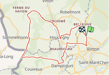
Randonnée V.T.T. de 19,5 km à découvrir à Wallonie, Luxembourg, Virton. Cette randonnée est proposée par Pascal L.

Description

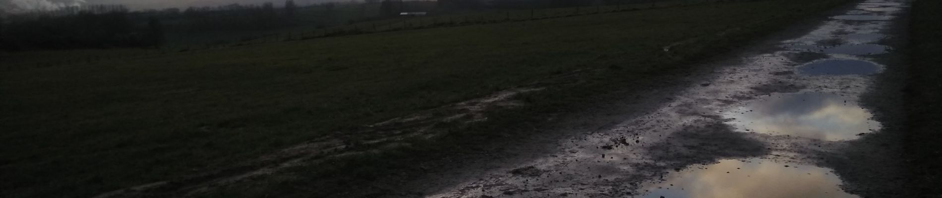
Départ/Retour: Virton (Grange au bois)
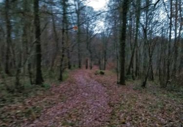
Endrois de passage: La Ferme de Rosière (Houdrigny), Moulin de Berchiwé, La Chevratte, Bois de Lavau, Naue Godin, Bois d'Arrentement, Mont Rivaux, Bois de Dampicourt, Rouvroy, Fontaine des Dames, Beauregard, Ferme Saint-Joseph.

Vidéos:
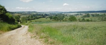
- https://vimeo.com/744950893  (vue sur les alentours d'Houdrigny et Villers-la-Loue)
- https://vimeo.com/744952586 (vue sur les alentours à Naue Godin)

Ref.
- https://www.meix-devant-virton.be/ma-commune/decouvrir/geographie/nos-villages/sommethonne
- https://fr.wikipedia.org/wiki/Sommethonne

(2021.12.11)

Profil altimétrique

Photos

Points d'intérêt

Point d'intérêt Rouvroy - Croix Sainte Reine - Photo
Pascal L
Point d'intérêt Meix-devant-Virton - La Ferme de Rosière à Houdrigny - Photo
Pascal L

Localisation

Pays :
Belgique
Région :
Wallonie
Département/Province :
Luxembourg
Commune :
Virton
Localité :
Virton
Départ:(UTM)
682573 ; 5494682 (31U) N.

Randonnées à proximité

Randonnée Marche Virton - RB-Lu-17_Ethe_via-var-1-et-2-et-3 - Photo
Marche
PRO

Marche

Très facile
(3)
Virton, Wallonie, Luxembourg, Belgique
29 km | 35 km-effort
7h 33min
Oui
Randonnée V.T.T. Virton - Autour de Ethe  -  Balade_VTT_20kms - Photo
V.T.T.
Pascal L

V.T.T.

Facile
(1)
Virton, Wallonie, Luxembourg, Belgique
21 km | 26 km-effort
1h 40min
Oui
Randonnée A pied Virton - La Bajocienne - Photo
A pied
GUIDE+

A pied

Facile
(1)
Virton, Wallonie, Luxembourg, Belgique
11 km | 14,5 km-effort
3h 17min
Oui
Randonnée Marche Virton - RB-Lu-17_Ethe_via-racc - Photo
Marche
PRO

Marche

Très facile
Virton, Wallonie, Luxembourg, Belgique
15,6 km | 19,3 km-effort
4h 8min
Oui
Randonnée Marche Virton - RB-Lu-17_Ethe - Photo
Marche
PRO

Marche

Très facile
Virton, Wallonie, Luxembourg, Belgique
22 km | 28 km-effort
5h 55min
Oui
Randonnée V.T.T. Virton - Autour de Tintigny  -  Balade_VTT_54Kms - Photo
V.T.T.
Pascal L

V.T.T.

Très difficile
Virton, Wallonie, Luxembourg, Belgique
54 km | 64 km-effort
4h 25min
Oui
Randonnée V.T.T. Virton - Monquintin  -  Balade_VTT_22Kms - Photo
V.T.T.
Pascal L

V.T.T.

Moyen
Virton, Wallonie, Luxembourg, Belgique
22 km | 26 km-effort
1h 48min
Oui
Randonnée V.T.T. Virton - Orval  -  Balade_VTT_50Kms - Photo
V.T.T.
Pascal L

V.T.T.

Très difficile
Virton, Wallonie, Luxembourg, Belgique
50 km | 61 km-effort
4h 15min
Non
Randonnée V.T.T. Virton - Bois du Bonlieu  -  Balade_VTT_24kms - Photo
V.T.T.
Pascal L

V.T.T.

Moyen
Virton, Wallonie, Luxembourg, Belgique
23 km | 28 km-effort
2h 1min
Oui


Fermer
Mes abonnements