![](/images/other/stat-length.png)
![Randonnée Ski de randonnée Le Châtelard - col de Rossanaz - Photo](https://media.geolcdn.com/t/1900/400/50e32d24-befc-4efc-87ab-b6a2311f6d3b.jpg&format=pjpeg&maxdim=2)
col de Rossanaz
nadd73
Utilisateur GUIDE
![Longueur](/images/other/stat-length.png)
Longueur
10,6 km
![Altitude max](https://static1.geolcdn.com/siteimages/upload/files/1508320355ic_sort_altitude_max_24dp.png)
Altitude max
1781 m
![Dénivelé positif](https://static1.geolcdn.com/siteimages/upload/files/1508320355ic_sort_den_pos_24dp.png)
Dénivelé positif
1041 m
![Km-Effort](/images/other/stat-length.png)
Km-Effort
24 km
![Altitude min](https://static1.geolcdn.com/siteimages/upload/files/1508320355ic_sort_altitude_min_24dp.png)
Altitude min
734 m
![Dénivelé négatif](https://static1.geolcdn.com/siteimages/upload/files/1508320355ic_sort_den_neg_24dp.png)
Dénivelé négatif
1044 m
![Boucle](https://static1.geolcdn.com/siteimages/upload/files/16400158638029165_repeat_loop_refresh_sync_direction_icon.png)
Boucle
Oui
Date de création :
2021-12-16 10:03:09.163
Dernière modification :
2021-12-16 18:15:17.08
![Ski de randonnée](https://static1.geolcdn.com/sitytour/trail-icons/503.png)
5h00
Difficulté : Difficile
![Scannez ce code QR pour ouvrir la randonnée dans l'application SityTrail](https://capi.geolives.com/qq0zvz2zws4bq2lad0pu/sitytour/trails/3028008/qr.png?size=200)
Application GPS de randonnée GRATUITE
À propos
Randonnée Ski de randonnée de 10,6 km à découvrir à Auvergne-Rhône-Alpes, Savoie, Le Châtelard. Cette randonnée est proposée par nadd73.
Description
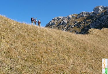
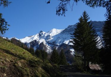
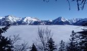
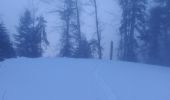
Départ de Montlardier. Galère à la montée car beaucoup d'arbres et pour contourner les barres en haut. Heureusement qu'à la descente j'ai eu de la poudreuse et c'était plus aéré.
Localisation
Pays :
France
Région :
Auvergne-Rhône-Alpes
Département/Province :
Savoie
Commune :
Le Châtelard
Localité :
Unknown
Départ:(Dec)
Départ:(UTM)
276181 ; 5062236 (32T) N.
Commentaires
Randonnées à proximité
![Randonnée Marche Arith - La Montagne de Bange 1434m, depuis Montagny - Photo](https://media.geolcdn.com/t/375/260/ext.jpg?maxdim=2&url=https%3A%2F%2Fservices.sitytrail.com%2FGeolivesWS%2FDownloadMedia.ashx%3FTrailID%3D317290%26Media%3D16482_1.jpg)
![Marche Marche](https://static1.geolcdn.com/sitytour/trail-icons/101.png)
La Montagne de Bange 1434m, depuis Montagny
Marche
Moyen
(1)
Arith,
Auvergne-Rhône-Alpes,
Savoie,
France
![](/images/other/stat-length.png)
10,5 km | 18,5 km-effort
3h 45min
![](https://static1.geolcdn.com/siteimages/upload/files/16400158638029165_repeat_loop_refresh_sync_direction_icon.png)
Oui
![Randonnée Marche Doucy-en-Bauges - Traversée du Mont Trélod, 2181m - Photo](https://media.geolcdn.com/t/375/260/ext.jpg?maxdim=2&url=https%3A%2F%2Fservices.sitytrail.com%2FGeolivesWS%2FDownloadMedia.ashx%3FTrailID%3D103833%26Media%3D6623_1.jpg)
![Marche Marche](https://static1.geolcdn.com/sitytour/trail-icons/101.png)
Traversée du Mont Trélod, 2181m
Marche
Moyen
(1)
Doucy-en-Bauges,
Auvergne-Rhône-Alpes,
Savoie,
France
![](/images/other/stat-length.png)
10,9 km | 28 km-effort
7h 30min
![](https://static1.geolcdn.com/siteimages/upload/files/16400158638029165_repeat_loop_refresh_sync_direction_icon.png)
Non
![Randonnée Marche Le Châtelard - Roc poyet - Photo](https://media.geolcdn.com/t/375/260/a503fd55-09ac-42bc-9003-547472a05706.jpg&format=jpg&maxdim=2)
![Marche Marche](https://static1.geolcdn.com/sitytour/trail-icons/101.png)
Roc poyet
Marche
Moyen
Le Châtelard,
Auvergne-Rhône-Alpes,
Savoie,
France
![](/images/other/stat-length.png)
8,2 km | 19,8 km-effort
5h 6min
![](https://static1.geolcdn.com/siteimages/upload/files/16400158638029165_repeat_loop_refresh_sync_direction_icon.png)
Oui
![Randonnée Marche Doucy-en-Bauges - 2015-09-11 Marche Mont Trelod - Photo](https://media.geolcdn.com/t/375/260/ext.jpg?maxdim=2&url=https%3A%2F%2Fstatic1.geolcdn.com%2Fsiteimages%2Fupload%2Ffiles%2F1553511878bg_sport_marche.png)
![Marche Marche](https://static1.geolcdn.com/sitytour/trail-icons/101.png)
2015-09-11 Marche Mont Trelod
Marche
Moyen
(1)
Doucy-en-Bauges,
Auvergne-Rhône-Alpes,
Savoie,
France
![](/images/other/stat-length.png)
12,4 km | 28 km-effort
5h 25min
![](https://static1.geolcdn.com/siteimages/upload/files/16400158638029165_repeat_loop_refresh_sync_direction_icon.png)
Oui
![Randonnée Marche Jarsy - nôtre dame de Bellevaux - Photo](https://media.geolcdn.com/t/375/260/1be31ea5-d3d1-459b-88d3-6aa2e29612aa.jpg&format=jpg&maxdim=2)
![Marche Marche](https://static1.geolcdn.com/sitytour/trail-icons/101.png)
nôtre dame de Bellevaux
Marche
Très facile
Jarsy,
Auvergne-Rhône-Alpes,
Savoie,
France
![](/images/other/stat-length.png)
5,2 km | 7,9 km-effort
1h 28min
![](https://static1.geolcdn.com/siteimages/upload/files/16400158638029165_repeat_loop_refresh_sync_direction_icon.png)
Oui
![Randonnée Marche Doucy-en-Bauges - 250524 Le Trelod et la Dents des Portes - Photo](https://media.geolcdn.com/t/375/260/4afdb455-3922-47f1-8f79-e9d92dd0333d.jpg&format=jpg&maxdim=2)
![Marche Marche](https://static1.geolcdn.com/sitytour/trail-icons/101.png)
250524 Le Trelod et la Dents des Portes
Marche
Très difficile
Doucy-en-Bauges,
Auvergne-Rhône-Alpes,
Savoie,
France
![](/images/other/stat-length.png)
11,9 km | 28 km-effort
6h 9min
![](https://static1.geolcdn.com/siteimages/upload/files/16400158638029165_repeat_loop_refresh_sync_direction_icon.png)
Oui
![Marche Marche](https://static1.geolcdn.com/sitytour/trail-icons/101.png)
Croix d'Allant et Plan de la Limace
Marche
Très difficile
Jarsy,
Auvergne-Rhône-Alpes,
Savoie,
France
![](/images/other/stat-length.png)
14,6 km | 26 km-effort
6h 29min
![](https://static1.geolcdn.com/siteimages/upload/files/16400158638029165_repeat_loop_refresh_sync_direction_icon.png)
Oui
![Randonnée Marche Aillon-le-Vieux - col colombier - Photo](https://media.geolcdn.com/t/375/260/e2b5f89d-50b0-4b1d-ae97-04fc8e08fc45.jpg&format=jpg&maxdim=2)
![Marche Marche](https://static1.geolcdn.com/sitytour/trail-icons/101.png)
col colombier
Marche
Moyen
Aillon-le-Vieux,
Auvergne-Rhône-Alpes,
Savoie,
France
![](/images/other/stat-length.png)
9,4 km | 21 km-effort
3h 5min
![](https://static1.geolcdn.com/siteimages/upload/files/16400158638029165_repeat_loop_refresh_sync_direction_icon.png)
Oui
![Randonnée Marche Arith - Col de la couchette en boucle avec passage au refuge - Photo](https://media.geolcdn.com/t/375/260/5494724c-8476-4b53-a696-21ced4d7d42a.jpg&format=jpg&maxdim=2)
![Marche Marche](https://static1.geolcdn.com/sitytour/trail-icons/101.png)
Col de la couchette en boucle avec passage au refuge
Marche
Facile
Arith,
Auvergne-Rhône-Alpes,
Savoie,
France
![](/images/other/stat-length.png)
12,9 km | 22 km-effort
4h 17min
![](https://static1.geolcdn.com/siteimages/upload/files/16400158638029165_repeat_loop_refresh_sync_direction_icon.png)
Oui