Randonnée Marche Yvoir - Liaison Ahinvaux  - Tricointe - Photo

Liaison Ahinvaux - Tricointe

 Michel.G.
Michel.G.

Utilisateur

© OpenStreetMap contributors
Longueur
Longueur
1,5 km
Altitude max
Altitude max
198 m
Dénivelé positif
Dénivelé positif
39 m
Km-Effort
Km-Effort  
1,9 km
Altitude min
Altitude min
160 m
Dénivelé négatif
Dénivelé négatif
5 m
Boucle
Boucle
Non
Date de création :
2021-12-14 12:36:41.1
Dernière modification :
2021-12-14 12:41:31.45

(0 Avis)

Marche
Marche
26m
Difficulté : Facile
Marche nordique
Marche nordique
--
Difficulté : Très facile
Course à pied
Course à pied
--
Difficulté : Très facile
Trail
Trail
--
Difficulté : Très facile
V.T.T.
V.T.T.
8m
Difficulté : Facile

Scannez ce code QR pour ouvrir la randonnée dans l'application SityTrail

Application GPS de randonnée GRATUITE

Logo SityTrail SityTrail

IGN / Instituts géographiques

Télécharger SityTrail sur l'App Store Télécharger SityTrail sur Google Play

Logo SityTrail SityTrail World

Le monde est à vous

Télécharger SityTrail sur l'App Store Télécharger SityTrail sur Google Play Télécharger SityTrail sur Huawei AppGallery

À propos

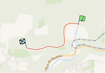
Randonnée Marche de 1,5 km à découvrir à Wallonie, Namur, Yvoir. Cette randonnée est proposée par Michel.G..

Description

12.2021 - Suite à à une importante exploitation forestière, ce passage est impraticable et interdit de passage par l'Administration communale d'Yvoir. Ceci jusqu'au 04.2022 sauf si la remise en état est effectuée avant.

Profil altimétrique

Localisation

Pays :
Belgique
Région :
Wallonie
Département/Province :
Namur
Commune :
Yvoir
Localité :
Unknown
Départ:(UTM)
635752 ; 5578491 (31U) N.

Randonnées à proximité

Randonnée Marche Profondeville - RL-GG-19 - Lustin - Namur - 2025-02-11 - Photo
Marche
PRO

Marche

Très difficile
(13)
Profondeville, Wallonie, Namur, Belgique
22 km | 29 km-effort
6h 30min
Non
Randonnée Marche Yvoir - RB-Na-21_Mont - Photo
Marche
PRO

Marche

Très difficile
(6)
Yvoir, Wallonie, Namur, Belgique
22 km | 30 km-effort
6h 51min
Oui
Randonnée Marche Profondeville - RB-Na-20_Profondeville_via-racc-2 - Photo
Marche
PRO

Marche

Très difficile
(11)
Profondeville, Wallonie, Namur, Belgique
14,6 km | 22 km-effort
4h 53min
Oui
Randonnée Marche Profondeville - RB-Na-20_Profondeville - Photo
Marche
PRO

Marche

Très difficile
(16)
Profondeville, Wallonie, Namur, Belgique
18,5 km | 26 km-effort
5h 55min
Oui
Randonnée Marche Assesse - RB-Na-02_Crupet_via-racc - Photo
Marche
PRO

Marche

Moyen
(7)
Assesse, Wallonie, Namur, Belgique
17 km | 23 km-effort
5h 32min
Oui
Randonnée Marche Assesse - RB-Na-02_Crupet - Photo
Marche
PRO

Marche

Moyen
(21)
Assesse, Wallonie, Namur, Belgique
21 km | 28 km-effort
5h 32min
Oui
Randonnée Marche Yvoir - RB-Na-03_Houx - Photo
Marche
PRO

Marche

Difficile
(11)
Yvoir, Wallonie, Namur, Belgique
22 km | 30 km-effort
7h 1min
Oui
Randonnée Marche Assesse - 05 Paysage condruzien - Photo
Marche
GUIDE+

Marche

Facile
(5)
Assesse, Wallonie, Namur, Belgique
10,2 km | 13,3 km-effort
2h 11min
Non
Randonnée Marche Yvoir - RL-GG-38_Godinne_Dinant - Photo
Marche
PRO

Marche

Très difficile
(6)
Yvoir, Wallonie, Namur, Belgique
19,5 km | 27 km-effort
6h 13min
Non


Fermer
Mes abonnements