Randonnée Marche Conflans-sur-Seine - ENTRE CONFLANS SUR SEINE ET MARCILLY SUR SEINE - Photo

ENTRE CONFLANS SUR SEINE ET MARCILLY SUR SEINE

 jeannine grandjean
jeannine grandjean

Utilisateur

© OpenStreetMap contributors
Longueur
Longueur
10,7 km
Altitude max
Altitude max
86 m
Dénivelé positif
Dénivelé positif
70 m
Km-Effort
Km-Effort  
11,7 km
Altitude min
Altitude min
63 m
Dénivelé négatif
Dénivelé négatif
68 m
Boucle
Boucle
Oui
Date de création :
2021-12-11 17:41:31.534
Dernière modification :
2022-01-31 21:23:44.014

(0 Avis)

Marche
Marche
2h39
Difficulté : Moyen

Scannez ce code QR pour ouvrir la randonnée dans l'application SityTrail

Application GPS de randonnée GRATUITE

Logo SityTrail SityTrail

IGN / Instituts géographiques

Télécharger SityTrail sur l'App Store Télécharger SityTrail sur Google Play

Logo SityTrail SityTrail World

Le monde est à vous

Télécharger SityTrail sur l'App Store Télécharger SityTrail sur Google Play Télécharger SityTrail sur Huawei AppGallery

À propos

Randonnée Marche de 10,7 km à découvrir à Grand Est, Marne, Conflans-sur-Seine. Cette randonnée est proposée par jeannine grandjean.

Description

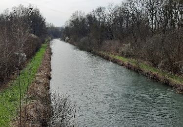
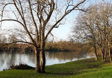
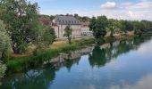
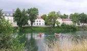
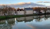
découverte des rives de la Seine et de ses noues, de la voie verte le long du canal de la Haute Seine et des 2 villages (attention : en cas d'inondation, chemin impraticable au retour, le long de la Seine)
sur les hauteurs de Conflans, vue panoramique en direction de Chantemerle

Profil altimétrique

Photos

Localisation

Pays :
France
Région :
Grand Est
Département/Province :
Marne
Commune :
Conflans-sur-Seine
Localité :
Unknown
Départ:(UTM)
550187 ; 5377650 (31U) N.

Randonnées à proximité

Randonnée Marche Crancey - Entre CRANCEY et PONT SUR SEINE - Photo
Marche
jeannine grandjean

Marche

Moyen
Crancey, Grand Est, Aube, France
10,2 km | 11,5 km-effort
2h 25min
Oui
Randonnée Marche Conflans-sur-Seine - au départ de CONFLANS sur SEINE - Photo
Marche
jeannine grandjean

Marche

Facile
Conflans-sur-Seine, Grand Est, Marne, France
15,7 km | 17,5 km-effort
3h 17min
Non
Randonnée Marche nordique Romilly-sur-Seine - la Béchère 6 décembre 2021 - Photo
Marche nordique
jeannine grandjean

Marche nordique

Moyen
Romilly-sur-Seine, Grand Est, Aube, France
8,5 km | 9 km-effort
1h 36min
Oui
Randonnée Vélo Romilly-sur-Seine - Balade en bord de Seine - Romilly sur Seine - Photo
Vélo
tracegps

Vélo

Moyen
Romilly-sur-Seine, Grand Est, Aube, France
58 km | 62 km-effort
2h 30min
Oui
Randonnée Marche Esclavolles-Lurey - tournée esclavolles-lurey  - Photo
Marche
cacal51

Marche

Facile
Esclavolles-Lurey, Grand Est, Marne, France
3,8 km | 3,9 km-effort
50min
Oui
Randonnée Marche Esclavolles-Lurey - esclavolles-lurey, Périgny  - Photo
Marche
cacal51

Marche

Facile
Esclavolles-Lurey, Grand Est, Marne, France
9,8 km | 11 km-effort
1h 58min
Oui
Randonnée Marche Esclavolles-Lurey - Esclavolles Esclavolles via éoliennes et Potangis - Photo
Marche
Patrick Castagne

Marche

Moyen
Esclavolles-Lurey, Grand Est, Marne, France
10,1 km | 11,9 km-effort
2h 36min
Oui
Randonnée Marche Romilly-sur-Seine - béchère  - Photo
Marche
cacal51

Marche

Facile
Romilly-sur-Seine, Grand Est, Aube, France
4,1 km | 4,5 km-effort
1h 32min
Oui
Randonnée sport Crancey - CRANCEY (10) - Circuit de La Bassée à la Haute Plaine  - Photo
sport
temmichel

sport

Très facile
Crancey, Grand Est, Aube, France
11,7 km | 12,9 km-effort
Inconnu
Oui


Fermer
Mes abonnements