![](/images/other/stat-length.png)
![Randonnée Marche Lamballe-Armor - Tour de Planguenoual - Photo](https://media.geolcdn.com/t/1900/400/ext.pjpeg?maxdim=2&url=https%3A%2F%2Fstatic1.geolcdn.com%2Fsiteimages%2Fupload%2Ffiles%2F1553511878bg_sport_marche.png)
Tour de Planguenoual
Loumo29
Utilisateur
![Longueur](/images/other/stat-length.png)
Longueur
18,1 km
![Altitude max](https://static1.geolcdn.com/siteimages/upload/files/1508320355ic_sort_altitude_max_24dp.png)
Altitude max
96 m
![Dénivelé positif](https://static1.geolcdn.com/siteimages/upload/files/1508320355ic_sort_den_pos_24dp.png)
Dénivelé positif
273 m
![Km-Effort](/images/other/stat-length.png)
Km-Effort
22 km
![Altitude min](https://static1.geolcdn.com/siteimages/upload/files/1508320355ic_sort_altitude_min_24dp.png)
Altitude min
5 m
![Dénivelé négatif](https://static1.geolcdn.com/siteimages/upload/files/1508320355ic_sort_den_neg_24dp.png)
Dénivelé négatif
274 m
![Boucle](https://static1.geolcdn.com/siteimages/upload/files/16400158638029165_repeat_loop_refresh_sync_direction_icon.png)
Boucle
Oui
Date de création :
2014-12-10 00:00:00.0
Dernière modification :
2014-12-10 00:00:00.0
![Marche](https://static1.geolcdn.com/sitytour/trail-icons/101.png)
4h42
Difficulté : Moyen
![Scannez ce code QR pour ouvrir la randonnée dans l'application SityTrail](https://capi.geolives.com/qq0zvz2zws4bq2lad0pu/sitytour/trails/301866/qr.png?size=200)
Application GPS de randonnée GRATUITE
À propos
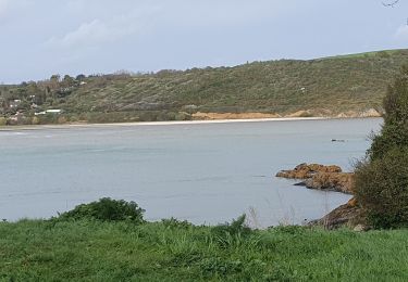
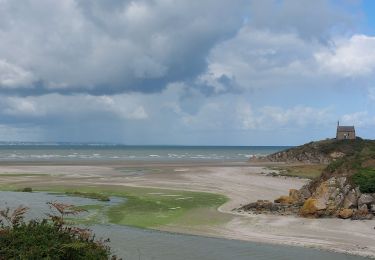
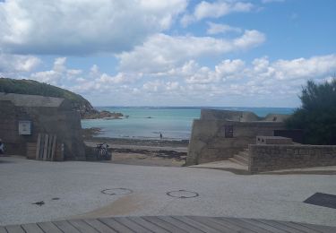
Randonnée Marche de 18,1 km à découvrir à Bretagne, Côtes-d'Armor, Lamballe-Armor. Cette randonnée est proposée par Loumo29.
Description
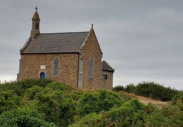
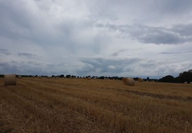
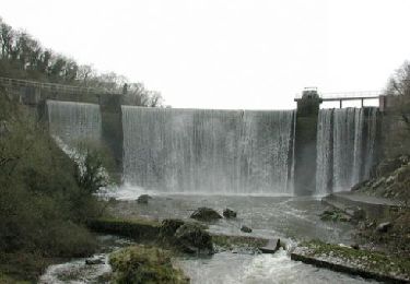
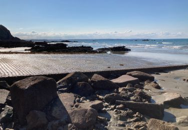
Départ de l'église de Planguenoual.Direction Jospinet puis le GR 34 jusqu'au pont-Rolland. Continuer vers les ponts-neufs.Rejoindre Planguenoual par les chemins agricoles et le stade.
Localisation
Pays :
France
Région :
Bretagne
Département/Province :
Côtes-d'Armor
Commune :
Lamballe-Armor
Localité :
Unknown
Départ:(Dec)
Départ:(UTM)
531192 ; 5375680 (30U) N.
Commentaires
Randonnées à proximité
![Randonnée Marche Hillion - Hillion - Photo](https://media.geolcdn.com/t/375/260/5f86b00a-294e-442a-9394-58fb975dda85.jpg&format=jpg&maxdim=2)
![Marche Marche](https://static1.geolcdn.com/sitytour/trail-icons/101.png)
![Randonnée Marche Lamballe-Armor - GR_34_CB_15_Lamballe_Yffiniac_20230922 - Photo](https://media.geolcdn.com/t/375/260/95482d3b-17df-46c8-b98d-a214b5d07890.jpg&format=jpg&maxdim=2)
![Marche Marche](https://static1.geolcdn.com/sitytour/trail-icons/101.png)
GR_34_CB_15_Lamballe_Yffiniac_20230922
Marche
Très difficile
Lamballe-Armor,
Bretagne,
Côtes-d'Armor,
France
![](/images/other/stat-length.png)
17 km | 20 km-effort
4h 38min
![](https://static1.geolcdn.com/siteimages/upload/files/16400158638029165_repeat_loop_refresh_sync_direction_icon.png)
Non
![Randonnée Marche Lamballe-Armor - La Côte du Port Morvan 6.7.23 - Photo](https://media.geolcdn.com/t/375/260/8311d318-82e2-44fd-9871-c2f1c72b6002.jpg&format=jpg&maxdim=2)
![Marche Marche](https://static1.geolcdn.com/sitytour/trail-icons/101.png)
La Côte du Port Morvan 6.7.23
Marche
Facile
Lamballe-Armor,
Bretagne,
Côtes-d'Armor,
France
![](/images/other/stat-length.png)
7,9 km | 10,2 km-effort
2h 15min
![](https://static1.geolcdn.com/siteimages/upload/files/16400158638029165_repeat_loop_refresh_sync_direction_icon.png)
Oui
![Randonnée Marche Lamballe-Armor - LES PONTS NEUFS DEPUIS LA CHAPELLE SAINT-MAURICE - Photo](https://media.geolcdn.com/t/375/260/50217cef-5adc-4fcb-b707-2ba68b727565.jpg&format=jpg&maxdim=2)
![Marche Marche](https://static1.geolcdn.com/sitytour/trail-icons/101.png)
LES PONTS NEUFS DEPUIS LA CHAPELLE SAINT-MAURICE
Marche
Difficile
Lamballe-Armor,
Bretagne,
Côtes-d'Armor,
France
![](/images/other/stat-length.png)
11,4 km | 14,4 km-effort
3h 10min
![](https://static1.geolcdn.com/siteimages/upload/files/16400158638029165_repeat_loop_refresh_sync_direction_icon.png)
Oui
![Randonnée Marche Lamballe-Armor - Hillion, Les ponts neufs, Grd tour - Photo](https://media.geolcdn.com/t/375/260/d6f9ac0c-bbb0-4e95-985e-ffd718b35a44.jpg&format=jpg&maxdim=2)
![Marche Marche](https://static1.geolcdn.com/sitytour/trail-icons/101.png)
Hillion, Les ponts neufs, Grd tour
Marche
Facile
Lamballe-Armor,
Bretagne,
Côtes-d'Armor,
France
![](/images/other/stat-length.png)
9,6 km | 11,1 km-effort
2h 55min
![](https://static1.geolcdn.com/siteimages/upload/files/16400158638029165_repeat_loop_refresh_sync_direction_icon.png)
Oui
![Randonnée Marche Lamballe-Armor - Planguenoual - GR34 - 1 - Photo](https://media.geolcdn.com/t/375/260/ext.jpg?maxdim=2&url=https%3A%2F%2Fservices.sitytrail.com%2FGeolivesWS%2FDownloadMedia.ashx%3FTrailID%3D301797%26Media%3Dbdaa7ae5-5900-4d86-b97c-0d1afc4379c1.jpg)
![Marche Marche](https://static1.geolcdn.com/sitytour/trail-icons/101.png)
Planguenoual - GR34 - 1
Marche
Moyen
Lamballe-Armor,
Bretagne,
Côtes-d'Armor,
France
![](/images/other/stat-length.png)
23 km | 29 km-effort
6h 7min
![](https://static1.geolcdn.com/siteimages/upload/files/16400158638029165_repeat_loop_refresh_sync_direction_icon.png)
Oui
![Randonnée Marche Saint-Alban - A la rencontre de la Flora - Saint Alban - Photo](https://media.geolcdn.com/t/375/260/ext.jpg?maxdim=2&url=https%3A%2F%2Fservices.sitytrail.com%2FGeolivesWS%2FDownloadMedia.ashx%3FTrailID%3D112673%26Media%3D11455_5.jpg)
![Marche Marche](https://static1.geolcdn.com/sitytour/trail-icons/101.png)
A la rencontre de la Flora - Saint Alban
Marche
Moyen
Saint-Alban,
Bretagne,
Côtes-d'Armor,
France
![](/images/other/stat-length.png)
10 km | 12 km-effort
2h 30min
![](https://static1.geolcdn.com/siteimages/upload/files/16400158638029165_repeat_loop_refresh_sync_direction_icon.png)
Oui
![Randonnée Marche Lamballe-Armor - Planguenouan - Photo](https://media.geolcdn.com/t/375/260/c8ac0864-9c49-43bb-8972-2ec0fd1097e5.jpg&format=jpg&maxdim=2)
![Marche Marche](https://static1.geolcdn.com/sitytour/trail-icons/101.png)
Planguenouan
Marche
Moyen
Lamballe-Armor,
Bretagne,
Côtes-d'Armor,
France
![](/images/other/stat-length.png)
14,2 km | 18,2 km-effort
4h 16min
![](https://static1.geolcdn.com/siteimages/upload/files/16400158638029165_repeat_loop_refresh_sync_direction_icon.png)
Oui
![Randonnée Marche Lamballe-Armor - GR 34 Etape 11 Morieux Saint Brieuc 22-10-2020 - Photo](https://media.geolcdn.com/t/375/260/ext.jpg?maxdim=2&url=https%3A%2F%2Fstatic1.geolcdn.com%2Fsiteimages%2Fupload%2Ffiles%2F1553511878bg_sport_marche.png)
![Marche Marche](https://static1.geolcdn.com/sitytour/trail-icons/101.png)
GR 34 Etape 11 Morieux Saint Brieuc 22-10-2020
Marche
Moyen
Lamballe-Armor,
Bretagne,
Côtes-d'Armor,
France
![](/images/other/stat-length.png)
21 km | 25 km-effort
5h 30min
![](https://static1.geolcdn.com/siteimages/upload/files/16400158638029165_repeat_loop_refresh_sync_direction_icon.png)
Non