![](/images/other/stat-length.png)
![Randonnée Marche Saint-Rome-de-Tarn - Saint Rome de Tarn - Photo](https://media.geolcdn.com/t/1900/400/504bbf4a-8a97-4f07-9f51-ffb0f0e46ee9.jpg&format=pjpeg&maxdim=2)
Saint Rome de Tarn
yvesmonteillet
Utilisateur
![Longueur](/images/other/stat-length.png)
Longueur
11,2 km
![Altitude max](https://static1.geolcdn.com/siteimages/upload/files/1508320355ic_sort_altitude_max_24dp.png)
Altitude max
476 m
![Dénivelé positif](https://static1.geolcdn.com/siteimages/upload/files/1508320355ic_sort_den_pos_24dp.png)
Dénivelé positif
337 m
![Km-Effort](/images/other/stat-length.png)
Km-Effort
15,7 km
![Altitude min](https://static1.geolcdn.com/siteimages/upload/files/1508320355ic_sort_altitude_min_24dp.png)
Altitude min
317 m
![Dénivelé négatif](https://static1.geolcdn.com/siteimages/upload/files/1508320355ic_sort_den_neg_24dp.png)
Dénivelé négatif
337 m
![Boucle](https://static1.geolcdn.com/siteimages/upload/files/16400158638029165_repeat_loop_refresh_sync_direction_icon.png)
Boucle
Oui
Date de création :
2021-11-28 07:56:18.757
Dernière modification :
2021-11-28 11:59:33.39
![Marche](https://static1.geolcdn.com/sitytour/trail-icons/101.png)
3h14
Difficulté : Difficile
![Scannez ce code QR pour ouvrir la randonnée dans l'application SityTrail](https://capi.geolives.com/qq0zvz2zws4bq2lad0pu/sitytour/trails/3014427/qr.png?size=200)
Application GPS de randonnée GRATUITE
À propos
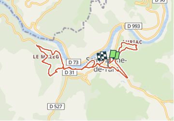
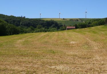
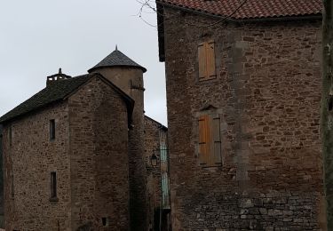
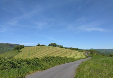
Randonnée Marche de 11,2 km à découvrir à Occitanie, Aveyron, Saint-Rome-de-Tarn. Cette randonnée est proposée par yvesmonteillet.
Description
Randonnée pour le Téléthon 2021
Super buffet pour le ravitaillement !
Venez nombreux en 2022 ...
Merci à tous les bénévoles !
Localisation
Pays :
France
Région :
Occitanie
Département/Province :
Aveyron
Commune :
Saint-Rome-de-Tarn
Localité :
Unknown
Départ:(Dec)
Départ:(UTM)
491744 ; 4877237 (31T) N.
Commentaires
Randonnées à proximité
![Randonnée Marche Montjaux - Concoules Montjaux - Photo](https://media.geolcdn.com/t/375/260/6744d9af-c2c8-4c45-9f05-8593c462ebb9.jpg&format=jpg&maxdim=2)
![Marche Marche](https://static1.geolcdn.com/sitytour/trail-icons/101.png)
Concoules Montjaux
Marche
Facile
Montjaux,
Occitanie,
Aveyron,
France
![](/images/other/stat-length.png)
10,8 km | 14,7 km-effort
3h 10min
![](https://static1.geolcdn.com/siteimages/upload/files/16400158638029165_repeat_loop_refresh_sync_direction_icon.png)
Oui
![Randonnée Marche Saint-Rome-de-Tarn - Au long du Tarn: de St-Rome-de-Tarn à Ayssènes - Photo](https://media.geolcdn.com/t/375/260/161b4c71-cb1b-4710-a622-a2007823687d.jpg&format=jpg&maxdim=2)
![Marche Marche](https://static1.geolcdn.com/sitytour/trail-icons/101.png)
Au long du Tarn: de St-Rome-de-Tarn à Ayssènes
Marche
Difficile
Saint-Rome-de-Tarn,
Occitanie,
Aveyron,
France
![](/images/other/stat-length.png)
22 km | 35 km-effort
7h 53min
![](https://static1.geolcdn.com/siteimages/upload/files/16400158638029165_repeat_loop_refresh_sync_direction_icon.png)
Non
![Randonnée V.T.C. Saint-Rome-de-Tarn - Le crayon - Photo](https://media.geolcdn.com/t/375/260/f8ce5a02-6b10-47e6-9147-72f9d24566c4.jpg&format=jpg&maxdim=2)
![V.T.C. V.T.C.](https://static1.geolcdn.com/sitytour/trail-icons/203.png)
Le crayon
V.T.C.
Moyen
Saint-Rome-de-Tarn,
Occitanie,
Aveyron,
France
![](/images/other/stat-length.png)
44 km | 58 km-effort
4h 14min
![](https://static1.geolcdn.com/siteimages/upload/files/16400158638029165_repeat_loop_refresh_sync_direction_icon.png)
Oui
![Randonnée V.T.T. Saint-Rome-de-Tarn - Relais st Rome petit tour - Photo](https://media.geolcdn.com/t/375/260/d88dcbb2-57c6-4d73-bb19-c80fc8e7f46c.jpg&format=jpg&maxdim=2)
![V.T.T. V.T.T.](https://static1.geolcdn.com/sitytour/trail-icons/202.png)
Relais st Rome petit tour
V.T.T.
Facile
Saint-Rome-de-Tarn,
Occitanie,
Aveyron,
France
![](/images/other/stat-length.png)
10,4 km | 14,6 km-effort
57min
![](https://static1.geolcdn.com/siteimages/upload/files/16400158638029165_repeat_loop_refresh_sync_direction_icon.png)
Oui
![Randonnée Vélo de route Saint-Rome-de-Tarn - Raspes du Tarn Pinet - Photo](https://media.geolcdn.com/t/375/260/36891b1a-9c66-4ed8-a3de-f51d39f939cf.jpg&format=jpg&maxdim=2)
![Vélo de route Vélo de route](https://static1.geolcdn.com/sitytour/trail-icons/201.png)
Raspes du Tarn Pinet
Vélo de route
Moyen
Saint-Rome-de-Tarn,
Occitanie,
Aveyron,
France
![](/images/other/stat-length.png)
33 km | 44 km-effort
4h 13min
![](https://static1.geolcdn.com/siteimages/upload/files/16400158638029165_repeat_loop_refresh_sync_direction_icon.png)
Oui
![Randonnée Vélo de route Saint-Rome-de-Tarn - castelnau Pegairolles - Photo](https://media.geolcdn.com/t/375/260/6bd21d13-5dad-4337-997a-401d6bd86279.jpg&format=jpg&maxdim=2)
![Vélo de route Vélo de route](https://static1.geolcdn.com/sitytour/trail-icons/201.png)
castelnau Pegairolles
Vélo de route
Facile
Saint-Rome-de-Tarn,
Occitanie,
Aveyron,
France
![](/images/other/stat-length.png)
47 km | 59 km-effort
3h 39min
![](https://static1.geolcdn.com/siteimages/upload/files/16400158638029165_repeat_loop_refresh_sync_direction_icon.png)
Oui
![Randonnée Marche Viala-du-Tarn - Via la du Tarn - Photo](https://media.geolcdn.com/t/375/260/e5d3932f-f8dd-41bd-a731-203731b62770.jpg&format=jpg&maxdim=2)
![Marche Marche](https://static1.geolcdn.com/sitytour/trail-icons/101.png)
Via la du Tarn
Marche
Très facile
Viala-du-Tarn,
Occitanie,
Aveyron,
France
![](/images/other/stat-length.png)
14,1 km | 19,6 km-effort
4h 0min
![](https://static1.geolcdn.com/siteimages/upload/files/16400158638029165_repeat_loop_refresh_sync_direction_icon.png)
Oui
![Randonnée Vélo électrique Saint-Rome-de-Tarn - St Victor Genève st Etienne carotte roubiere truelle St Victor - Photo](https://media.geolcdn.com/t/375/260/0682b38d-97a4-4b73-9d0a-ee6b0a2deb76.jpg&format=jpg&maxdim=2)
![Vélo électrique Vélo électrique](https://static1.geolcdn.com/sitytour/trail-icons/205.png)
St Victor Genève st Etienne carotte roubiere truelle St Victor
Vélo électrique
Difficile
(1)
Saint-Rome-de-Tarn,
Occitanie,
Aveyron,
France
![](/images/other/stat-length.png)
60 km | 82 km-effort
6h 41min
![](https://static1.geolcdn.com/siteimages/upload/files/16400158638029165_repeat_loop_refresh_sync_direction_icon.png)
Oui
![Randonnée Marche Viala-du-Tarn - le Viala du Tarn - Photo](https://media.geolcdn.com/t/375/260/2d3bba2b-6543-40f4-95e3-be9cf6117f5b.jpg&format=jpg&maxdim=2)
![Marche Marche](https://static1.geolcdn.com/sitytour/trail-icons/101.png)
le Viala du Tarn
Marche
Très difficile
Viala-du-Tarn,
Occitanie,
Aveyron,
France
![](/images/other/stat-length.png)
15,9 km | 0 m-effort
5h 34min
![](https://static1.geolcdn.com/siteimages/upload/files/16400158638029165_repeat_loop_refresh_sync_direction_icon.png)
Oui