![](/images/other/stat-length.png)
![Randonnée Marche Ougney-Douvot - ougney la Roche (douvot) - Photo](https://media.geolcdn.com/t/1900/400/532e6234-3db8-43f6-834f-754785112099.jpg&format=pjpeg&maxdim=2)
ougney la Roche (douvot)
eltonnermou
Utilisateur
![Longueur](/images/other/stat-length.png)
![Altitude max](https://static1.geolcdn.com/siteimages/upload/files/1508320355ic_sort_altitude_max_24dp.png)
![Dénivelé positif](https://static1.geolcdn.com/siteimages/upload/files/1508320355ic_sort_den_pos_24dp.png)
![Km-Effort](/images/other/stat-length.png)
![Altitude min](https://static1.geolcdn.com/siteimages/upload/files/1508320355ic_sort_altitude_min_24dp.png)
![Dénivelé négatif](https://static1.geolcdn.com/siteimages/upload/files/1508320355ic_sort_den_neg_24dp.png)
![Boucle](https://static1.geolcdn.com/siteimages/upload/files/16400158638029165_repeat_loop_refresh_sync_direction_icon.png)
![Marche](https://static1.geolcdn.com/sitytour/trail-icons/101.png)
1h54
Difficulté : Facile
![Scannez ce code QR pour ouvrir la randonnée dans l'application SityTrail](https://capi.geolives.com/qq0zvz2zws4bq2lad0pu/sitytour/trails/3011372/qr.png?size=200)
Application GPS de randonnée GRATUITE
À propos
Randonnée Marche de 11,7 km à découvrir à Bourgogne-Franche-Comté, Doubs, Ougney-Douvot. Cette randonnée est proposée par eltonnermou.
Description
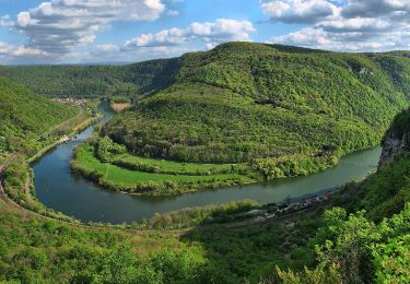
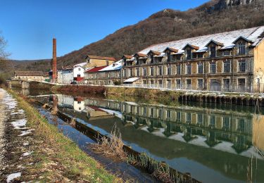
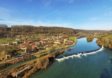
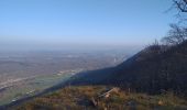
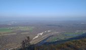
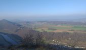
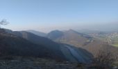
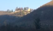
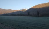
Cette très belle randonnée pédestre vous entrainera à travers différents paysages. Beaucoup de beaux points de vues sur la vallée du Doubs (de Baume les dames à Besançon), sur le mont Souvence et sur le mont notre dame d'Aigremont, puis sur des éoliennes. A l'aller et au retour vous longez le doubs avec ses hérons cendrés, cormorans et autres canards. Un petit défilé entre roches, fort sympathique. Une vue du château de Roulans peu habituelle.
Avec un peu de chance, vous surprendrez des chamois sur les pentes escarpées du secteur. Vous pourrez apprécier la diversité de la flore et profiter (suivant la saison) d'un parcours ombragé et très agréable au bord de l'eau.
Localisation
Commentaires
Randonnées à proximité
![Randonnée Marche Dammartin-les-Templiers - dammartin les templiers - Photo](https://media.geolcdn.com/t/375/260/c2bd0938-453f-48b0-b513-762bbdd613a3.jpg&format=jpg&maxdim=2)
![Marche Marche](https://static1.geolcdn.com/sitytour/trail-icons/101.png)
Marche
![](/images/other/stat-length.png)
![](https://static1.geolcdn.com/siteimages/upload/files/16400158638029165_repeat_loop_refresh_sync_direction_icon.png)
![Randonnée A pied Deluz - Sentier du Château Loriot - Photo](https://media.geolcdn.com/t/375/260/a6c0a960-bcfb-4e05-ab1e-cb250b6d6d40.jpeg&format=jpg&maxdim=2)
![A pied A pied](https://static1.geolcdn.com/sitytour/trail-icons/100.png)
A pied
![](/images/other/stat-length.png)
![](https://static1.geolcdn.com/siteimages/upload/files/16400158638029165_repeat_loop_refresh_sync_direction_icon.png)
![Randonnée A pied Deluz - Sentier du Patrimoine - Photo](https://media.geolcdn.com/t/375/260/3858c5b3-abf9-4504-8767-bbab2b7352b8.jpeg&format=jpg&maxdim=2)
![A pied A pied](https://static1.geolcdn.com/sitytour/trail-icons/100.png)
A pied
![](/images/other/stat-length.png)
![](https://static1.geolcdn.com/siteimages/upload/files/16400158638029165_repeat_loop_refresh_sync_direction_icon.png)
![Randonnée Marche Silley-Bléfond - Silley Blėfond - Photo](https://media.geolcdn.com/t/375/260/72cba853-944f-4e71-a6a4-e1015b10675c.jpg&format=jpg&maxdim=2)
![Marche Marche](https://static1.geolcdn.com/sitytour/trail-icons/101.png)
Marche
![](/images/other/stat-length.png)
![](https://static1.geolcdn.com/siteimages/upload/files/16400158638029165_repeat_loop_refresh_sync_direction_icon.png)
![Randonnée A pied Champlive - Sentier des Crêtes - Photo](https://media.geolcdn.com/t/375/260/7c732505-4f0b-4f56-a014-1317e06c73a8.jpeg&format=jpg&maxdim=2)
![A pied A pied](https://static1.geolcdn.com/sitytour/trail-icons/100.png)
A pied
![](/images/other/stat-length.png)
![](https://static1.geolcdn.com/siteimages/upload/files/16400158638029165_repeat_loop_refresh_sync_direction_icon.png)
![Randonnée A pied Bretigney-Notre-Dame - Les Gorges de l'Audeux - Photo](https://media.geolcdn.com/t/375/260/3c4f074e-3673-45a1-aa6d-0738dd54ea67.jpeg&format=jpg&maxdim=2)
![A pied A pied](https://static1.geolcdn.com/sitytour/trail-icons/100.png)
A pied
![](/images/other/stat-length.png)
![](https://static1.geolcdn.com/siteimages/upload/files/16400158638029165_repeat_loop_refresh_sync_direction_icon.png)
![Randonnée Marche Roulans - Roulans - Photo](https://media.geolcdn.com/t/375/260/2cbbd98c-ccf8-4bac-a479-dbed0aefef86.jpg&format=jpg&maxdim=2)
![Marche Marche](https://static1.geolcdn.com/sitytour/trail-icons/101.png)
Marche
![](/images/other/stat-length.png)
![](https://static1.geolcdn.com/siteimages/upload/files/16400158638029165_repeat_loop_refresh_sync_direction_icon.png)
![Randonnée Marche Séchin - Sechin 23 janvier 2020 CAF - Photo](https://media.geolcdn.com/t/375/260/9bdc166d-03a0-478f-a63a-eb5267e40a66.jpg&format=jpg&maxdim=2)
![Marche Marche](https://static1.geolcdn.com/sitytour/trail-icons/101.png)
Marche
![](/images/other/stat-length.png)
![](https://static1.geolcdn.com/siteimages/upload/files/16400158638029165_repeat_loop_refresh_sync_direction_icon.png)
![Randonnée Marche Le Puy - Le Puy - Photo](https://media.geolcdn.com/t/375/260/258f3f3c-c50b-405c-bd68-a6ac42ea325f.jpg&format=jpg&maxdim=2)
![Marche Marche](https://static1.geolcdn.com/sitytour/trail-icons/101.png)
Marche
![](/images/other/stat-length.png)
![](https://static1.geolcdn.com/siteimages/upload/files/16400158638029165_repeat_loop_refresh_sync_direction_icon.png)