![](/images/other/stat-length.png)
![Randonnée A pied Nogent-sur-Seine - NOGENT SUR SEINE, VILLE, JARDINS, SEINE - Photo](https://media.geolcdn.com/t/1900/400/ext.pjpeg?maxdim=2&url=https%3A%2F%2Fstatic1.geolcdn.com%2Fsiteimages%2Fupload%2Ffiles%2F1545311037marcheuse_200dpi.jpg)
NOGENT SUR SEINE, VILLE, JARDINS, SEINE
jeannine grandjean
Utilisateur
![Longueur](/images/other/stat-length.png)
Longueur
8,3 km
![Altitude max](https://static1.geolcdn.com/siteimages/upload/files/1508320355ic_sort_altitude_max_24dp.png)
Altitude max
86 m
![Dénivelé positif](https://static1.geolcdn.com/siteimages/upload/files/1508320355ic_sort_den_pos_24dp.png)
Dénivelé positif
65 m
![Km-Effort](/images/other/stat-length.png)
Km-Effort
9,2 km
![Altitude min](https://static1.geolcdn.com/siteimages/upload/files/1508320355ic_sort_altitude_min_24dp.png)
Altitude min
58 m
![Dénivelé négatif](https://static1.geolcdn.com/siteimages/upload/files/1508320355ic_sort_den_neg_24dp.png)
Dénivelé négatif
62 m
![Boucle](https://static1.geolcdn.com/siteimages/upload/files/16400158638029165_repeat_loop_refresh_sync_direction_icon.png)
Boucle
Oui
Date de création :
2021-11-15 14:31:46.578
Dernière modification :
2021-11-15 14:36:18.824
![A pied](https://static1.geolcdn.com/sitytour/trail-icons/100.png)
2h05
Difficulté : Facile
![Scannez ce code QR pour ouvrir la randonnée dans l'application SityTrail](https://capi.geolives.com/qq0zvz2zws4bq2lad0pu/sitytour/trails/3003409/qr.png?size=200)
Application GPS de randonnée GRATUITE
À propos
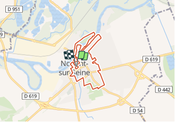
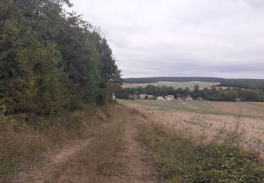
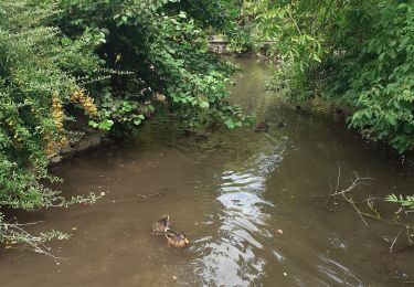
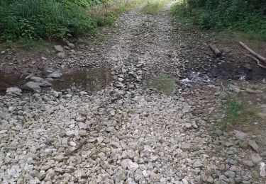
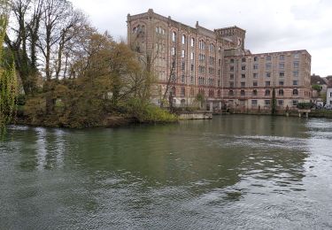
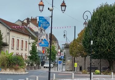
Randonnée A pied de 8,3 km à découvrir à Grand Est, Aube, Nogent-sur-Seine. Cette randonnée est proposée par jeannine grandjean.
Description
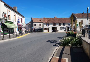
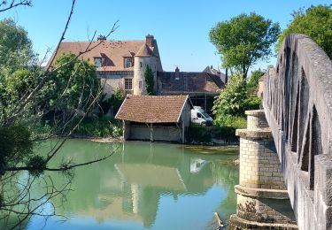
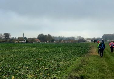
Randonnée variée avec la découverte des principaux monuments du centre-ville, les rives de la Seine, les jardins familiaux et l'île Olive
Localisation
Pays :
France
Région :
Grand Est
Département/Province :
Aube
Commune :
Nogent-sur-Seine
Localité :
Unknown
Départ:(Dec)
Départ:(UTM)
536843 ; 5371181 (31U) N.
Commentaires
Randonnées à proximité
![Randonnée Vélo de route Nogent-sur-Seine - EXT65 Nogent sur Seine-02 - Photo](https://media.geolcdn.com/t/375/260/ca417b70-cfc7-449d-acaf-f03a858412c8.jpg&format=jpg&maxdim=2)
![Vélo de route Vélo de route](https://static1.geolcdn.com/sitytour/trail-icons/201.png)
EXT65 Nogent sur Seine-02
Vélo de route
Facile
Nogent-sur-Seine,
Grand Est,
Aube,
France
![](/images/other/stat-length.png)
66 km | 74 km-effort
2h 52min
![](https://static1.geolcdn.com/siteimages/upload/files/16400158638029165_repeat_loop_refresh_sync_direction_icon.png)
Oui
![Randonnée Vélo de route Nogent-sur-Seine - EXT65 Nogent sur Seine-01 - Photo](https://media.geolcdn.com/t/375/260/f12c7822-7616-49c7-aa13-046d75c5f2da.jpg&format=jpg&maxdim=2)
![Vélo de route Vélo de route](https://static1.geolcdn.com/sitytour/trail-icons/201.png)
EXT65 Nogent sur Seine-01
Vélo de route
Moyen
Nogent-sur-Seine,
Grand Est,
Aube,
France
![](/images/other/stat-length.png)
65 km | 72 km-effort
3h 19min
![](https://static1.geolcdn.com/siteimages/upload/files/16400158638029165_repeat_loop_refresh_sync_direction_icon.png)
Oui
![Randonnée Marche Saint-Aubin - Saint Aubin et la vallée de l'Ardusson - Photo](https://media.geolcdn.com/t/375/260/f350ed10-944d-4a3f-a8a0-a8fbb2c48c0b.jpg&format=jpg&maxdim=2)
![Marche Marche](https://static1.geolcdn.com/sitytour/trail-icons/101.png)
Saint Aubin et la vallée de l'Ardusson
Marche
Difficile
Saint-Aubin,
Grand Est,
Aube,
France
![](/images/other/stat-length.png)
11 km | 12,5 km-effort
2h 28min
![](https://static1.geolcdn.com/siteimages/upload/files/16400158638029165_repeat_loop_refresh_sync_direction_icon.png)
Oui
![Randonnée Marche Saint-Aubin - St Aubin - Fontaine Mâcon - St Aubin - Photo](https://media.geolcdn.com/t/375/260/e257991e-7cb7-4143-9b1a-d9a805529f6d.jpg&format=jpg&maxdim=2)
![Marche Marche](https://static1.geolcdn.com/sitytour/trail-icons/101.png)
St Aubin - Fontaine Mâcon - St Aubin
Marche
Difficile
Saint-Aubin,
Grand Est,
Aube,
France
![](/images/other/stat-length.png)
11,5 km | 13,1 km-effort
2h 20min
![](https://static1.geolcdn.com/siteimages/upload/files/16400158638029165_repeat_loop_refresh_sync_direction_icon.png)
Oui
![Randonnée Marche Saint-Aubin - St Aubin - Fontaine Mâcon - Abbaye du Paraclet - St Aubin - Photo](https://media.geolcdn.com/t/375/260/91520258-9572-40f5-aac3-ae8eb59945ec.jpg&format=jpg&maxdim=2)
![Marche Marche](https://static1.geolcdn.com/sitytour/trail-icons/101.png)
St Aubin - Fontaine Mâcon - Abbaye du Paraclet - St Aubin
Marche
Difficile
Saint-Aubin,
Grand Est,
Aube,
France
![](/images/other/stat-length.png)
14,2 km | 16,3 km-effort
3h 15min
![](https://static1.geolcdn.com/siteimages/upload/files/16400158638029165_repeat_loop_refresh_sync_direction_icon.png)
Oui
![Randonnée V.T.C. Marnay-sur-Seine - Marnay bis - Photo](https://media.geolcdn.com/t/375/260/d3dd4a92-ca0b-442d-80fb-f340a7687fae.jpg&format=jpg&maxdim=2)
![V.T.C. V.T.C.](https://static1.geolcdn.com/sitytour/trail-icons/203.png)
![Randonnée Marche Nogent-sur-Seine - Nogent sur Seine 230330 - Photo](https://media.geolcdn.com/t/375/260/d5eae0c2-429b-436a-8eb9-e4b49cb4c570.jpg&format=jpg&maxdim=2)
![Marche Marche](https://static1.geolcdn.com/sitytour/trail-icons/101.png)
Nogent sur Seine 230330
Marche
Facile
Nogent-sur-Seine,
Grand Est,
Aube,
France
![](/images/other/stat-length.png)
3,6 km | 3,9 km-effort
53min
![](https://static1.geolcdn.com/siteimages/upload/files/16400158638029165_repeat_loop_refresh_sync_direction_icon.png)
Oui
![Randonnée Marche Nogent-sur-Seine - 221016 Nogent sur Seine - Photo](https://media.geolcdn.com/t/375/260/f36b1d3f-ad34-4eca-906f-9809ed42b371.jpg&format=jpg&maxdim=2)
![Marche Marche](https://static1.geolcdn.com/sitytour/trail-icons/101.png)
221016 Nogent sur Seine
Marche
Très facile
Nogent-sur-Seine,
Grand Est,
Aube,
France
![](/images/other/stat-length.png)
8,4 km | 9,3 km-effort
3h 29min
![](https://static1.geolcdn.com/siteimages/upload/files/16400158638029165_repeat_loop_refresh_sync_direction_icon.png)
Oui
![Randonnée Vélo Nogent-sur-Seine - De menhirs en château - Nogent sur Seine - Photo](https://media.geolcdn.com/t/375/260/ext.jpg?maxdim=2&url=https%3A%2F%2Fservices.sitytrail.com%2FGeolivesWS%2FDownloadMedia.ashx%3FTrailID%3D112581%26Media%3D11028_1.jpg)
![Vélo Vélo](https://static1.geolcdn.com/sitytour/trail-icons/200.png)
De menhirs en château - Nogent sur Seine
Vélo
Moyen
Nogent-sur-Seine,
Grand Est,
Aube,
France
![](/images/other/stat-length.png)
70 km | 77 km-effort
3h 30min
![](https://static1.geolcdn.com/siteimages/upload/files/16400158638029165_repeat_loop_refresh_sync_direction_icon.png)
Oui