Randonnée V.T.T. La Baume-de-Transit - Gravel - La Baume / Gigondas - Photo
 Philippe.lebrou
Philippe.lebrou

Utilisateur

© OpenStreetMap contributors
Longueur
Longueur
50 km
Altitude max
Altitude max
572 m
Dénivelé positif
Dénivelé positif
977 m
Km-Effort
Km-Effort  
63 km
Altitude min
Altitude min
101 m
Dénivelé négatif
Dénivelé négatif
992 m
Boucle
Boucle
Non
Date de création :
2021-11-13 11:43:59.0
Dernière modification :
2021-11-13 16:25:58.937

(0 Avis)

V.T.T.
V.T.T.
4h40
Difficulté : Difficile

Scannez ce code QR pour ouvrir la randonnée dans l'application SityTrail

Application GPS de randonnée GRATUITE

Logo SityTrail SityTrail

IGN / Instituts géographiques

Télécharger SityTrail sur l'App Store Télécharger SityTrail sur Google Play

Logo SityTrail SityTrail World

Le monde est à vous

Télécharger SityTrail sur l'App Store Télécharger SityTrail sur Google Play Télécharger SityTrail sur Huawei AppGallery

À propos

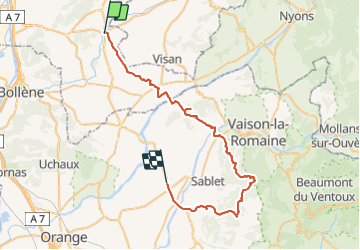
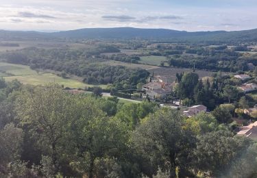
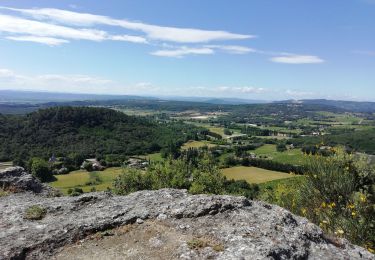
Randonnée V.T.T. de 50 km à découvrir à Auvergne-Rhône-Alpes, Drôme, La Baume-de-Transit. Cette randonnée est proposée par Philippe.lebrou.

Description

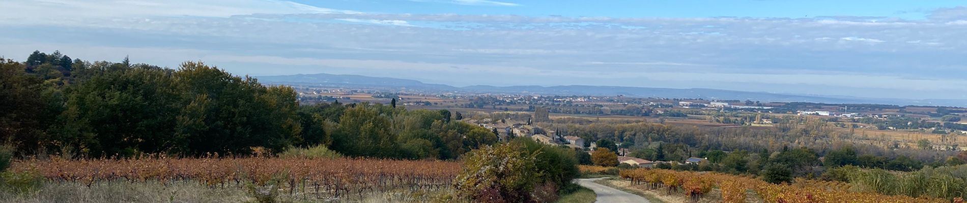
Mi rte mi pistes ou chemins
Trace par TULETTE Roaix pistes en direction des Crêtes de St Amand - descente sur Lafare - Col du Cayron - Gigondas

Profil altimétrique

Photos

Localisation

Pays :
France
Région :
Auvergne-Rhône-Alpes
Département/Province :
Drôme
Commune :
La Baume-de-Transit
Localité :
Unknown
Départ:(Dec)
Départ:(UTM)
648689 ; 4911114 (31T) N.

Randonnées à proximité

Randonnée Marche Montségur-sur-Lauzon - Bassin des druides. Montségur-lauzon - Photo
Marche
Pacekall

Marche

Facile
(1)
Montségur-sur-Lauzon, Auvergne-Rhône-Alpes, Drôme, France
10,7 km | 13,1 km-effort
3h 14min
Oui
Randonnée Marche Suze-la-Rousse - soleirieu - Photo
Marche
losjo

Marche

Facile
(1)
Suze-la-Rousse, Auvergne-Rhône-Alpes, Drôme, France
11,9 km | 14,7 km-effort
3h 8min
Oui
Randonnée Marche Clansayes - Clansayes Le Rouvergue 12km - Photo
Marche
GUIDE
thonyc

Marche

Facile
Clansayes, Auvergne-Rhône-Alpes, Drôme, France
12,4 km | 15,8 km-effort
3h 0min
Oui
Randonnée Marche Clansayes - Clansayes Le Rouvergue 11km - Photo
Marche
chancha

Marche

Difficile
Clansayes, Auvergne-Rhône-Alpes, Drôme, France
11,1 km | 14,5 km-effort
3h 21min
Oui
Randonnée Marche Clansayes - Clansayes  Côte du Serre Chapelle Toronne 7km - Photo
Marche
GUIDE
thonyc

Marche

Très facile
Clansayes, Auvergne-Rhône-Alpes, Drôme, France
7,3 km | 10,3 km-effort
2h 32min
Oui
Randonnée Marche Clansayes - Clansayes - Photo
Marche
poisson1103

Marche

Difficile
Clansayes, Auvergne-Rhône-Alpes, Drôme, France
12,1 km | 17 km-effort
3h 51min
Oui
Randonnée Marche Clansayes - Les jumelles de Rozet - Photo
Marche
yvon26

Marche

Facile
(2)
Clansayes, Auvergne-Rhône-Alpes, Drôme, France
5,4 km | 7,4 km-effort
1h 41min
Oui
Randonnée Marche Clansayes - Clansayes Montsègur-sur-Lauzon 18km. - Photo
Marche
chancha

Marche

Difficile
Clansayes, Auvergne-Rhône-Alpes, Drôme, France
18,2 km | 22 km-effort
5h 2min
Oui
Randonnée Marche Clansayes - les crevasses  - Photo
Marche
Vero7684

Marche

Moyen
Clansayes, Auvergne-Rhône-Alpes, Drôme, France
16,3 km | 21 km-effort
4h 28min
Oui


Fermer
Mes abonnements