


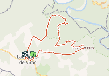

13,7 km | 22 km-effort


Utilisateur


Application GPS de randonnée GRATUITE
 SityTrail
IGN / Instituts géographiques
SityTrail World
Le monde est à vous
Randonnée Marche de 10,8 km à découvrir à Auvergne-Rhône-Alpes, Ardèche, Labastide-de-Virac. Cette randonnée est proposée par topolino.
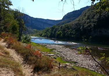
Une belle balade sans difficultés à l'ombre des arbres qui va offrir une magnifique vue sur les gorges de l' Ardèche.

Marche

Marche

Marche

Marche

Marche

Marche
Marche
Marche
Marche