35 km | 53 km-effort
depart les tavins ,circuit de la jougnena 2021
gerardmicheline
Utilisateur
Longueur
21 km
Altitude max
965 m
Dénivelé positif
570 m
Km-Effort
28 km
Altitude min
631 m
Dénivelé négatif
567 m
Boucle
Oui
Date de création :
2021-10-16 13:28:29.084
Dernière modification :
2021-10-16 13:29:33.234
6h23
Difficulté : Très difficile
Application GPS de randonnée GRATUITE
À propos
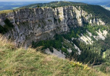
Randonnée Marche de 21 km à découvrir à Bourgogne-Franche-Comté, Doubs, Jougne. Cette randonnée est proposée par gerardmicheline.
Localisation
Pays :
France
Région :
Bourgogne-Franche-Comté
Département/Province :
Doubs
Commune :
Jougne
Localité :
Unknown
Départ:(Dec)
Départ:(UTM)
299346 ; 5179733 (32T) N.
Commentaires
Randonnées à proximité
Le Suchet
V.T.T.
Très facile
(1)
Vallorbe,
Vaud,
District du Jura-Nord vaudois,
Suisse
14h 41min
Oui
Ballaigues-Vallorbe
A pied
Facile
Ballaigues,
Vaud,
District du Jura-Nord vaudois,
Suisse
5,1 km | 6,3 km-effort
1h 25min
Non
GTJ Metabief - Pontarlier
Marche
Moyen
(1)
Métabief,
Bourgogne-Franche-Comté,
Doubs,
France
25 km | 35 km-effort
7h 17min
Non
Le mont d 0r
Marche
Moyen
Métabief,
Bourgogne-Franche-Comté,
Doubs,
France
18,5 km | 25 km-effort
4h 38min
Non
Mont d'or
Marche
Facile
Rochejean,
Bourgogne-Franche-Comté,
Doubs,
France
11,9 km | 17,5 km-effort
4h 53min
Oui
Les hauteurs de Metabief
Raquettes à neige
Moyen
Métabief,
Bourgogne-Franche-Comté,
Doubs,
France
15,5 km | 23 km-effort
3h 51min
Oui
La Jougnena
Marche
Très difficile
(1)
Jougne,
Bourgogne-Franche-Comté,
Doubs,
France
17,7 km | 24 km-effort
5h 32min
Oui
La poyette
Marche
Moyen
Jougne,
Bourgogne-Franche-Comté,
Doubs,
France
11,8 km | 17,9 km-effort
4h 7min
Oui
Mont d'Or
Marche
Moyen
Métabief,
Bourgogne-Franche-Comté,
Doubs,
France
13,5 km | 21 km-effort
3h 39min
Non