![](/images/other/stat-length.png)
![Randonnée Marche Montmaur-en-Diois - Forêt, lavandes et Vieux Village - Photo](https://media.geolcdn.com/t/1900/400/a44036e7-43d5-4b17-ba6f-65a9c3ee67f9.jpg&format=pjpeg&maxdim=2)
Forêt, lavandes et Vieux Village
Pierjosef
Utilisateur
![Longueur](/images/other/stat-length.png)
Longueur
5,7 km
![Altitude max](https://static1.geolcdn.com/siteimages/upload/files/1508320355ic_sort_altitude_max_24dp.png)
Altitude max
762 m
![Dénivelé positif](https://static1.geolcdn.com/siteimages/upload/files/1508320355ic_sort_den_pos_24dp.png)
Dénivelé positif
199 m
![Km-Effort](/images/other/stat-length.png)
Km-Effort
8,3 km
![Altitude min](https://static1.geolcdn.com/siteimages/upload/files/1508320355ic_sort_altitude_min_24dp.png)
Altitude min
557 m
![Dénivelé négatif](https://static1.geolcdn.com/siteimages/upload/files/1508320355ic_sort_den_neg_24dp.png)
Dénivelé négatif
199 m
![Boucle](https://static1.geolcdn.com/siteimages/upload/files/16400158638029165_repeat_loop_refresh_sync_direction_icon.png)
Boucle
Oui
Date de création :
2021-10-16 13:08:56.683
Dernière modification :
2021-10-16 16:45:53.229
![Marche](https://static1.geolcdn.com/sitytour/trail-icons/101.png)
1h53
Difficulté : Moyen
![Scannez ce code QR pour ouvrir la randonnée dans l'application SityTrail](https://capi.geolives.com/qq0zvz2zws4bq2lad0pu/sitytour/trails/2971809/qr.png?size=200)
Application GPS de randonnée GRATUITE
À propos
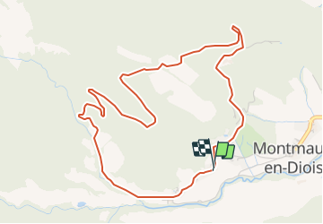
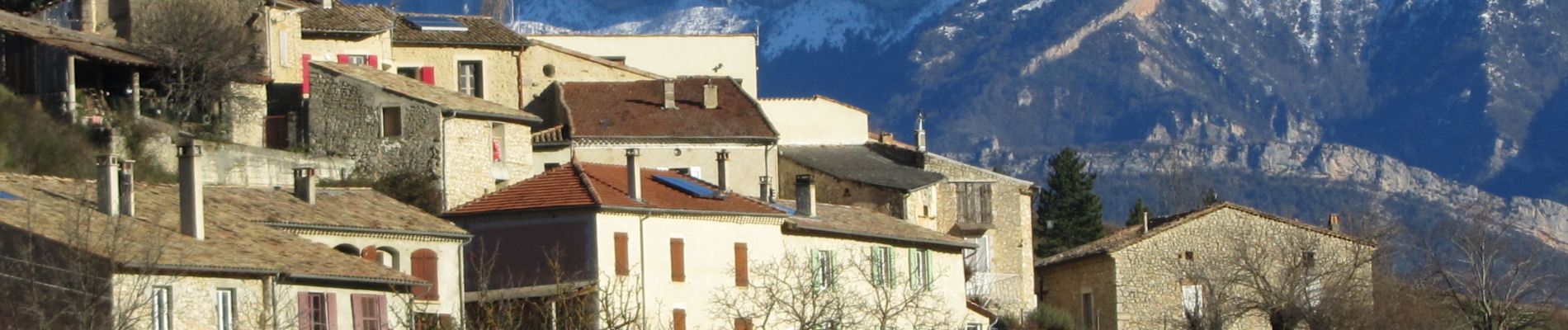
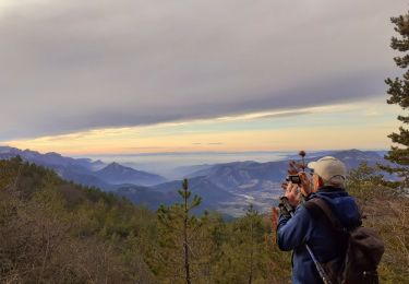
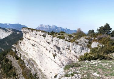
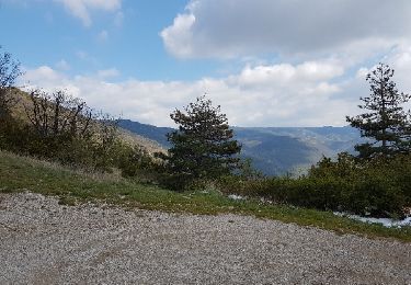
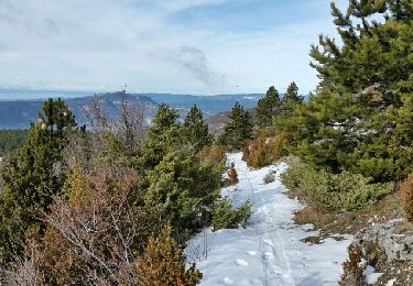
Randonnée Marche de 5,7 km à découvrir à Auvergne-Rhône-Alpes, Drôme, Montmaur-en-Diois. Cette randonnée est proposée par Pierjosef.
Description
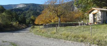
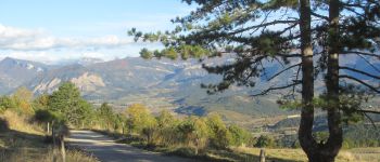
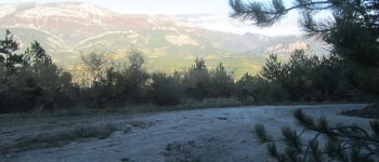
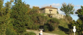
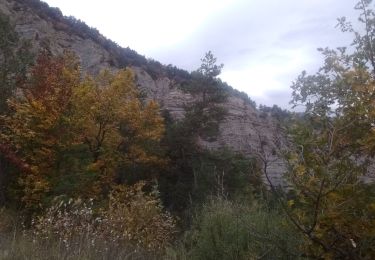
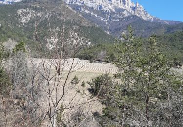
Circuit sur piste forestière au milieu de la forêt domaniale de Solaure et des champs de lavande.
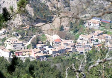
Ne pas hésiter à visiter le vieux village et son église que les Amis de Montmaur tentent de restaurer.
Bonne promenade !
Localisation
Pays :
France
Région :
Auvergne-Rhône-Alpes
Département/Province :
Drôme
Commune :
Montmaur-en-Diois
Localité :
Unknown
Départ:(Dec)
Départ:(UTM)
687999 ; 4949590 (31T) N.
Commentaires
Randonnées à proximité
![Randonnée Marche Rimon-et-Savel - rimon 2/1/2022 - Photo](https://media.geolcdn.com/t/375/260/d71302a3-bf5b-468d-ad27-fcad37c90032.jpg&format=jpg&maxdim=2)
![Marche Marche](https://static1.geolcdn.com/sitytour/trail-icons/101.png)
rimon 2/1/2022
Marche
Moyen
Rimon-et-Savel,
Auvergne-Rhône-Alpes,
Drôme,
France
![](/images/other/stat-length.png)
5,4 km | 6,9 km-effort
1h 48min
![](https://static1.geolcdn.com/siteimages/upload/files/16400158638029165_repeat_loop_refresh_sync_direction_icon.png)
Non
![Randonnée Vélo de route Recoubeau-Jansac - col de Penne - Photo](https://media.geolcdn.com/t/375/260/47037570-c0aa-4718-9214-10ee3d6f6cd7.jpg&format=jpg&maxdim=2)
![Vélo de route Vélo de route](https://static1.geolcdn.com/sitytour/trail-icons/201.png)
col de Penne
Vélo de route
Facile
Recoubeau-Jansac,
Auvergne-Rhône-Alpes,
Drôme,
France
![](/images/other/stat-length.png)
24 km | 33 km-effort
1h 31min
![](https://static1.geolcdn.com/siteimages/upload/files/16400158638029165_repeat_loop_refresh_sync_direction_icon.png)
Oui
![Randonnée Marche Laval-d'Aix - Laval d'Aix col ayase col fauchare - Photo](https://media.geolcdn.com/t/375/260/d2ab9f61-22c5-4d05-b795-6a1ef7794d3e.jpg&format=jpg&maxdim=2)
![Marche Marche](https://static1.geolcdn.com/sitytour/trail-icons/101.png)
Laval d'Aix col ayase col fauchare
Marche
Facile
Laval-d'Aix,
Auvergne-Rhône-Alpes,
Drôme,
France
![](/images/other/stat-length.png)
13,9 km | 24 km-effort
4h 15min
![](https://static1.geolcdn.com/siteimages/upload/files/16400158638029165_repeat_loop_refresh_sync_direction_icon.png)
Oui
![Randonnée Marche Aurel - Le Plateau de Solaure par Aurel - Photo](https://media.geolcdn.com/t/375/260/f9469c55-e221-43bf-9e27-eaf4200de7b7.jpg&format=jpg&maxdim=2)
![Marche Marche](https://static1.geolcdn.com/sitytour/trail-icons/101.png)
Le Plateau de Solaure par Aurel
Marche
Difficile
Aurel,
Auvergne-Rhône-Alpes,
Drôme,
France
![](/images/other/stat-length.png)
17,6 km | 29 km-effort
5h 0min
![](https://static1.geolcdn.com/siteimages/upload/files/16400158638029165_repeat_loop_refresh_sync_direction_icon.png)
Oui
![Randonnée Marche Aurel - Le Plateau de Solaure par Aurel - Photo](https://media.geolcdn.com/t/375/260/d6a67fe1-b272-48fd-a657-a0a29568d153.jpg&format=jpg&maxdim=2)
![Marche Marche](https://static1.geolcdn.com/sitytour/trail-icons/101.png)
Le Plateau de Solaure par Aurel
Marche
Difficile
Aurel,
Auvergne-Rhône-Alpes,
Drôme,
France
![](/images/other/stat-length.png)
17,6 km | 29 km-effort
5h 0min
![](https://static1.geolcdn.com/siteimages/upload/files/16400158638029165_repeat_loop_refresh_sync_direction_icon.png)
Oui
![Randonnée V.T.T. Recoubeau-Jansac - 08/05/2017 Recoubeau/Luc/Claps/ Col de Clamontard/Clpas/Recoubeau - Photo](https://media.geolcdn.com/t/375/260/ext.jpg?maxdim=2&url=https%3A%2F%2Fservices.sitytrail.com%2FGeolivesWS%2FDownloadMedia.ashx%3FTrailID%3D749284%26Media%3Dfix__20170508102853.jpg)
![V.T.T. V.T.T.](https://static1.geolcdn.com/sitytour/trail-icons/202.png)
08/05/2017 Recoubeau/Luc/Claps/ Col de Clamontard/Clpas/Recoubeau
V.T.T.
Difficile
Recoubeau-Jansac,
Auvergne-Rhône-Alpes,
Drôme,
France
![](/images/other/stat-length.png)
26 km | 36 km-effort
2h 34min
![](https://static1.geolcdn.com/siteimages/upload/files/16400158638029165_repeat_loop_refresh_sync_direction_icon.png)
Oui
![Randonnée V.T.T. Recoubeau-Jansac - 28-04-2017 Recoubeau - Col de Pennes - Photo](https://media.geolcdn.com/t/375/260/ext.jpg?maxdim=2&url=https%3A%2F%2Fservices.sitytrail.com%2FGeolivesWS%2FDownloadMedia.ashx%3FTrailID%3D744501%26Media%3Dfix__20170428161817.jpg)
![V.T.T. V.T.T.](https://static1.geolcdn.com/sitytour/trail-icons/202.png)
28-04-2017 Recoubeau - Col de Pennes
V.T.T.
Moyen
Recoubeau-Jansac,
Auvergne-Rhône-Alpes,
Drôme,
France
![](/images/other/stat-length.png)
19,2 km | 27 km-effort
1h 31min
![](https://static1.geolcdn.com/siteimages/upload/files/16400158638029165_repeat_loop_refresh_sync_direction_icon.png)
Oui
![Randonnée Marche Barnave - barnave - Photo](https://media.geolcdn.com/t/375/260/ext.jpg?maxdim=2&url=https%3A%2F%2Fstatic1.geolcdn.com%2Fsiteimages%2Fupload%2Ffiles%2F1553511878bg_sport_marche.png)
![Marche Marche](https://static1.geolcdn.com/sitytour/trail-icons/101.png)
barnave
Marche
Moyen
(2)
Barnave,
Auvergne-Rhône-Alpes,
Drôme,
France
![](/images/other/stat-length.png)
12,4 km | 23 km-effort
6h 56min
![](https://static1.geolcdn.com/siteimages/upload/files/16400158638029165_repeat_loop_refresh_sync_direction_icon.png)
Oui
![Randonnée Marche nordique Montmaur-en-Diois - 23/01/2016 Montmaur-Col du Royet - Photo](https://media.geolcdn.com/t/375/260/ext.jpg?maxdim=2&url=https%3A%2F%2Fservices.sitytrail.com%2FGeolivesWS%2FDownloadMedia.ashx%3FTrailID%3D516310%26Media%3Dfix__20160123115742.jpg)
![Marche nordique Marche nordique](https://static1.geolcdn.com/sitytour/trail-icons/102.png)
23/01/2016 Montmaur-Col du Royet
Marche nordique
Moyen
Montmaur-en-Diois,
Auvergne-Rhône-Alpes,
Drôme,
France
![](/images/other/stat-length.png)
17,2 km | 26 km-effort
4h 0min
![](https://static1.geolcdn.com/siteimages/upload/files/16400158638029165_repeat_loop_refresh_sync_direction_icon.png)
Oui