


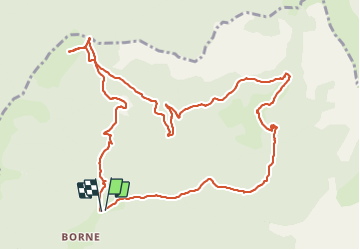

17 km | 29 km-effort

Utilisateur


Application GPS de randonnée GRATUITE
 SityTrail
IGN / Instituts géographiques
SityTrail World
Le monde est à vous
Randonnée Marche de 13,6 km à découvrir à Auvergne-Rhône-Alpes, Drôme, Glandage. Cette randonnée est proposée par ajd26.
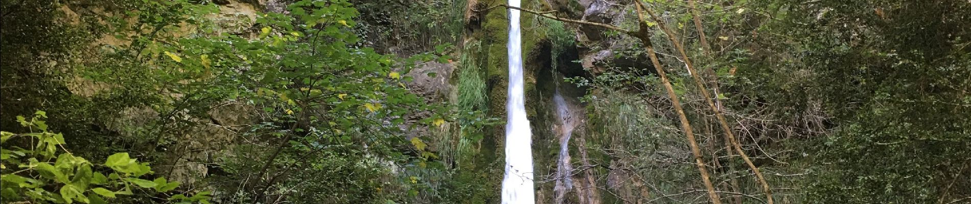
Borne, col du Plat, col de la Plainie, cascade au retour
balade d'automne sympa sans difficultés


Marche

Marche

Marche

Marche

Marche

Marche

Marche

Marche

A pied