![](/images/other/stat-length.png)
![Randonnée Marche Saint-Sauveur-de-Cruzières - Saint Sauveur de Cruzières - Photo](https://media.geolcdn.com/t/1900/400/ext.pjpeg?maxdim=2&url=https%3A%2F%2Fstatic1.geolcdn.com%2Fsiteimages%2Fupload%2Ffiles%2F1553511878bg_sport_marche.png)
Saint Sauveur de Cruzières
Did JP
Utilisateur
![Longueur](/images/other/stat-length.png)
Longueur
5,9 km
![Altitude max](https://static1.geolcdn.com/siteimages/upload/files/1508320355ic_sort_altitude_max_24dp.png)
Altitude max
355 m
![Dénivelé positif](https://static1.geolcdn.com/siteimages/upload/files/1508320355ic_sort_den_pos_24dp.png)
Dénivelé positif
239 m
![Km-Effort](/images/other/stat-length.png)
Km-Effort
9,1 km
![Altitude min](https://static1.geolcdn.com/siteimages/upload/files/1508320355ic_sort_altitude_min_24dp.png)
Altitude min
135 m
![Dénivelé négatif](https://static1.geolcdn.com/siteimages/upload/files/1508320355ic_sort_den_neg_24dp.png)
Dénivelé négatif
239 m
![Boucle](https://static1.geolcdn.com/siteimages/upload/files/16400158638029165_repeat_loop_refresh_sync_direction_icon.png)
Boucle
Oui
Date de création :
2021-10-06 19:53:26.885
Dernière modification :
2021-10-06 19:53:28.505
![Marche](https://static1.geolcdn.com/sitytour/trail-icons/101.png)
1h40
Difficulté : Moyen
![Scannez ce code QR pour ouvrir la randonnée dans l'application SityTrail](https://capi.geolives.com/qq0zvz2zws4bq2lad0pu/sitytour/trails/2960831/qr.png?size=200)
Application GPS de randonnée GRATUITE
À propos
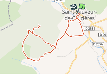
Randonnée Marche de 5,9 km à découvrir à Auvergne-Rhône-Alpes, Ardèche, Saint-Sauveur-de-Cruzières. Cette randonnée est proposée par Did JP.
Description
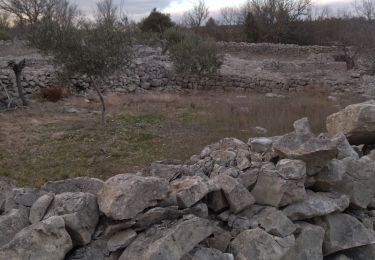
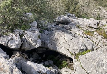
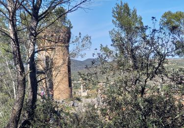
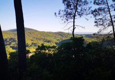
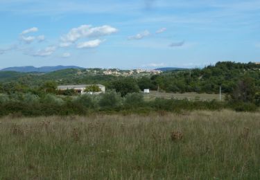
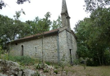
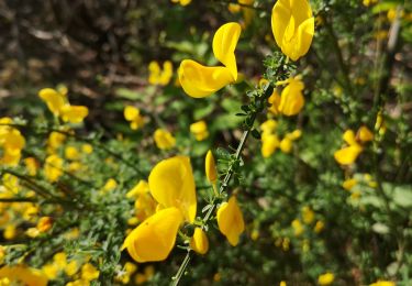
Petite randonnée panoramique jusqu'à la table d'orientation de la chapelle St.Privas. Passage dans les vignes, les oliveraies, la garrigue et le long de la Claysse.
Localisation
Pays :
France
Région :
Auvergne-Rhône-Alpes
Département/Province :
Ardèche
Commune :
Saint-Sauveur-de-Cruzières
Localité :
Unknown
Départ:(Dec)
Départ:(UTM)
599956 ; 4905944 (31T) N.
Commentaires
Randonnées à proximité
![Randonnée Marche Bessas - Le Puy Lacher par les crêtes - Photo](https://media.geolcdn.com/t/375/260/ext.jpg?maxdim=2&url=https%3A%2F%2Fstatic1.geolcdn.com%2Fsiteimages%2Fupload%2Ffiles%2F1553511878bg_sport_marche.png)
![Marche Marche](https://static1.geolcdn.com/sitytour/trail-icons/101.png)
Le Puy Lacher par les crêtes
Marche
Difficile
(2)
Bessas,
Auvergne-Rhône-Alpes,
Ardèche,
France
![](/images/other/stat-length.png)
10,2 km | 16,3 km-effort
3h 10min
![](https://static1.geolcdn.com/siteimages/upload/files/16400158638029165_repeat_loop_refresh_sync_direction_icon.png)
Oui
![Randonnée Marche Saint-André-de-Cruzières - CHADOUILLET - Photo](https://media.geolcdn.com/t/375/260/ext.jpg?maxdim=2&url=https%3A%2F%2Fmedia.geolcdn.com%2Ff%2F772623f8-cb56-4d04-9b3d-145b33c03c4b.jpeg)
![Marche Marche](https://static1.geolcdn.com/sitytour/trail-icons/101.png)
CHADOUILLET
Marche
Moyen
Saint-André-de-Cruzières,
Auvergne-Rhône-Alpes,
Ardèche,
France
![](/images/other/stat-length.png)
7,8 km | 9,4 km-effort
2h 8min
![](https://static1.geolcdn.com/siteimages/upload/files/16400158638029165_repeat_loop_refresh_sync_direction_icon.png)
Oui
![Randonnée Marche Saint-Ambroix - Autour de St Ambroix - Photo](https://media.geolcdn.com/t/375/260/ext.jpg?maxdim=2&url=https%3A%2F%2Fmedia.geolcdn.com%2Ff%2F82ff88e1-535b-48d4-a2a3-cbd68a960bf2.jpg)
![Marche Marche](https://static1.geolcdn.com/sitytour/trail-icons/101.png)
Autour de St Ambroix
Marche
Moyen
Saint-Ambroix,
Occitanie,
Gard,
France
![](/images/other/stat-length.png)
18,6 km | 27 km-effort
5h 39min
![](https://static1.geolcdn.com/siteimages/upload/files/16400158638029165_repeat_loop_refresh_sync_direction_icon.png)
Oui
![Randonnée Marche Saint-André-de-Cruzières - 07 chandouillet grotte cotepatiere sauvas peyrejol - Photo](https://media.geolcdn.com/t/375/260/ext.jpg?maxdim=2&url=https%3A%2F%2Fmedia.geolcdn.com%2Ff%2Ff87b5d53-f27e-44e1-a082-e539e9102b98.jpg)
![Marche Marche](https://static1.geolcdn.com/sitytour/trail-icons/101.png)
07 chandouillet grotte cotepatiere sauvas peyrejol
Marche
Moyen
Saint-André-de-Cruzières,
Auvergne-Rhône-Alpes,
Ardèche,
France
![](/images/other/stat-length.png)
17,8 km | 24 km-effort
7h 47min
![](https://static1.geolcdn.com/siteimages/upload/files/16400158638029165_repeat_loop_refresh_sync_direction_icon.png)
Oui
![Randonnée Marche nordique Saint-Ambroix - 24.05.20 montèze - Photo](https://media.geolcdn.com/t/375/260/ext.jpg?maxdim=2&url=https%3A%2F%2Fmedia.geolcdn.com%2Ff%2F10bdb4ea-d96a-491f-8780-6b95f3222b15.jpg)
![Marche nordique Marche nordique](https://static1.geolcdn.com/sitytour/trail-icons/102.png)
24.05.20 montèze
Marche nordique
Très facile
Saint-Ambroix,
Occitanie,
Gard,
France
![](/images/other/stat-length.png)
7,4 km | 11,3 km-effort
2h 9min
![](https://static1.geolcdn.com/siteimages/upload/files/16400158638029165_repeat_loop_refresh_sync_direction_icon.png)
Non
![Randonnée Marche Bessas - Le Puy Lacher - Bessas - Photo](https://media.geolcdn.com/t/375/260/ext.jpg?maxdim=2&url=https%3A%2F%2Fservices.sitytrail.com%2FGeolivesWS%2FDownloadMedia.ashx%3FTrailID%3D317233%26Media%3D16412_6.jpg)
![Marche Marche](https://static1.geolcdn.com/sitytour/trail-icons/101.png)
Le Puy Lacher - Bessas
Marche
Moyen
Bessas,
Auvergne-Rhône-Alpes,
Ardèche,
France
![](/images/other/stat-length.png)
18,3 km | 27 km-effort
5h 0min
![](https://static1.geolcdn.com/siteimages/upload/files/16400158638029165_repeat_loop_refresh_sync_direction_icon.png)
Oui
![Randonnée Marche Saint-André-de-Cruzières - Montagne de la Serre - Saint André de Cruzières - Photo](https://media.geolcdn.com/t/375/260/ext.jpg?maxdim=2&url=https%3A%2F%2Fservices.sitytrail.com%2FGeolivesWS%2FDownloadMedia.ashx%3FTrailID%3D317001%26Media%3D16134_6.jpg)
![Marche Marche](https://static1.geolcdn.com/sitytour/trail-icons/101.png)
Montagne de la Serre - Saint André de Cruzières
Marche
Difficile
Saint-André-de-Cruzières,
Auvergne-Rhône-Alpes,
Ardèche,
France
![](/images/other/stat-length.png)
17,9 km | 25 km-effort
5h 0min
![](https://static1.geolcdn.com/siteimages/upload/files/16400158638029165_repeat_loop_refresh_sync_direction_icon.png)
Oui
![Randonnée Marche Saint-Ambroix - Saint Ambroix - Photo](https://media.geolcdn.com/t/375/260/ext.jpg?maxdim=2&url=https%3A%2F%2Fmedia.geolcdn.com%2Ff%2F32fe2a3c-cd11-4d0a-b728-f780d5f26d6d.jpg)
![Marche Marche](https://static1.geolcdn.com/sitytour/trail-icons/101.png)
Saint Ambroix
Marche
Très difficile
Saint-Ambroix,
Occitanie,
Gard,
France
![](/images/other/stat-length.png)
16,7 km | 24 km-effort
6h 26min
![](https://static1.geolcdn.com/siteimages/upload/files/16400158638029165_repeat_loop_refresh_sync_direction_icon.png)
Non
![Randonnée Marche nordique Saint-Ambroix - montalet - Photo](https://media.geolcdn.com/t/375/260/ext.jpg?maxdim=2&url=https%3A%2F%2Fmedia.geolcdn.com%2Ff%2Fc7c7ad35-4788-46f3-91f6-8a5c18aa9d17.jpg)
![Marche nordique Marche nordique](https://static1.geolcdn.com/sitytour/trail-icons/102.png)
montalet
Marche nordique
Très facile
Saint-Ambroix,
Occitanie,
Gard,
France
![](/images/other/stat-length.png)
6,8 km | 10,6 km-effort
2h 31min
![](https://static1.geolcdn.com/siteimages/upload/files/16400158638029165_repeat_loop_refresh_sync_direction_icon.png)
Non