![](/images/other/stat-length.png)
![Randonnée Marche Mol - Sun parc Kempense Meren 01 - Photo](https://media.geolcdn.com/t/1900/400/ext.pjpeg?maxdim=2&url=https%3A%2F%2Fmedia.geolcdn.com%2Ff%2F3cc67463-7b57-4172-992b-cc542ae8eb39.jpg)
Sun parc Kempense Meren 01
Mudry
Utilisateur
![Longueur](/images/other/stat-length.png)
Longueur
5,3 km
![Altitude max](https://static1.geolcdn.com/siteimages/upload/files/1508320355ic_sort_altitude_max_24dp.png)
Altitude max
47 m
![Dénivelé positif](https://static1.geolcdn.com/siteimages/upload/files/1508320355ic_sort_den_pos_24dp.png)
Dénivelé positif
46 m
![Km-Effort](/images/other/stat-length.png)
Km-Effort
5,9 km
![Altitude min](https://static1.geolcdn.com/siteimages/upload/files/1508320355ic_sort_altitude_min_24dp.png)
Altitude min
28 m
![Dénivelé négatif](https://static1.geolcdn.com/siteimages/upload/files/1508320355ic_sort_den_neg_24dp.png)
Dénivelé négatif
46 m
![Boucle](https://static1.geolcdn.com/siteimages/upload/files/16400158638029165_repeat_loop_refresh_sync_direction_icon.png)
Boucle
Oui
Date de création :
2021-09-29 13:22:37.267
Dernière modification :
2021-09-29 13:41:18.873
![Marche](https://static1.geolcdn.com/sitytour/trail-icons/101.png)
1h20
Difficulté : Facile
![Scannez ce code QR pour ouvrir la randonnée dans l'application SityTrail](https://capi.geolives.com/qq0zvz2zws4bq2lad0pu/sitytour/trails/2953525/qr.png?size=200)
Application GPS de randonnée GRATUITE
À propos
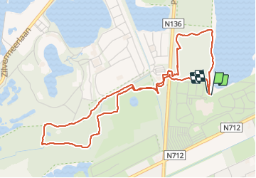
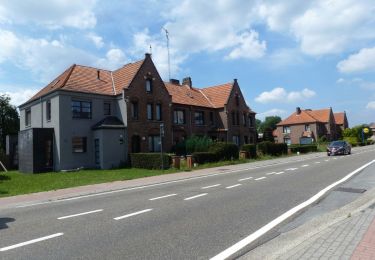
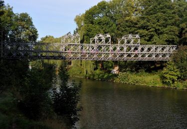
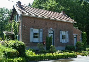
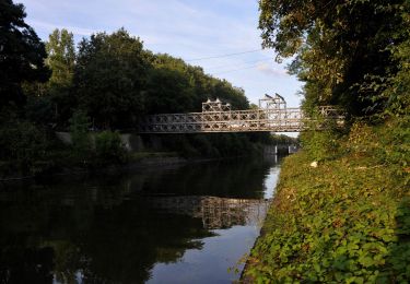
Randonnée Marche de 5,3 km à découvrir à Flandre, Anvers, Mol. Cette randonnée est proposée par Mudry.
Description
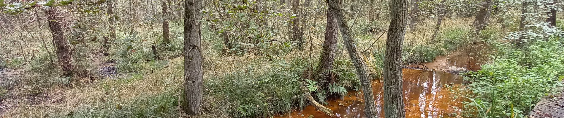
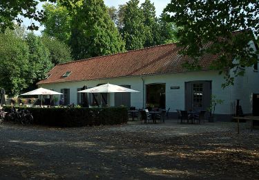
Promenade balisée au départ du Sun Park. Balisage top. Un dépliant papier est disponible à l'accueil du Sun Park. Pas de difficulté majeure mais le parcours le long du cours d'eau est parfois un peu glissant et...mouillé...
Localisation
Pays :
Belgique
Région :
Flandre
Département/Province :
Anvers
Commune :
Mol
Localité :
Unknown
Départ:(Dec)
Départ:(UTM)
652812 ; 5676297 (31U) N.
Commentaires
Randonnées à proximité
![Randonnée A pied Mol - Merenpad 7km - Photo](https://media.geolcdn.com/t/375/260/ext.jpg?maxdim=2&url=https%3A%2F%2Fmedia.geolcdn.com%2Ff%2F4f059d46-9351-4bfb-b85c-d0034645b3fe.jpeg)
![A pied A pied](https://static1.geolcdn.com/sitytour/trail-icons/100.png)
![Randonnée A pied Mol - Galbergenpad - Photo](https://media.geolcdn.com/t/375/260/ext.jpg?maxdim=2&url=https%3A%2F%2Fmedia.geolcdn.com%2Ff%2Fac6c45ad-0a3f-46f0-8730-3bf99148b3e6.jpeg)
![A pied A pied](https://static1.geolcdn.com/sitytour/trail-icons/100.png)
![Randonnée A pied Mol - Netepad - Photo](https://media.geolcdn.com/t/375/260/ext.jpg?maxdim=2&url=https%3A%2F%2Fmedia.geolcdn.com%2Ff%2Fb8d824ab-b7ec-46ac-901d-e1a19a60eee0.jpeg)
![A pied A pied](https://static1.geolcdn.com/sitytour/trail-icons/100.png)
![Randonnée A pied Mol - Merenpad - Photo](https://media.geolcdn.com/t/375/260/ext.jpg?maxdim=2&url=https%3A%2F%2Fmedia.geolcdn.com%2Ff%2F03f8c97e-ed17-4356-a72b-3f3c82846f0d.jpeg)
![A pied A pied](https://static1.geolcdn.com/sitytour/trail-icons/100.png)
![Randonnée A pied Lommel - Blauwe Kei Rode driehoek - Photo](https://media.geolcdn.com/t/375/260/ext.jpg?maxdim=2&url=https%3A%2F%2Fmedia.geolcdn.com%2Ff%2F9bca7f32-27e0-4e61-aadd-7c6bcb57fbd7.jpeg)
![A pied A pied](https://static1.geolcdn.com/sitytour/trail-icons/100.png)
Blauwe Kei Rode driehoek
A pied
Facile
Lommel,
Flandre,
Limbourg,
Belgique
![](/images/other/stat-length.png)
11,4 km | 12,2 km-effort
2h 47min
![](https://static1.geolcdn.com/siteimages/upload/files/16400158638029165_repeat_loop_refresh_sync_direction_icon.png)
Oui
![Randonnée A pied Lommel - Blauwe Kei Groene rechthoek - Photo](https://media.geolcdn.com/t/375/260/ext.jpg?maxdim=2&url=https%3A%2F%2Fmedia.geolcdn.com%2Ff%2F9bca7f32-27e0-4e61-aadd-7c6bcb57fbd7.jpeg)
![A pied A pied](https://static1.geolcdn.com/sitytour/trail-icons/100.png)
Blauwe Kei Groene rechthoek
A pied
Facile
Lommel,
Flandre,
Limbourg,
Belgique
![](/images/other/stat-length.png)
4,9 km | 5,3 km-effort
1h 11min
![](https://static1.geolcdn.com/siteimages/upload/files/16400158638029165_repeat_loop_refresh_sync_direction_icon.png)
Oui
![Randonnée A pied Lommel - Blauwe Kei Gele zeshoek - Photo](https://media.geolcdn.com/t/375/260/ext.jpg?maxdim=2&url=https%3A%2F%2Fmedia.geolcdn.com%2Ff%2Fc27b7662-6e94-4e29-b3cf-5c4fe5dc9647.jpeg)
![A pied A pied](https://static1.geolcdn.com/sitytour/trail-icons/100.png)
Blauwe Kei Gele zeshoek
A pied
Facile
Lommel,
Flandre,
Limbourg,
Belgique
![](/images/other/stat-length.png)
8,8 km | 9,6 km-effort
2h 10min
![](https://static1.geolcdn.com/siteimages/upload/files/16400158638029165_repeat_loop_refresh_sync_direction_icon.png)
Oui
![Randonnée A pied Lommel - De Maat blauwe vlam - Photo](https://media.geolcdn.com/t/375/260/ext.jpg?maxdim=2&url=https%3A%2F%2Fmedia.geolcdn.com%2Ff%2Ffeb75399-7b57-4327-8c6f-945ea77a910c.jpeg)
![A pied A pied](https://static1.geolcdn.com/sitytour/trail-icons/100.png)
De Maat blauwe vlam
A pied
Facile
Lommel,
Flandre,
Limbourg,
Belgique
![](/images/other/stat-length.png)
5,7 km | 6,1 km-effort
1h 23min
![](https://static1.geolcdn.com/siteimages/upload/files/16400158638029165_repeat_loop_refresh_sync_direction_icon.png)
Oui
![Randonnée A pied Mol - Den Diel - Photo](https://media.geolcdn.com/t/375/260/ext.jpg?maxdim=2&url=https%3A%2F%2Fmedia.geolcdn.com%2Ff%2Fc27b7662-6e94-4e29-b3cf-5c4fe5dc9647.jpeg)
![A pied A pied](https://static1.geolcdn.com/sitytour/trail-icons/100.png)