


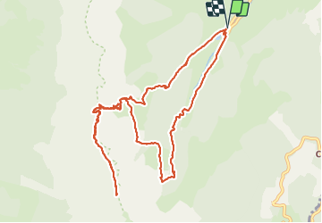

14,3 km | 31 km-effort

Utilisateur


Application GPS de randonnée GRATUITE
 SityTrail
IGN / Instituts géographiques
SityTrail World
Le monde est à vous
Randonnée Marche de 13,6 km à découvrir à Auvergne-Rhône-Alpes, Isère, Gresse-en-Vercors. Cette randonnée est proposée par Emelle.
Randonnée classique avec un retour par un autre itinéraire moins connu qui permet de faire une belle boucle.
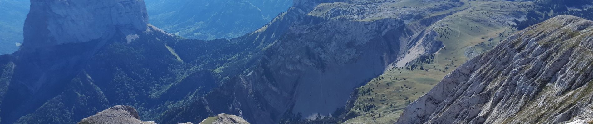
La seule difficulté réside dans le dénivelé soutenu jusqu'au sommet. Magnifique point de vue au sommet dont le Mont Aiguille.


Marche

Marche

Marche

Marche

Marche

Marche

Marche

Marche

Marche