![](/images/other/stat-length.png)
![Randonnée Marche Villiers-sur-Loir - Randonnée à Villiers-sur-Loir - Photo](https://media.geolcdn.com/t/1900/400/9d560b2a-37ce-47eb-82e2-14ccac1a8b83.jpg&format=pjpeg&maxdim=2)
Randonnée à Villiers-sur-Loir
guydu41
Utilisateur
![Longueur](/images/other/stat-length.png)
Longueur
9,7 km
![Altitude max](https://static1.geolcdn.com/siteimages/upload/files/1508320355ic_sort_altitude_max_24dp.png)
Altitude max
138 m
![Dénivelé positif](https://static1.geolcdn.com/siteimages/upload/files/1508320355ic_sort_den_pos_24dp.png)
Dénivelé positif
98 m
![Km-Effort](/images/other/stat-length.png)
Km-Effort
11 km
![Altitude min](https://static1.geolcdn.com/siteimages/upload/files/1508320355ic_sort_altitude_min_24dp.png)
Altitude min
72 m
![Dénivelé négatif](https://static1.geolcdn.com/siteimages/upload/files/1508320355ic_sort_den_neg_24dp.png)
Dénivelé négatif
96 m
![Boucle](https://static1.geolcdn.com/siteimages/upload/files/16400158638029165_repeat_loop_refresh_sync_direction_icon.png)
Boucle
Oui
Date de création :
2021-09-22 07:00:06.227
Dernière modification :
2021-09-23 04:03:17.399
![Marche](https://static1.geolcdn.com/sitytour/trail-icons/101.png)
3h06
Difficulté : Très facile
![Scannez ce code QR pour ouvrir la randonnée dans l'application SityTrail](https://capi.geolives.com/qq0zvz2zws4bq2lad0pu/sitytour/trails/2945279/qr.png?size=200)
Application GPS de randonnée GRATUITE
À propos
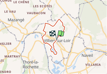
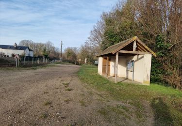
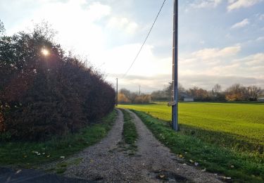
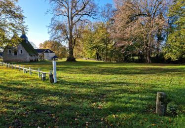
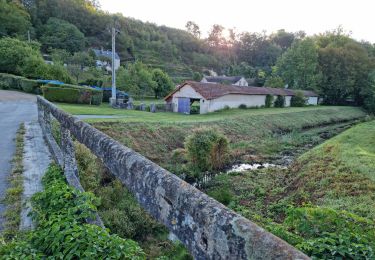
Randonnée Marche de 9,7 km à découvrir à Centre-Val de Loire, Loir-et-Cher, Villiers-sur-Loir. Cette randonnée est proposée par guydu41.
Description
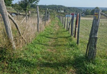
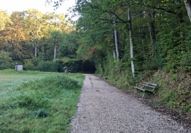
Ce très beau parcours est un "Mix" entre le Circuit PR "Promenade et Randonnée" balisé jaune (voir trace correspondante sur ce site) et la "Randonnée des Coteaux" balisée bleu (voir trace sur ce site).
Départ/Arrivée : Parking devant la Mairie.
Localisation
Pays :
France
Région :
Centre-Val de Loire
Département/Province :
Loir-et-Cher
Commune :
Villiers-sur-Loir
Localité :
Unknown
Départ:(Dec)
Départ:(UTM)
349865 ; 5296715 (31T) N.
Commentaires
Randonnées à proximité
![Randonnée A pied Villiers-sur-Loir - Circuit des Côteaux - Photo](https://media.geolcdn.com/t/375/260/25cb373c-e85b-47b3-b4c8-0c4c4213b15c.jpeg&format=jpg&maxdim=2)
![A pied A pied](https://static1.geolcdn.com/sitytour/trail-icons/100.png)
Circuit des Côteaux
A pied
Facile
Villiers-sur-Loir,
Centre-Val de Loire,
Loir-et-Cher,
France
![](/images/other/stat-length.png)
9,4 km | 11 km-effort
2h 29min
![](https://static1.geolcdn.com/siteimages/upload/files/16400158638029165_repeat_loop_refresh_sync_direction_icon.png)
Oui
![Randonnée Marche Thoré-la-Rochette - Thoré-la-Rochette - Vallée et Coteaux du Loir - Photo](https://media.geolcdn.com/t/375/260/3f4c80d2-3437-4e69-84de-30a02f464543.jpg&format=jpg&maxdim=2)
![Marche Marche](https://static1.geolcdn.com/sitytour/trail-icons/101.png)
Thoré-la-Rochette - Vallée et Coteaux du Loir
Marche
Moyen
Thoré-la-Rochette,
Centre-Val de Loire,
Loir-et-Cher,
France
![](/images/other/stat-length.png)
9,2 km | 11,6 km-effort
2h 38min
![](https://static1.geolcdn.com/siteimages/upload/files/16400158638029165_repeat_loop_refresh_sync_direction_icon.png)
Oui
![Randonnée Marche Marcilly-en-Beauce - Varennes - Photo](https://media.geolcdn.com/t/375/260/e5fe1065-d10c-4b43-96c8-69a926a5b2c1.jpg&format=jpg&maxdim=2)
![Marche Marche](https://static1.geolcdn.com/sitytour/trail-icons/101.png)
Varennes
Marche
Facile
Marcilly-en-Beauce,
Centre-Val de Loire,
Loir-et-Cher,
France
![](/images/other/stat-length.png)
7,9 km | 9,1 km-effort
2h 3min
![](https://static1.geolcdn.com/siteimages/upload/files/16400158638029165_repeat_loop_refresh_sync_direction_icon.png)
Oui
![Randonnée Marche Naveil - Naveil - Photo](https://media.geolcdn.com/t/375/260/37d67a4f-f628-4e03-8093-029fa7b56966.jpg&format=jpg&maxdim=2)
![Marche Marche](https://static1.geolcdn.com/sitytour/trail-icons/101.png)
Naveil
Marche
Facile
Naveil,
Centre-Val de Loire,
Loir-et-Cher,
France
![](/images/other/stat-length.png)
9,8 km | 11,3 km-effort
2h 33min
![](https://static1.geolcdn.com/siteimages/upload/files/16400158638029165_repeat_loop_refresh_sync_direction_icon.png)
Oui
![Randonnée Marche Mazangé - Bonaventure - Moulin de la Loupe - Photo](https://media.geolcdn.com/t/375/260/759d7924-4ccb-43c3-8104-ebc2f5335c97.jpg&format=jpg&maxdim=2)
![Marche Marche](https://static1.geolcdn.com/sitytour/trail-icons/101.png)
Bonaventure - Moulin de la Loupe
Marche
Moyen
Mazangé,
Centre-Val de Loire,
Loir-et-Cher,
France
![](/images/other/stat-length.png)
8,3 km | 9,9 km-effort
2h 15min
![](https://static1.geolcdn.com/siteimages/upload/files/16400158638029165_repeat_loop_refresh_sync_direction_icon.png)
Oui
![Randonnée Marche Lunay - Château de la Mézière - Asnières - Photo](https://media.geolcdn.com/t/375/260/7020eb26-114b-4b8b-93d9-05c4bb72eb01.jpg&format=jpg&maxdim=2)
![Marche Marche](https://static1.geolcdn.com/sitytour/trail-icons/101.png)
Château de la Mézière - Asnières
Marche
Moyen
Lunay,
Centre-Val de Loire,
Loir-et-Cher,
France
![](/images/other/stat-length.png)
7,4 km | 8,5 km-effort
1h 56min
![](https://static1.geolcdn.com/siteimages/upload/files/16400158638029165_repeat_loop_refresh_sync_direction_icon.png)
Oui
![Randonnée Marche Vendôme - Vendôme - Villiers-sur-Loir - Photo](https://media.geolcdn.com/t/375/260/e66027b3-088b-4b5f-b5f5-ac0b8671fb02.jpg&format=jpg&maxdim=2)
![Marche Marche](https://static1.geolcdn.com/sitytour/trail-icons/101.png)
Vendôme - Villiers-sur-Loir
Marche
Moyen
Vendôme,
Centre-Val de Loire,
Loir-et-Cher,
France
![](/images/other/stat-length.png)
13,2 km | 15,6 km-effort
3h 32min
![](https://static1.geolcdn.com/siteimages/upload/files/16400158638029165_repeat_loop_refresh_sync_direction_icon.png)
Oui
![Randonnée Marche Vendôme - Vendôme Nord - Photo](https://media.geolcdn.com/t/375/260/8467046a-0d6b-4c3c-968e-b82cf7fdf11f.jpg&format=jpg&maxdim=2)
![Marche Marche](https://static1.geolcdn.com/sitytour/trail-icons/101.png)
Vendôme Nord
Marche
Moyen
Vendôme,
Centre-Val de Loire,
Loir-et-Cher,
France
![](/images/other/stat-length.png)
9,6 km | 11,5 km-effort
2h 37min
![](https://static1.geolcdn.com/siteimages/upload/files/16400158638029165_repeat_loop_refresh_sync_direction_icon.png)
Oui
![Randonnée Marche Mazangé - Mazangé - Lavoir Coteaux Vallées - Photo](https://media.geolcdn.com/t/375/260/80592688-f9b6-4715-9b8f-004afd996a29.jpg&format=jpg&maxdim=2)
![Marche Marche](https://static1.geolcdn.com/sitytour/trail-icons/101.png)
Mazangé - Lavoir Coteaux Vallées
Marche
Moyen
Mazangé,
Centre-Val de Loire,
Loir-et-Cher,
France
![](/images/other/stat-length.png)
9,4 km | 11,6 km-effort
2h 38min
![](https://static1.geolcdn.com/siteimages/upload/files/16400158638029165_repeat_loop_refresh_sync_direction_icon.png)
Oui