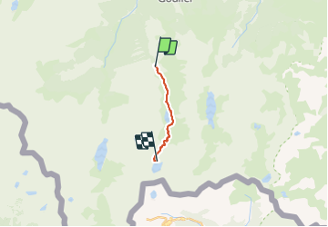
Randonnée A pied Auzat - Fourcat - Photo
 georghinio
georghinio

Utilisateur

© OpenStreetMap contributors
Longueur
Longueur
9,4 km
Altitude max
Altitude max
2442 m
Dénivelé positif
Dénivelé positif
1332 m
Km-Effort
Km-Effort  
23 km
Altitude min
Altitude min
1154 m
Dénivelé négatif
Dénivelé négatif
48 m
Boucle
Boucle
Non
Date de création :
2021-09-17 09:16:55.364
Dernière modification :
2021-09-17 09:20:01.694

(0 Avis)

A pied
A pied
5h12
Difficulté : Moyen

Scannez ce code QR pour ouvrir la randonnée dans l'application SityTrail

Application GPS de randonnée GRATUITE

Logo SityTrail SityTrail

IGN / Instituts géographiques

Télécharger SityTrail sur l'App Store Télécharger SityTrail sur Google Play

Logo SityTrail SityTrail World

Le monde est à vous

Télécharger SityTrail sur l'App Store Télécharger SityTrail sur Google Play Télécharger SityTrail sur Huawei AppGallery

À propos

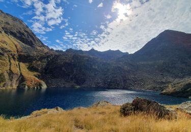
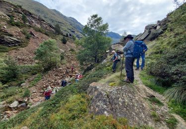
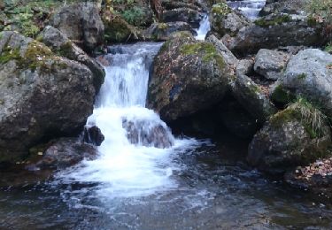
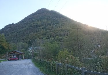
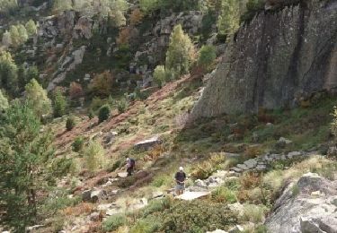
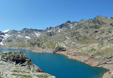
Randonnée A pied de 9,4 km à découvrir à Occitanie, Ariège, Auzat. Cette randonnée est proposée par georghinio.

Description

Départ centale, arrivée refuge du Fourcat

Profil altimétrique

Localisation

Pays :
France
Région :
Occitanie
Département/Province :
Ariège
Commune :
Auzat
Localité :
Unknown
Départ:(UTM)
376198 ; 4730494 (31T) N.

Randonnées à proximité

Randonnée Marche Auzat - Le Picot - Photo
Marche
beautrix

Marche

Difficile
(2)
Auzat, Occitanie, Ariège, France
6,3 km | 18,9 km-effort
4h 0min
Non
Randonnée Marche Auzat - 171008 EnCours - Photo
Marche
randodan

Marche

Très facile
Auzat, Occitanie, Ariège, France
7,3 km | 14,2 km-effort
3h 50min
Oui
Randonnée Marche Val-de-Sos - 171007 EnCours - Photo
Marche
randodan

Marche

Très facile
(1)
Val-de-Sos, Occitanie, Ariège, France
10,8 km | 17,1 km-effort
4h 50min
Oui
Randonnée Marche Auzat - 171006.2 EnCours - Photo
Marche
randodan

Marche

Très facile
Auzat, Occitanie, Ariège, France
8,7 km | 13,5 km-effort
3h 45min
Oui
Randonnée Marche Auzat - 171004 EnCours - Photo
Marche
randodan

Marche

Très facile
Auzat, Occitanie, Ariège, France
12,3 km | 24 km-effort
7h 30min
Oui
Randonnée Marche Val-de-Sos - La Pique d'Endron - Goulier - Photo
Marche
tracegps

Marche

Très difficile
Val-de-Sos, Occitanie, Ariège, France
8 km | 21 km-effort
5h 49min
Oui
Randonnée Marche Auzat - Etang d'Izourt - Orri de Petsiguer - Etang de la Goueille -Etang  Fourcat - Photo
Marche
tracegps

Marche

Difficile
Auzat, Occitanie, Ariège, France
17,9 km | 39 km-effort
11h 0min
Oui
Randonnée Marche Auzat - Etang du Picot - Photo
Marche
prous31

Marche

Difficile
Auzat, Occitanie, Ariège, France
8 km | 17,9 km-effort
4h 4min
Oui
Randonnée Marche Auzat - 2022 TRANSPYRÉNÉENNE - étangs de Bassiès - Goulier - Siguer - Photo
Marche
LEGUE

Marche

Très difficile
Auzat, Occitanie, Ariège, France
22 km | 36 km-effort
5h 56min
Non


Fermer
Mes abonnements