


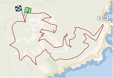

17,7 km | 25 km-effort

Utilisateur


Application GPS de randonnée GRATUITE
 SityTrail
IGN / Instituts géographiques
SityTrail World
Le monde est à vous
Randonnée Marche de 10,4 km à découvrir à Provence-Alpes-Côte d'Azur, Var, Saint-Raphaël. Cette randonnée est proposée par jeromelacoste.
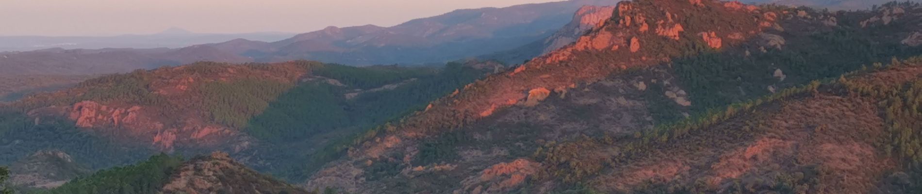
Superbe randonnée, mêlant roche ocre et rouge ainsi qu'une vue à 360 surplombant la mer magnifique.chaussure randonnée conseillée car très rocailleux.


Marche

Marche

Marche

Marche

Marche

Marche

Marche

Marche
Marche
belle randonnée avec des paysages superbes et des vues magnifiques sur la mer ,dommage que le sentier soit beaucoup pierreux
Superbe randonnée, mêlant roche ocre et rouge ainsi qu'une vue à 360 surplombant la mer magnifique.