![](/images/other/stat-length.png)
![Randonnée Marche Neuf-Marché - Circuit-N°8_Le_Bois_du_Temple_Neuf-Marché à Montroty - Photo](https://media.geolcdn.com/t/1900/400/ext.pjpeg?maxdim=2&url=https%3A%2F%2Fstatic1.geolcdn.com%2Fsiteimages%2Fupload%2Ffiles%2F1553511878bg_sport_marche.png)
Circuit-N°8_Le_Bois_du_Temple_Neuf-Marché à Montroty
Marie-Claire-mcp
Utilisateur
![Longueur](/images/other/stat-length.png)
Longueur
11,8 km
![Altitude max](https://static1.geolcdn.com/siteimages/upload/files/1508320355ic_sort_altitude_max_24dp.png)
Altitude max
220 m
![Dénivelé positif](https://static1.geolcdn.com/siteimages/upload/files/1508320355ic_sort_den_pos_24dp.png)
Dénivelé positif
182 m
![Km-Effort](/images/other/stat-length.png)
Km-Effort
14,3 km
![Altitude min](https://static1.geolcdn.com/siteimages/upload/files/1508320355ic_sort_altitude_min_24dp.png)
Altitude min
82 m
![Dénivelé négatif](https://static1.geolcdn.com/siteimages/upload/files/1508320355ic_sort_den_neg_24dp.png)
Dénivelé négatif
182 m
![Boucle](https://static1.geolcdn.com/siteimages/upload/files/16400158638029165_repeat_loop_refresh_sync_direction_icon.png)
Boucle
Oui
Date de création :
2021-09-10 09:10:28.079
Dernière modification :
2023-09-20 13:19:12.675
![Marche](https://static1.geolcdn.com/sitytour/trail-icons/101.png)
3h14
Difficulté : Difficile
![Scannez ce code QR pour ouvrir la randonnée dans l'application SityTrail](https://capi.geolives.com/qq0zvz2zws4bq2lad0pu/sitytour/trails/2931214/qr.png?size=200)
Application GPS de randonnée GRATUITE
À propos
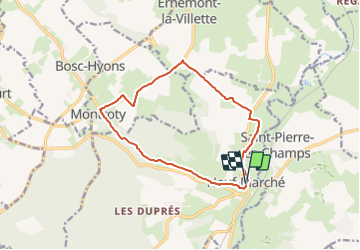
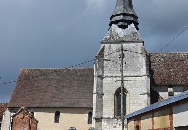
Randonnée Marche de 11,8 km à découvrir à Normandie, Seine-Maritime, Neuf-Marché. Cette randonnée est proposée par Marie-Claire-mcp.
Description
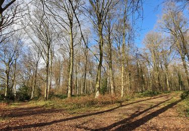
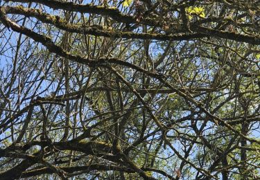
Départ place de la mairie à Neuf-Marché - Balisage Bleu Un point de vue imprenable sur le Pays de Bray à partir de Neuf-Marché. A chaque pas et au fil des saisons vous pourrez découvrir la flore, la faune locale et l'Epte qui coule paisiblement.
Localisation
Pays :
France
Région :
Normandie
Département/Province :
Seine-Maritime
Commune :
Neuf-Marché
Localité :
Unknown
Départ:(Dec)
Départ:(UTM)
406969 ; 5475294 (31U) N.
Commentaires
Randonnées à proximité
![Randonnée Marche Martagny - Martagny, forêt domaniale de Lyons et le monument de la Rougemare - Photo](https://media.geolcdn.com/t/375/260/8a602ec9-d0ca-42f6-b8dd-595ff5f1acc5.jpg&format=jpg&maxdim=2)
![Marche Marche](https://static1.geolcdn.com/sitytour/trail-icons/101.png)
Martagny, forêt domaniale de Lyons et le monument de la Rougemare
Marche
Difficile
(1)
Martagny,
Normandie,
Eure,
France
![](/images/other/stat-length.png)
10,4 km | 13,1 km-effort
2h 16min
![](https://static1.geolcdn.com/siteimages/upload/files/16400158638029165_repeat_loop_refresh_sync_direction_icon.png)
Oui
![Randonnée Marche Talmontiers - Marche Nordique 48 - Talmontiers - Photo](https://media.geolcdn.com/t/375/260/ext.jpg?maxdim=2&url=https%3A%2F%2Fstatic1.geolcdn.com%2Fsiteimages%2Fupload%2Ffiles%2F1553511878bg_sport_marche.png)
![Marche Marche](https://static1.geolcdn.com/sitytour/trail-icons/101.png)
Marche Nordique 48 - Talmontiers
Marche
Facile
(1)
Talmontiers,
Hauts-de-France,
Oise,
France
![](/images/other/stat-length.png)
8,1 km | 10,7 km-effort
2h 17min
![](https://static1.geolcdn.com/siteimages/upload/files/16400158638029165_repeat_loop_refresh_sync_direction_icon.png)
Oui
![Randonnée Marche Martagny - Rando Santé 2 - Martagny - Photo](https://media.geolcdn.com/t/375/260/ext.jpg?maxdim=2&url=https%3A%2F%2Fstatic1.geolcdn.com%2Fsiteimages%2Fupload%2Ffiles%2F1553511878bg_sport_marche.png)
![Marche Marche](https://static1.geolcdn.com/sitytour/trail-icons/101.png)
Rando Santé 2 - Martagny
Marche
Facile
(1)
Martagny,
Normandie,
Eure,
France
![](/images/other/stat-length.png)
4,9 km | 6,2 km-effort
1h 30min
![](https://static1.geolcdn.com/siteimages/upload/files/16400158638029165_repeat_loop_refresh_sync_direction_icon.png)
Oui
![Randonnée Marche Neuf-Marché - Neufmarché - Bouchevilliers 10 - Photo](https://media.geolcdn.com/t/375/260/ext.jpg?maxdim=2&url=https%3A%2F%2Fstatic1.geolcdn.com%2Fsiteimages%2Fupload%2Ffiles%2F1553511878bg_sport_marche.png)
![Marche Marche](https://static1.geolcdn.com/sitytour/trail-icons/101.png)
Neufmarché - Bouchevilliers 10
Marche
Facile
(1)
Neuf-Marché,
Normandie,
Seine-Maritime,
France
![](/images/other/stat-length.png)
10,4 km | 12,1 km-effort
2h 41min
![](https://static1.geolcdn.com/siteimages/upload/files/16400158638029165_repeat_loop_refresh_sync_direction_icon.png)
Oui
![Randonnée Marche Talmontiers - Talmontiers - Neufmarché le long de l''Epte - Photo](https://media.geolcdn.com/t/375/260/ext.jpg?maxdim=2&url=https%3A%2F%2Fstatic1.geolcdn.com%2Fsiteimages%2Fupload%2Ffiles%2F1553511878bg_sport_marche.png)
![Marche Marche](https://static1.geolcdn.com/sitytour/trail-icons/101.png)
Talmontiers - Neufmarché le long de l''Epte
Marche
Facile
(1)
Talmontiers,
Hauts-de-France,
Oise,
France
![](/images/other/stat-length.png)
12,3 km | 14,2 km-effort
3h 10min
![](https://static1.geolcdn.com/siteimages/upload/files/16400158638029165_repeat_loop_refresh_sync_direction_icon.png)
Oui
![Randonnée Marche Neuf-Marché - Neufmarché à Montroty - Photo](https://media.geolcdn.com/t/375/260/91b55741-5d18-43bb-8a41-763dd3522b88.jpg&format=jpg&maxdim=2)
![Marche Marche](https://static1.geolcdn.com/sitytour/trail-icons/101.png)
Neufmarché à Montroty
Marche
Moyen
Neuf-Marché,
Normandie,
Seine-Maritime,
France
![](/images/other/stat-length.png)
9,4 km | 11,7 km-effort
2h 16min
![](https://static1.geolcdn.com/siteimages/upload/files/16400158638029165_repeat_loop_refresh_sync_direction_icon.png)
Oui
![Randonnée A pied Montroty - Montroty - Forêt de Lyons 10 km - Photo](https://media.geolcdn.com/t/375/260/ext.jpg?maxdim=2&url=https%3A%2F%2Fstatic1.geolcdn.com%2Fsiteimages%2Fupload%2Ffiles%2F1545311037marcheuse_200dpi.jpg)
![A pied A pied](https://static1.geolcdn.com/sitytour/trail-icons/100.png)
Montroty - Forêt de Lyons 10 km
A pied
Facile
(1)
Montroty,
Normandie,
Seine-Maritime,
France
![](/images/other/stat-length.png)
10 km | 12,2 km-effort
2h 46min
![](https://static1.geolcdn.com/siteimages/upload/files/16400158638029165_repeat_loop_refresh_sync_direction_icon.png)
Oui
![Randonnée Marche Talmontiers - Talmontiers, Les landes - Photo](https://media.geolcdn.com/t/375/260/7d1f6958-679a-46ce-94a5-ebb4160c2870.jpg&format=jpg&maxdim=2)
![Marche Marche](https://static1.geolcdn.com/sitytour/trail-icons/101.png)
Talmontiers, Les landes
Marche
Difficile
Talmontiers,
Hauts-de-France,
Oise,
France
![](/images/other/stat-length.png)
9,6 km | 12,5 km-effort
3h 16min
![](https://static1.geolcdn.com/siteimages/upload/files/16400158638029165_repeat_loop_refresh_sync_direction_icon.png)
Oui
![Randonnée Marche Talmontiers - Talmontiers - Amécourt et Guerguesalle - Photo](https://media.geolcdn.com/t/375/260/afe2ad19-57c3-42ca-a08e-f82b880bd3f9.jpg&format=jpg&maxdim=2)
![Marche Marche](https://static1.geolcdn.com/sitytour/trail-icons/101.png)
Talmontiers - Amécourt et Guerguesalle
Marche
Moyen
Talmontiers,
Hauts-de-France,
Oise,
France
![](/images/other/stat-length.png)
9,1 km | 11,1 km-effort
2h 34min
![](https://static1.geolcdn.com/siteimages/upload/files/16400158638029165_repeat_loop_refresh_sync_direction_icon.png)
Oui