![](/images/other/stat-length.png)
![Randonnée Marche Mortcerf - Boucle 20 km autour de Mortcerf - Photo](https://media.geolcdn.com/t/1900/400/7dccf5cc-6d2c-4b9e-bfab-f503983628ba.jpg&format=pjpeg&maxdim=2)
Boucle 20 km autour de Mortcerf
chessyca
Utilisateur GUIDE
![Longueur](/images/other/stat-length.png)
Longueur
21 km
![Altitude max](https://static1.geolcdn.com/siteimages/upload/files/1508320355ic_sort_altitude_max_24dp.png)
Altitude max
137 m
![Dénivelé positif](https://static1.geolcdn.com/siteimages/upload/files/1508320355ic_sort_den_pos_24dp.png)
Dénivelé positif
337 m
![Km-Effort](/images/other/stat-length.png)
Km-Effort
25 km
![Altitude min](https://static1.geolcdn.com/siteimages/upload/files/1508320355ic_sort_altitude_min_24dp.png)
Altitude min
57 m
![Dénivelé négatif](https://static1.geolcdn.com/siteimages/upload/files/1508320355ic_sort_den_neg_24dp.png)
Dénivelé négatif
337 m
![Boucle](https://static1.geolcdn.com/siteimages/upload/files/16400158638029165_repeat_loop_refresh_sync_direction_icon.png)
Boucle
Oui
Date de création :
2021-09-05 07:45:31.144
Dernière modification :
2021-09-05 16:29:13.348
![Marche](https://static1.geolcdn.com/sitytour/trail-icons/101.png)
5h05
Difficulté : Moyen
![Scannez ce code QR pour ouvrir la randonnée dans l'application SityTrail](https://capi.geolives.com/qq0zvz2zws4bq2lad0pu/sitytour/trails/2925803/qr.png?size=200)
Application GPS de randonnée GRATUITE
À propos
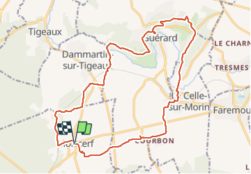
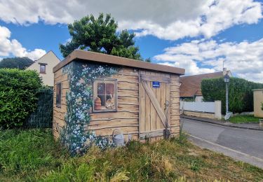
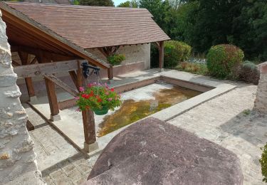
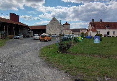
Randonnée Marche de 21 km à découvrir à Île-de-France, Seine-et-Marne, Mortcerf. Cette randonnée est proposée par chessyca.
Description
Superbe boucle menée par Hélène autour de Mortcerf.
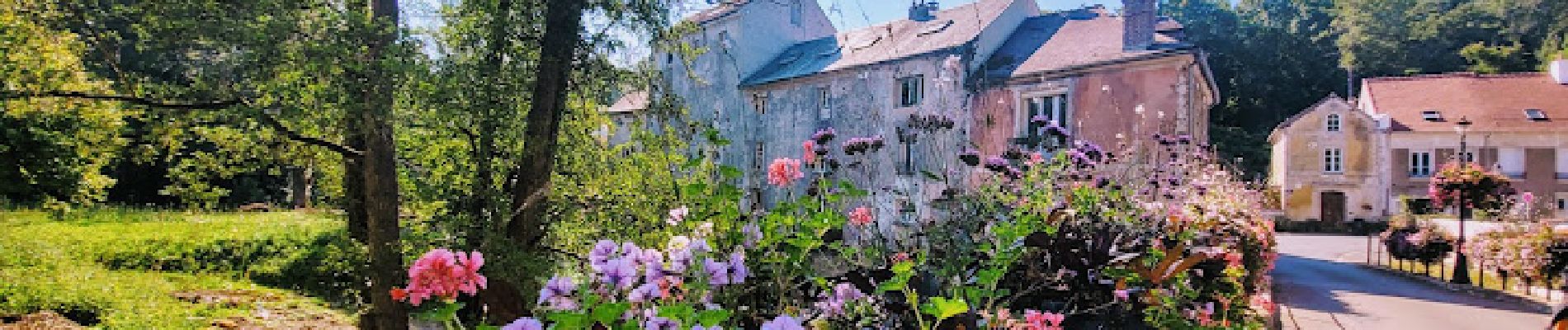
Une grande variété de paysage et des traversées de villages pittoresques
Localisation
Pays :
France
Région :
Île-de-France
Département/Province :
Seine-et-Marne
Commune :
Mortcerf
Localité :
Unknown
Départ:(Dec)
Départ:(UTM)
493859 ; 5404052 (31U) N.
Commentaires
Randonnées à proximité
![Randonnée V.T.T. Mortcerf - Espace VTT FFC - Les Coteaux du Morin et de l'Aubetin - Circuit n° 12 - Mortcerf - Photo](https://media.geolcdn.com/t/375/260/ext.jpg?maxdim=2&url=https%3A%2F%2Fservices.sitytrail.com%2FGeolivesWS%2FDownloadMedia.ashx%3FTrailID%3D104876%26Media%3D8399_1.jpg)
![V.T.T. V.T.T.](https://static1.geolcdn.com/sitytour/trail-icons/202.png)
Espace VTT FFC - Les Coteaux du Morin et de l'Aubetin - Circuit n° 12 - Mortcerf
V.T.T.
Moyen
(1)
Mortcerf,
Île-de-France,
Seine-et-Marne,
France
![](/images/other/stat-length.png)
12 km | 13,8 km-effort
1h 0min
![](https://static1.geolcdn.com/siteimages/upload/files/16400158638029165_repeat_loop_refresh_sync_direction_icon.png)
Oui
![Randonnée A pied Mortcerf - Boucle autour de Mortcerf - Photo](https://media.geolcdn.com/t/375/260/59e379b2-0348-4e21-a816-ab3e2c16cdc1.jpg&format=jpg&maxdim=2)
![A pied A pied](https://static1.geolcdn.com/sitytour/trail-icons/100.png)
Boucle autour de Mortcerf
A pied
Très facile
Mortcerf,
Île-de-France,
Seine-et-Marne,
France
![](/images/other/stat-length.png)
22 km | 26 km-effort
5h 53min
![](https://static1.geolcdn.com/siteimages/upload/files/16400158638029165_repeat_loop_refresh_sync_direction_icon.png)
Oui
![Randonnée Marche Mortcerf - Le tour du Grand Paris via le GR1 - Etape 11 Morcerf - Verneuil l'Etang - Photo](https://media.geolcdn.com/t/375/260/7c77b534-b6ca-4f92-9593-6e4e45d1fef2.jpg&format=jpg&maxdim=2)
![Marche Marche](https://static1.geolcdn.com/sitytour/trail-icons/101.png)
Le tour du Grand Paris via le GR1 - Etape 11 Morcerf - Verneuil l'Etang
Marche
Moyen
Mortcerf,
Île-de-France,
Seine-et-Marne,
France
![](/images/other/stat-length.png)
31 km | 34 km-effort
5h 41min
![](https://static1.geolcdn.com/siteimages/upload/files/16400158638029165_repeat_loop_refresh_sync_direction_icon.png)
Non
![Randonnée Marche Guérard - Guérard - Photo](https://media.geolcdn.com/t/375/260/604a5cf1-31c1-4e64-b7ed-ed1e6e2756f8.jpg&format=jpg&maxdim=2)
![Marche Marche](https://static1.geolcdn.com/sitytour/trail-icons/101.png)
Guérard
Marche
Difficile
Guérard,
Île-de-France,
Seine-et-Marne,
France
![](/images/other/stat-length.png)
15,4 km | 18,5 km-effort
4h 3min
![](https://static1.geolcdn.com/siteimages/upload/files/16400158638029165_repeat_loop_refresh_sync_direction_icon.png)
Oui
![Randonnée Marche Tigeaux - Tigeaux - Photo](https://media.geolcdn.com/t/375/260/ext.jpg?maxdim=2&url=https%3A%2F%2Fstatic1.geolcdn.com%2Fsiteimages%2Fupload%2Ffiles%2F1553511878bg_sport_marche.png)
![Marche Marche](https://static1.geolcdn.com/sitytour/trail-icons/101.png)
Tigeaux
Marche
Moyen
(1)
Tigeaux,
Île-de-France,
Seine-et-Marne,
France
![](/images/other/stat-length.png)
19,1 km | 24 km-effort
5h 24min
![](https://static1.geolcdn.com/siteimages/upload/files/16400158638029165_repeat_loop_refresh_sync_direction_icon.png)
Oui
![Randonnée Marche Crèvecœur-en-Brie - Crèvecoeur-en-Brie - Photo](https://media.geolcdn.com/t/375/260/2b87ef65-5f63-49b7-96fa-665b4a148457.jpg&format=jpg&maxdim=2)
![Marche Marche](https://static1.geolcdn.com/sitytour/trail-icons/101.png)
Crèvecoeur-en-Brie
Marche
Facile
Crèvecœur-en-Brie,
Île-de-France,
Seine-et-Marne,
France
![](/images/other/stat-length.png)
4,4 km | 4,7 km-effort
1h 22min
![](https://static1.geolcdn.com/siteimages/upload/files/16400158638029165_repeat_loop_refresh_sync_direction_icon.png)
Oui
![Randonnée sport Hautefeuille - 2019-08-10_23h17m35_parcours_Hautefeuille - Photo](https://media.geolcdn.com/t/375/260/ext.jpg?maxdim=2&url=https%3A%2F%2Fsecurestorage.geolives.com%2Fsitytour%2Ftrail-bg%2Fdefault.jpg)
2019-08-10_23h17m35_parcours_Hautefeuille
sport
Très facile
(1)
Hautefeuille,
Île-de-France,
Seine-et-Marne,
France
![](/images/other/stat-length.png)
15,3 km | 17,2 km-effort
Inconnu
![](https://static1.geolcdn.com/siteimages/upload/files/16400158638029165_repeat_loop_refresh_sync_direction_icon.png)
Oui
![Randonnée Marche Mortcerf - obelisque - Photo](https://media.geolcdn.com/t/375/260/78cdb237-79f3-4d4d-8955-60b0b7b069b2.jpg&format=jpg&maxdim=2)
![Marche Marche](https://static1.geolcdn.com/sitytour/trail-icons/101.png)
obelisque
Marche
Très facile
Mortcerf,
Île-de-France,
Seine-et-Marne,
France
![](/images/other/stat-length.png)
11,8 km | 12,7 km-effort
2h 44min
![](https://static1.geolcdn.com/siteimages/upload/files/16400158638029165_repeat_loop_refresh_sync_direction_icon.png)
Oui
![Randonnée Marche Mortcerf - obelisque 2 - Photo](https://media.geolcdn.com/t/375/260/ext.jpg?maxdim=2&url=https%3A%2F%2Fstatic1.geolcdn.com%2Fsiteimages%2Fupload%2Ffiles%2F1553511878bg_sport_marche.png)
![Marche Marche](https://static1.geolcdn.com/sitytour/trail-icons/101.png)
obelisque 2
Marche
Facile
(1)
Mortcerf,
Île-de-France,
Seine-et-Marne,
France
![](/images/other/stat-length.png)
11,4 km | 12,3 km-effort
2h 43min
![](https://static1.geolcdn.com/siteimages/upload/files/16400158638029165_repeat_loop_refresh_sync_direction_icon.png)
Oui