![](/images/other/stat-length.png)
![Randonnée Marche Jausiers - Lac des terres pleines et Arrête Rocher Tête de Clapouse - Photo](https://media.geolcdn.com/t/1900/400/d1054b44-5d4f-4b75-8f39-d2a1a9487359.jpg&format=pjpeg&maxdim=2)
Lac des terres pleines et Arrête Rocher Tête de Clapouse
PapouBertrand
Utilisateur
![Longueur](/images/other/stat-length.png)
![Altitude max](https://static1.geolcdn.com/siteimages/upload/files/1508320355ic_sort_altitude_max_24dp.png)
![Dénivelé positif](https://static1.geolcdn.com/siteimages/upload/files/1508320355ic_sort_den_pos_24dp.png)
![Km-Effort](/images/other/stat-length.png)
![Altitude min](https://static1.geolcdn.com/siteimages/upload/files/1508320355ic_sort_altitude_min_24dp.png)
![Dénivelé négatif](https://static1.geolcdn.com/siteimages/upload/files/1508320355ic_sort_den_neg_24dp.png)
![Boucle](https://static1.geolcdn.com/siteimages/upload/files/16400158638029165_repeat_loop_refresh_sync_direction_icon.png)
![Marche](https://static1.geolcdn.com/sitytour/trail-icons/101.png)
5h22
Difficulté : Difficile
![Scannez ce code QR pour ouvrir la randonnée dans l'application SityTrail](https://capi.geolives.com/qq0zvz2zws4bq2lad0pu/sitytour/trails/2919882/qr.png?size=200)
Application GPS de randonnée GRATUITE
À propos
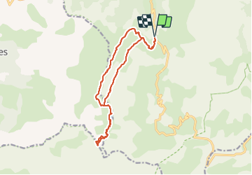
Randonnée Marche de 16,4 km à découvrir à Provence-Alpes-Côte d'Azur, Alpes-de-Haute-Provence, Jausiers. Cette randonnée est proposée par PapouBertrand.
Description
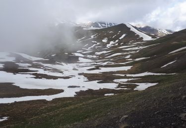
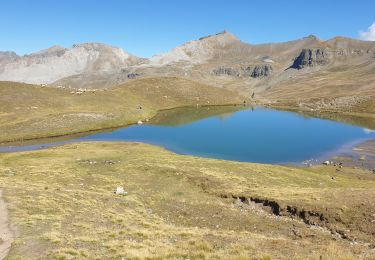
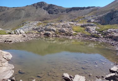
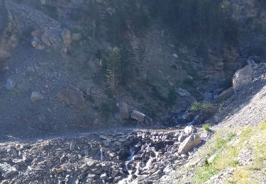
Randonnée Marche de 16 km à découvrir à Jausiers, Alpes-de-Haute-Provence, Provence-Alpes-Côte d'Azur. Au départ de Halte 2000, très jolie Rando mais, attention, arrête finale dangereuse. Pour la boucle retour attention aux troupeaux et surtout aux Patous.
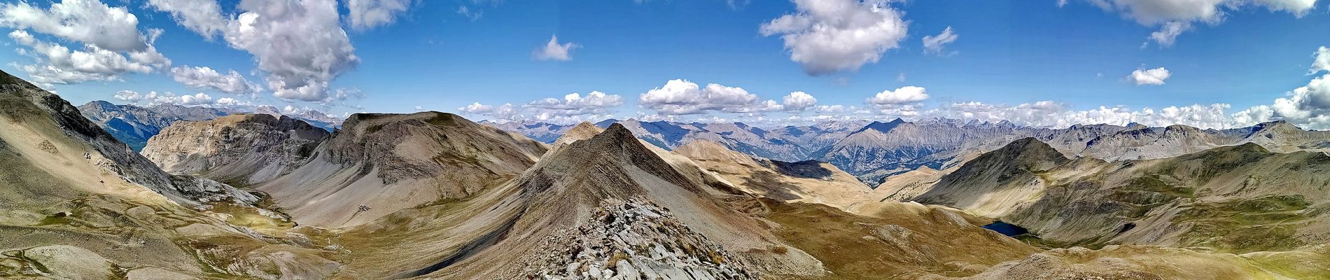
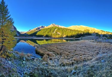
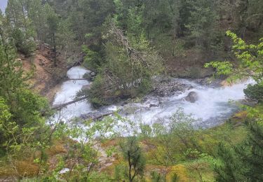
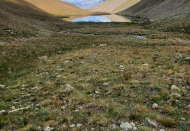
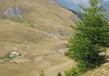
Localisation
Commentaires
Randonnées à proximité
![Randonnée Marche Jausiers - Cîme de Voga Via Jausier (lac de Sagne) - Photo](https://media.geolcdn.com/t/375/260/765bd632-4e4c-4e4b-9c51-061ee1a2012f.jpg&format=jpg&maxdim=2)
![Marche Marche](https://static1.geolcdn.com/sitytour/trail-icons/101.png)
Marche
![](/images/other/stat-length.png)
![](https://static1.geolcdn.com/siteimages/upload/files/16400158638029165_repeat_loop_refresh_sync_direction_icon.png)
![Randonnée Marche Jausiers - Fontaine de la pissoun 15-08-12 - Photo](https://media.geolcdn.com/t/375/260/ext.jpg?maxdim=2&url=https%3A%2F%2Fstatic1.geolcdn.com%2Fsiteimages%2Fupload%2Ffiles%2F1553511878bg_sport_marche.png)
![Marche Marche](https://static1.geolcdn.com/sitytour/trail-icons/101.png)
Marche
![](/images/other/stat-length.png)
![](https://static1.geolcdn.com/siteimages/upload/files/16400158638029165_repeat_loop_refresh_sync_direction_icon.png)
![Randonnée Marche Jausiers - cascadede pissoun 24 06 2024 - Photo](https://media.geolcdn.com/t/375/260/5ad66409-df89-4698-a4d8-4799e98719e1.jpg&format=jpg&maxdim=2)
![Marche Marche](https://static1.geolcdn.com/sitytour/trail-icons/101.png)
Marche
![](/images/other/stat-length.png)
![](https://static1.geolcdn.com/siteimages/upload/files/16400158638029165_repeat_loop_refresh_sync_direction_icon.png)
![Randonnée Marche Jausiers - Du col de Restefond, Mourre Haut - Photo](https://media.geolcdn.com/t/375/260/b5130266-8ed9-4d64-b271-5afc7d36d1fe.jpg&format=jpg&maxdim=2)
![Marche Marche](https://static1.geolcdn.com/sitytour/trail-icons/101.png)
Marche
![](/images/other/stat-length.png)
![](https://static1.geolcdn.com/siteimages/upload/files/16400158638029165_repeat_loop_refresh_sync_direction_icon.png)
![Randonnée Marche Jausiers - Toureis Restefond - Photo](https://media.geolcdn.com/t/375/260/20a0b540-9148-4e55-9ce1-b89ad38324dc.jpg&format=jpg&maxdim=2)
![Marche Marche](https://static1.geolcdn.com/sitytour/trail-icons/101.png)
Marche
![](/images/other/stat-length.png)
![](https://static1.geolcdn.com/siteimages/upload/files/16400158638029165_repeat_loop_refresh_sync_direction_icon.png)
![Randonnée Marche Jausiers - Le Chevalier 2886m 13.5.22 - Photo](https://media.geolcdn.com/t/375/260/c20c6b52-a1cc-4332-b67c-5306bb5ca764.jpg&format=jpg&maxdim=2)
![Marche Marche](https://static1.geolcdn.com/sitytour/trail-icons/101.png)
Marche
![](/images/other/stat-length.png)
![](https://static1.geolcdn.com/siteimages/upload/files/16400158638029165_repeat_loop_refresh_sync_direction_icon.png)
![Randonnée Marche Jausiers - Pissoun de Terres plaines - Photo](https://media.geolcdn.com/t/375/260/f6326150-71ee-4660-99d1-d67a7aec75c0.jpg&format=jpg&maxdim=2)
![Marche Marche](https://static1.geolcdn.com/sitytour/trail-icons/101.png)
Marche
![](/images/other/stat-length.png)
![](https://static1.geolcdn.com/siteimages/upload/files/16400158638029165_repeat_loop_refresh_sync_direction_icon.png)
![Randonnée Marche Jausiers - lac des terres pleines..tête du lac..tete de clapouse - Photo](https://media.geolcdn.com/t/375/260/dbe871f2-244d-4658-8f8d-27b13f12c9df.jpg&format=jpg&maxdim=2)
![Marche Marche](https://static1.geolcdn.com/sitytour/trail-icons/101.png)
Marche
![](/images/other/stat-length.png)
![](https://static1.geolcdn.com/siteimages/upload/files/16400158638029165_repeat_loop_refresh_sync_direction_icon.png)
![Randonnée Marche Jausiers - Lac des Terres Pleines. Route de la Bonette - Photo](https://media.geolcdn.com/t/375/260/5e6a2fea-9299-434d-8857-ab984f48c575.jpg&format=jpg&maxdim=2)
![Marche Marche](https://static1.geolcdn.com/sitytour/trail-icons/101.png)
Marche
![](/images/other/stat-length.png)
![](https://static1.geolcdn.com/siteimages/upload/files/16400158638029165_repeat_loop_refresh_sync_direction_icon.png)