Randonnée V.T.T. Virton - Le Gros Cron de Lahage  -  Balade_VTT_23Kms - Photo

Le Gros Cron de Lahage - Balade_VTT_23Kms

 Pascal L
Pascal L

Utilisateur

© OpenStreetMap contributors
Longueur
Longueur
23 km
Altitude max
Altitude max
350 m
Dénivelé positif
Dénivelé positif
428 m
Km-Effort
Km-Effort  
29 km
Altitude min
Altitude min
218 m
Dénivelé négatif
Dénivelé négatif
428 m
Boucle
Boucle
Oui
Date de création :
2021-08-29 15:24:32.313
Dernière modification :
2022-11-28 10:01:32.248

(0 Avis)

V.T.T.
V.T.T.
2h00
Difficulté : Moyen

Scannez ce code QR pour ouvrir la randonnée dans l'application SityTrail

Application GPS de randonnée GRATUITE

Logo SityTrail SityTrail

IGN / Instituts géographiques

Télécharger SityTrail sur l'App Store Télécharger SityTrail sur Google Play

Logo SityTrail SityTrail World

Le monde est à vous

Télécharger SityTrail sur l'App Store Télécharger SityTrail sur Google Play Télécharger SityTrail sur Huawei AppGallery

À propos

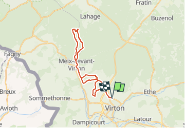
Randonnée V.T.T. de 23 km à découvrir à Wallonie, Luxembourg, Virton. Cette randonnée est proposée par Pascal L.

Description

Départ/Retour: Virton (Val d'Away)
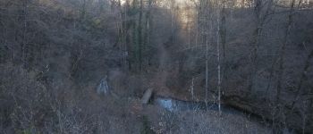
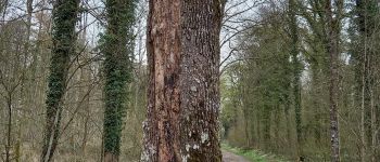
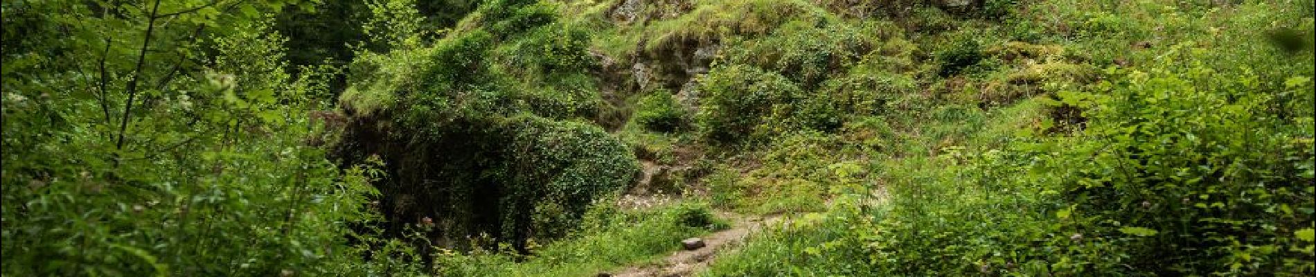
Endroits de passage: Belle Vue, Robelmont, la Poncette, la Cawette, Meix-devant-Virton et son bois, Ruisseau la Chevratte, Haut du Wâ, la Cranière, le rocher "Gros Cron", voie de chemin de fer, Berchiwé, la Hallebarde, Houdrigny

Ref.
- https://walloniebelgiquetourisme.be/fr-be/content/le-gros-cron-une-formation-rocheuse-impressionnante
- https://www.luxembourg-belge.be/diffusio/fr/voir-faire/visiter/patrimoine-naturel/lahage/le-gros-cron-a-lahage_TFO12309.php
- http://biodiversite.wallonie.be/fr/1240-gros-cron-de-lahage.html?IDD=251660576&highlighttext=Gros Cron de Lahage &IDC=1881

(2021.02.21)

Profil altimétrique

Photos

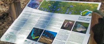
48 photos au total. Cliquez sur une photo pour les afficher toutes dans la galerie.

Points d'intérêt

Point d'intérêt Tintigny - Gros Cron à Lahage - Photo
Pascal L
Point d'intérêt Virton - La Vierge Jacques - Photo
Pascal L
Point d'intérêt Meix-devant-Virton - La Ferme de Rosière à Houdrigny - Photo
Pascal L
Point d'intérêt Meix-devant-Virton - Réserve naturelle de La Cawette - Photo
Pascal L

Localisation

Pays :
Belgique
Région :
Wallonie
Département/Province :
Luxembourg
Commune :
Virton
Localité :
Virton
Départ:(UTM)
682893 ; 5494558 (31U) N.

Randonnées à proximité

Randonnée Marche Virton - RB-Lu-17_Ethe_via-var-1-et-2-et-3 - Photo
Marche
PRO

Marche

Très facile
(3)
Virton, Wallonie, Luxembourg, Belgique
29 km | 35 km-effort
7h 33min
Oui
Randonnée V.T.T. Virton - Autour de Ethe  -  Balade_VTT_20kms - Photo
V.T.T.
Pascal L

V.T.T.

Facile
(1)
Virton, Wallonie, Luxembourg, Belgique
21 km | 26 km-effort
1h 40min
Oui
Randonnée Marche Virton - GAUME Balade  naturelle et historique - Photo
Marche
julucasi

Marche

Très facile
(1)
Virton, Wallonie, Luxembourg, Belgique
5,2 km | 6,8 km-effort
1h 16min
Oui
Randonnée A pied Virton - La Bajocienne - Photo
A pied
GUIDE+

A pied

Facile
(1)
Virton, Wallonie, Luxembourg, Belgique
11 km | 14,5 km-effort
3h 17min
Oui
Randonnée Marche Virton - RB-Lu-17_Ethe_via-racc - Photo
Marche
PRO

Marche

Très facile
Virton, Wallonie, Luxembourg, Belgique
15,6 km | 19,3 km-effort
4h 8min
Oui
Randonnée Marche Virton - RB-Lu-17_Ethe - Photo
Marche
PRO

Marche

Très facile
Virton, Wallonie, Luxembourg, Belgique
22 km | 28 km-effort
5h 55min
Oui
Randonnée V.T.T. Virton - Autour de Tintigny  -  Balade_VTT_54Kms - Photo
V.T.T.
Pascal L

V.T.T.

Très difficile
Virton, Wallonie, Luxembourg, Belgique
54 km | 64 km-effort
4h 25min
Oui
Randonnée V.T.T. Virton - Monquintin  -  Balade_VTT_22Kms - Photo
V.T.T.
Pascal L

V.T.T.

Moyen
Virton, Wallonie, Luxembourg, Belgique
22 km | 26 km-effort
1h 48min
Oui
Randonnée V.T.T. Virton - Orval  -  Balade_VTT_50Kms - Photo
V.T.T.
Pascal L

V.T.T.

Très difficile
Virton, Wallonie, Luxembourg, Belgique
50 km | 61 km-effort
4h 15min
Non


Fermer
Mes abonnements