![](/images/other/stat-length.png)
#190823 - Promenade des Hougardiers***
Randos Ouvertes
Utilisateur
![Longueur](/images/other/stat-length.png)
![Altitude max](https://static1.geolcdn.com/siteimages/upload/files/1508320355ic_sort_altitude_max_24dp.png)
![Dénivelé positif](https://static1.geolcdn.com/siteimages/upload/files/1508320355ic_sort_den_pos_24dp.png)
![Km-Effort](/images/other/stat-length.png)
![Altitude min](https://static1.geolcdn.com/siteimages/upload/files/1508320355ic_sort_altitude_min_24dp.png)
![Dénivelé négatif](https://static1.geolcdn.com/siteimages/upload/files/1508320355ic_sort_den_neg_24dp.png)
![Boucle](https://static1.geolcdn.com/siteimages/upload/files/16400158638029165_repeat_loop_refresh_sync_direction_icon.png)
![Marche](https://static1.geolcdn.com/sitytour/trail-icons/101.png)
2h02
Difficulté : Moyen
![Scannez ce code QR pour ouvrir la randonnée dans l'application SityTrail](https://capi.geolives.com/qq0zvz2zws4bq2lad0pu/sitytour/trails/2908181/qr.png?size=200)
Application GPS de randonnée GRATUITE
À propos
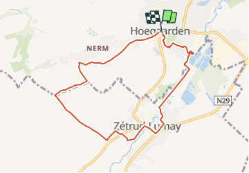
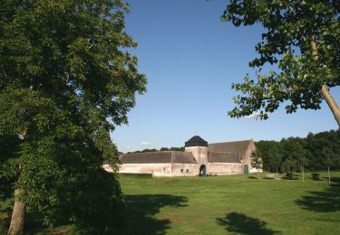
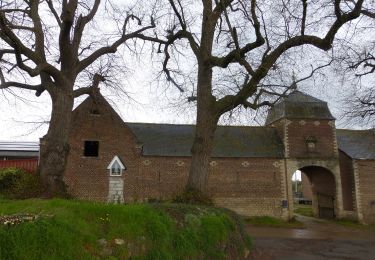
Randonnée Marche de 7,8 km à découvrir à Flandre, Brabant flamand, Hougaerde. Cette randonnée est proposée par Randos Ouvertes.
Description
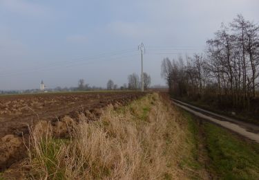
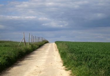
Très belle marche au départ d'une belle ville du Brabant Flamand.
Parcours basé en partie sur Promenade des Hougardiers.
Suppression de deux parties sans grand intérêt.
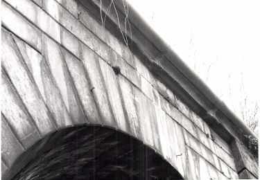
Assez bien de routes, mais très beua cadre et belles maisons à voir.
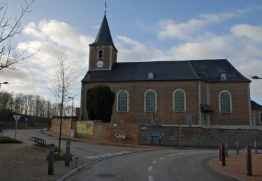
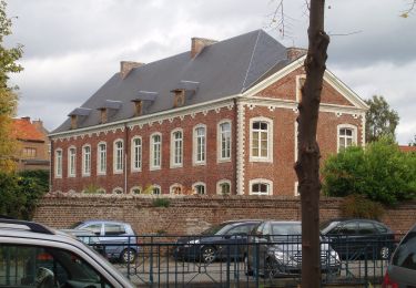
À Hoegaarden**** très belles construction historiques au centre ville.
Localisation
Commentaires
Randonnées à proximité
![Randonnée Marche Hougaerde - Meldert - Photo](https://media.geolcdn.com/t/375/260/31b1a0a0-1852-490a-917d-83e16fb1a5a8.jpg&format=jpg&maxdim=2)
![Marche Marche](https://static1.geolcdn.com/sitytour/trail-icons/101.png)
Marche
![](/images/other/stat-length.png)
![](https://static1.geolcdn.com/siteimages/upload/files/16400158638029165_repeat_loop_refresh_sync_direction_icon.png)
![Randonnée A pied Tirlemont - Orbeccawandeling Kort - Photo](https://media.geolcdn.com/t/375/260/e812d299-df6e-4ffd-bbb0-c17a49cbfa6d.jpeg&format=jpg&maxdim=2)
![A pied A pied](https://static1.geolcdn.com/sitytour/trail-icons/100.png)
A pied
![](/images/other/stat-length.png)
![](https://static1.geolcdn.com/siteimages/upload/files/16400158638029165_repeat_loop_refresh_sync_direction_icon.png)
![Randonnée A pied Tirlemont - Historische stadswandeling lange versie - Photo](https://media.geolcdn.com/t/375/260/880c2351-9a43-4116-b784-ff3c5f0a5c77.jpeg&format=jpg&maxdim=2)
![A pied A pied](https://static1.geolcdn.com/sitytour/trail-icons/100.png)
A pied
![](/images/other/stat-length.png)
![](https://static1.geolcdn.com/siteimages/upload/files/16400158638029165_repeat_loop_refresh_sync_direction_icon.png)
![Randonnée A pied Tirlemont - Historische stadswandeling korte versie - Photo](https://media.geolcdn.com/t/375/260/88b016db-5db9-4642-9498-4fbb5c5b2028.jpeg&format=jpg&maxdim=2)
![A pied A pied](https://static1.geolcdn.com/sitytour/trail-icons/100.png)
A pied
![](/images/other/stat-length.png)
![](https://static1.geolcdn.com/siteimages/upload/files/16400158638029165_repeat_loop_refresh_sync_direction_icon.png)
![Randonnée A pied Jodoigne - Promenade des Hougardiers - Photo](https://media.geolcdn.com/t/375/260/1071dc8c-34bb-425f-a7cf-e1b285bff63f.jpeg&format=jpg&maxdim=2)
![A pied A pied](https://static1.geolcdn.com/sitytour/trail-icons/100.png)
A pied
![](/images/other/stat-length.png)
![](https://static1.geolcdn.com/siteimages/upload/files/16400158638029165_repeat_loop_refresh_sync_direction_icon.png)
![Randonnée A pied Jodoigne - Promenade de Bon Secours - Photo](https://media.geolcdn.com/t/375/260/ec9ec11a-6d77-4c0b-aac1-93a6a5470637.jpeg&format=jpg&maxdim=2)
![A pied A pied](https://static1.geolcdn.com/sitytour/trail-icons/100.png)
A pied
![](/images/other/stat-length.png)
![](https://static1.geolcdn.com/siteimages/upload/files/16400158638029165_repeat_loop_refresh_sync_direction_icon.png)
![Randonnée A pied Beauvechain - Promenade de Sclûse - Photo](https://media.geolcdn.com/t/375/260/c1929032-f640-4516-9c4c-d087908ff1e2.jpeg&format=jpg&maxdim=2)
![A pied A pied](https://static1.geolcdn.com/sitytour/trail-icons/100.png)
A pied
![](/images/other/stat-length.png)
![](https://static1.geolcdn.com/siteimages/upload/files/16400158638029165_repeat_loop_refresh_sync_direction_icon.png)
![Randonnée A pied Hougaerde - Mene- en Jordaanwandeling - Photo](https://media.geolcdn.com/t/375/260/758c5d97-4085-4265-85c9-f07729efccc1.jpeg&format=jpg&maxdim=2)
![A pied A pied](https://static1.geolcdn.com/sitytour/trail-icons/100.png)
A pied
![](/images/other/stat-length.png)
![](https://static1.geolcdn.com/siteimages/upload/files/16400158638029165_repeat_loop_refresh_sync_direction_icon.png)
![Randonnée A pied Hougaerde - Dorps- en Kapellenwandeling - Photo](https://media.geolcdn.com/t/375/260/233912c1-8e5e-4a86-a9ad-b7484bc407f1.jpeg&format=jpg&maxdim=2)
![A pied A pied](https://static1.geolcdn.com/sitytour/trail-icons/100.png)
A pied
![](/images/other/stat-length.png)
![](https://static1.geolcdn.com/siteimages/upload/files/16400158638029165_repeat_loop_refresh_sync_direction_icon.png)