![](/images/other/stat-length.png)
![Randonnée Marche Mornant - Mornant-Lac de la Madone à St Sorlin - Photo](https://media.geolcdn.com/t/1900/400/a7fe3626-6640-4450-bfe5-8d72b58566d1.jpg&format=pjpeg&maxdim=2)
Mornant-Lac de la Madone à St Sorlin
Sigmut
Utilisateur
![Longueur](/images/other/stat-length.png)
Longueur
7,3 km
![Altitude max](https://static1.geolcdn.com/siteimages/upload/files/1508320355ic_sort_altitude_max_24dp.png)
Altitude max
493 m
![Dénivelé positif](https://static1.geolcdn.com/siteimages/upload/files/1508320355ic_sort_den_pos_24dp.png)
Dénivelé positif
167 m
![Km-Effort](/images/other/stat-length.png)
Km-Effort
9,5 km
![Altitude min](https://static1.geolcdn.com/siteimages/upload/files/1508320355ic_sort_altitude_min_24dp.png)
Altitude min
385 m
![Dénivelé négatif](https://static1.geolcdn.com/siteimages/upload/files/1508320355ic_sort_den_neg_24dp.png)
Dénivelé négatif
166 m
![Boucle](https://static1.geolcdn.com/siteimages/upload/files/16400158638029165_repeat_loop_refresh_sync_direction_icon.png)
Boucle
Oui
Date de création :
2021-08-18 13:20:59.8
Dernière modification :
2023-01-21 23:04:02.5
![Marche](https://static1.geolcdn.com/sitytour/trail-icons/101.png)
1h28
Difficulté : Moyen
![Scannez ce code QR pour ouvrir la randonnée dans l'application SityTrail](https://capi.geolives.com/qq0zvz2zws4bq2lad0pu/sitytour/trails/2903570/qr.png?size=200)
Application GPS de randonnée GRATUITE
À propos
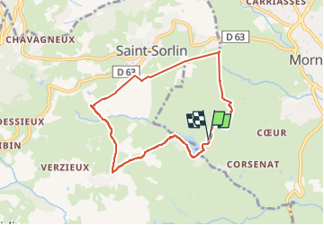
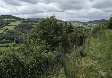
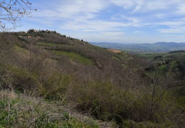
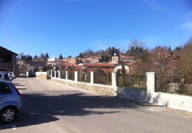
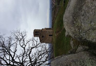
Randonnée Marche de 7,3 km à découvrir à Auvergne-Rhône-Alpes, Rhône, Mornant. Cette randonnée est proposée par Sigmut.
Description
Promenade sympathique faite avec des enfants de 4 et 6 ans.
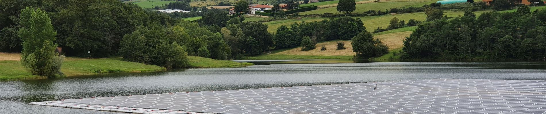
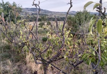
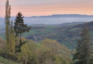
Localisation
Pays :
France
Région :
Auvergne-Rhône-Alpes
Département/Province :
Rhône
Commune :
Mornant
Localité :
Unknown
Départ:(Dec)
Départ:(UTM)
628666 ; 5051887 (31T) N.
Commentaires
Randonnées à proximité
![Randonnée Marche Chabanière - 69-st-maurice-dargoire2-19km-580m - Photo](https://media.geolcdn.com/t/375/260/c4b20fd4-ad58-4836-9971-2020b70efe6f.jpg&format=jpg&maxdim=2)
![Marche Marche](https://static1.geolcdn.com/sitytour/trail-icons/101.png)
69-st-maurice-dargoire2-19km-580m
Marche
Difficile
Chabanière,
Auvergne-Rhône-Alpes,
Rhône,
France
![](/images/other/stat-length.png)
19,2 km | 27 km-effort
5h 47min
![](https://static1.geolcdn.com/siteimages/upload/files/16400158638029165_repeat_loop_refresh_sync_direction_icon.png)
Oui
![Randonnée Marche Chabanière - 69_st_maurice_dargeoire_12km_300m - Photo](https://media.geolcdn.com/t/375/260/83f5b7e0-e7a1-44e9-9c6c-d04e1b215358.jpg&format=jpg&maxdim=2)
![Marche Marche](https://static1.geolcdn.com/sitytour/trail-icons/101.png)
69_st_maurice_dargeoire_12km_300m
Marche
Moyen
Chabanière,
Auvergne-Rhône-Alpes,
Rhône,
France
![](/images/other/stat-length.png)
11,6 km | 15,5 km-effort
3h 31min
![](https://static1.geolcdn.com/siteimages/upload/files/16400158638029165_repeat_loop_refresh_sync_direction_icon.png)
Oui
![Randonnée Marche Riverie - Riverie - Tour au dessus de Riverie - Photo](https://media.geolcdn.com/t/375/260/f386fa9b-109a-4f00-b8bc-6419b37fffdc.jpg&format=jpg&maxdim=2)
![Marche Marche](https://static1.geolcdn.com/sitytour/trail-icons/101.png)
Riverie - Tour au dessus de Riverie
Marche
Moyen
Riverie,
Auvergne-Rhône-Alpes,
Rhône,
France
![](/images/other/stat-length.png)
5,7 km | 7,8 km-effort
2h 4min
![](https://static1.geolcdn.com/siteimages/upload/files/16400158638029165_repeat_loop_refresh_sync_direction_icon.png)
Oui
![Randonnée Marche Saint-André-la-Côte - 69-st-andre-la cote-mattiole-20km-640m-mai22 - Photo](https://media.geolcdn.com/t/375/260/7a464e9e-07ad-49d2-9fc0-eab7bce1d3e5.jpg&format=jpg&maxdim=2)
![Marche Marche](https://static1.geolcdn.com/sitytour/trail-icons/101.png)
69-st-andre-la cote-mattiole-20km-640m-mai22
Marche
Moyen
Saint-André-la-Côte,
Auvergne-Rhône-Alpes,
Rhône,
France
![](/images/other/stat-length.png)
20 km | 29 km-effort
5h 56min
![](https://static1.geolcdn.com/siteimages/upload/files/16400158638029165_repeat_loop_refresh_sync_direction_icon.png)
Oui
![Randonnée Marche Saint-André-la-Côte - 69-St-andre-la-cote-Ste-catherine-14km-453m - Photo](https://media.geolcdn.com/t/375/260/06cb0992-8e16-4e77-b851-837722622855.jpg&format=jpg&maxdim=2)
![Marche Marche](https://static1.geolcdn.com/sitytour/trail-icons/101.png)
69-St-andre-la-cote-Ste-catherine-14km-453m
Marche
Moyen
Saint-André-la-Côte,
Auvergne-Rhône-Alpes,
Rhône,
France
![](/images/other/stat-length.png)
14,2 km | 20 km-effort
3h 48min
![](https://static1.geolcdn.com/siteimages/upload/files/16400158638029165_repeat_loop_refresh_sync_direction_icon.png)
Oui
![Randonnée Marche Riverie - Tour de Riverie - Photo](https://media.geolcdn.com/t/375/260/921cac9b-3a26-4e9e-996b-090d375df192.jpg&format=jpg&maxdim=2)
![Marche Marche](https://static1.geolcdn.com/sitytour/trail-icons/101.png)
Tour de Riverie
Marche
Très facile
Riverie,
Auvergne-Rhône-Alpes,
Rhône,
France
![](/images/other/stat-length.png)
5,5 km | 8,2 km-effort
3h 1min
![](https://static1.geolcdn.com/siteimages/upload/files/16400158638029165_repeat_loop_refresh_sync_direction_icon.png)
Oui
![Randonnée Marche Riverie - De Riverie à Sainte Catherine - Photo](https://media.geolcdn.com/t/375/260/c7a98120-57a9-4a3e-a51c-d75d0931a5ce.jpg&format=jpg&maxdim=2)
![Marche Marche](https://static1.geolcdn.com/sitytour/trail-icons/101.png)
De Riverie à Sainte Catherine
Marche
Facile
Riverie,
Auvergne-Rhône-Alpes,
Rhône,
France
![](/images/other/stat-length.png)
6,3 km | 9,2 km-effort
4h 5min
![](https://static1.geolcdn.com/siteimages/upload/files/16400158638029165_repeat_loop_refresh_sync_direction_icon.png)
Oui
![Randonnée Marche Saint-André-la-Côte - tour du signal de St-André - Photo](https://media.geolcdn.com/t/375/260/ext.jpg?maxdim=2&url=https%3A%2F%2Fservices.sitytrail.com%2FGeolivesWS%2FDownloadMedia.ashx%3FTrailID%3D257747%26Media%3D20140316141936.jpg)
![Marche Marche](https://static1.geolcdn.com/sitytour/trail-icons/101.png)
tour du signal de St-André
Marche
Facile
Saint-André-la-Côte,
Auvergne-Rhône-Alpes,
Rhône,
France
![](/images/other/stat-length.png)
9,8 km | 13,9 km-effort
2h 57min
![](https://static1.geolcdn.com/siteimages/upload/files/16400158638029165_repeat_loop_refresh_sync_direction_icon.png)
Oui
![Randonnée Autre activité Saint-Laurent-d'Agny - st Laurent d agny - Photo](https://media.geolcdn.com/t/375/260/ext.jpg?maxdim=2&url=https%3A%2F%2Fservices.sitytrail.com%2FGeolivesWS%2FDownloadMedia.ashx%3FTrailID%3D170804%26Media%3D20130120155655.jpeg)
![Autre activité Autre activité](https://static1.geolcdn.com/sitytour/trail-icons/900.png)
st Laurent d agny
Autre activité
Très facile
Saint-Laurent-d'Agny,
Auvergne-Rhône-Alpes,
Rhône,
France
![](/images/other/stat-length.png)
7,8 km | 9,8 km-effort
2h 6min
![](https://static1.geolcdn.com/siteimages/upload/files/16400158638029165_repeat_loop_refresh_sync_direction_icon.png)
Oui