

PC11-Circuit de creyssens-LE BOULVE

alain2306
Utilisateur

Longueur
7,2 km

Altitude max
274 m

Dénivelé positif
177 m

Km-Effort
9,5 km

Altitude min
149 m

Dénivelé négatif
178 m
Boucle
Oui
Date de création :
2021-08-15 08:26:27.678
Dernière modification :
2021-08-16 07:27:39.219
2h09
Difficulté : Moyen

Application GPS de randonnée GRATUITE
À propos
Randonnée Marche de 7,2 km à découvrir à Occitanie, Lot, Porte-du-Quercy. Cette randonnée est proposée par alain2306.
Description
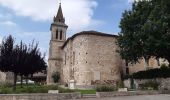
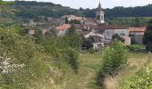
Départ au coeur d’une vallée fertile, le circuit vous offrira un
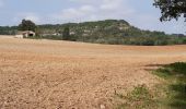
étonnant contraste de couleurs - entre terres
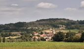
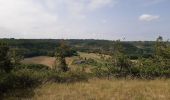
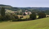
rouges et calcaires du Quercy Blanc -, puis une vue remarquable sur un large panorama.
Localisation
Pays :
France
Région :
Occitanie
Département/Province :
Lot
Commune :
Porte-du-Quercy
Localité :
Unknown
Départ:(Dec)
Départ:(UTM)
352491 ; 4920183 (31T) N.
Commentaires
Randonnées à proximité
De Sérignac à Bonnemaison


V.T.T.
Difficile
Sérignac,
Occitanie,
Lot,
France

36 km | 45 km-effort
2h 45min
Oui
Belaye Grezel


Marche
Très facile
Bélaye,
Occitanie,
Lot,
France

13,9 km | 17,1 km-effort
2h 56min
Oui
Boucle VTT de Bovila à Bagat en Quercy - Saint Matré


V.T.T.
Difficile
Porte-du-Quercy,
Occitanie,
Lot,
France

35 km | 42 km-effort
2h 30min
Oui

boulve 1


Marche
Difficile
Porte-du-Quercy,
Occitanie,
Lot,
France

11,8 km | 15,9 km-effort
3h 5min
Oui


Floressas belaye grezel


sport
Très facile
Floressas,
Occitanie,
Lot,
France

23 km | 30 km-effort
Inconnu
Oui

Etape 4 - Le Boulve / Saint Cyprien


Randonnée équestre
Moyen
Porte-du-Quercy,
Occitanie,
Lot,
France

24 km | 30 km-effort
3h 59min
Non

Petits ruisseaux et Grandes Vignes


Marche
Difficile
Porte-du-Quercy,
Occitanie,
Lot,
France

11,2 km | 13,7 km-effort
3h 6min
Oui


 SityTrail


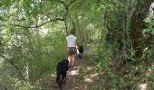
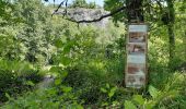
entre hauteurs avec panoramas et chemin ombragé rando à fzire toute l'année.