![](/images/other/stat-length.png)
![Randonnée Annecy - 2021-08-13_21h17m29_Cirkwi-Marais_de_Lesse_et_Mathonex_à_Vieugy - Photo](https://media.geolcdn.com/t/1900/400/ext.pjpeg?maxdim=2&url=https%3A%2F%2Fsecurestorage.geolives.com%2Fsitytour%2Ftrail-bg%2Fdefault.jpg)
2021-08-13_21h17m29_Cirkwi-Marais_de_Lesse_et_Mathonex_à_Vieugy
Ladyclairdelune74
Utilisateur
![Longueur](/images/other/stat-length.png)
![Altitude max](https://static1.geolcdn.com/siteimages/upload/files/1508320355ic_sort_altitude_max_24dp.png)
![Dénivelé positif](https://static1.geolcdn.com/siteimages/upload/files/1508320355ic_sort_den_pos_24dp.png)
![Km-Effort](/images/other/stat-length.png)
![Altitude min](https://static1.geolcdn.com/siteimages/upload/files/1508320355ic_sort_altitude_min_24dp.png)
![Dénivelé négatif](https://static1.geolcdn.com/siteimages/upload/files/1508320355ic_sort_den_neg_24dp.png)
![Boucle](https://static1.geolcdn.com/siteimages/upload/files/16400158638029165_repeat_loop_refresh_sync_direction_icon.png)
![Scannez ce code QR pour ouvrir la randonnée dans l'application SityTrail](https://capi.geolives.com/qq0zvz2zws4bq2lad0pu/sitytour/trails/2897034/qr.png?size=200)
Application GPS de randonnée GRATUITE
À propos
Randonnée de 6,3 km à découvrir à Auvergne-Rhône-Alpes, Haute-Savoie, Annecy. Cette randonnée est proposée par Ladyclairdelune74.
Description
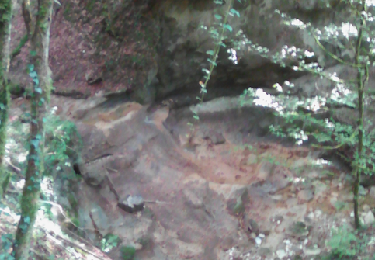
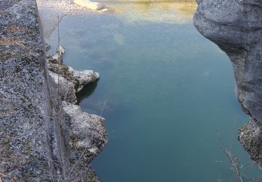
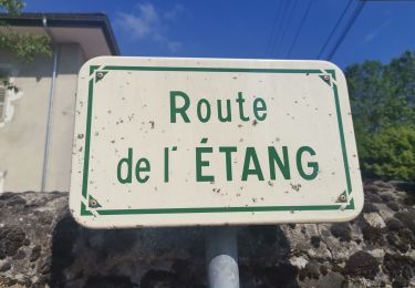
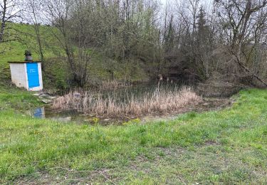
Cette balade familiale et champêtre, au départ de la place de l'église de Vieugy, permet de découvrir la biodiversité des marais de Lesse et Mathonex.Ces espaces naturels protégés abritent de nombreuses espèces d'animaux et surtout de remarquables insectes : papillons et libellules. Au fil des saisons vous pourrez contempler une grande variété de plantes : des orchidées, la jolie parnassie des marais, le populage des marais ou encore des trèfles d'eau. Actuellement c'est l'association Asters (Conservatoire des espaces naturels Haute Savoie) qui s'occupe de la préservation de ces zones humides. Idéal au printemps, en été ou en automne, ce chemin paisible est praticable aux randonneurs, aux VTTistes et aux cavaliers. Le point de départ de cette randonnée est accessible en transport en commun depuis le centre d'Annecy. Idéale pour des familles, le sentier alterne entre forêt, prairie et villages pittoresques !
Localisation
Commentaires
Randonnées à proximité
![Randonnée Marche Chavanod - CHAVANOD - Photo](https://media.geolcdn.com/t/375/260/ext.jpg?maxdim=2&url=https%3A%2F%2Fservices.sitytrail.com%2FGeolivesWS%2FDownloadMedia.ashx%3FTrailID%3D642834%26Media%3Dcf99f68d-cd6d-4093-a6f9-aa7a1c09564a.png)
![Marche Marche](https://static1.geolcdn.com/sitytour/trail-icons/101.png)
Marche
![](/images/other/stat-length.png)
![](https://static1.geolcdn.com/siteimages/upload/files/16400158638029165_repeat_loop_refresh_sync_direction_icon.png)
![Randonnée Marche Lovagny - 28/02/2022 - Gorges du Fier - Nonglard - Lovagny - Chavanod - Photo](https://media.geolcdn.com/t/375/260/03500606-e21f-4d38-a3f6-549dc5117f26.jpg&format=jpg&maxdim=2)
![Marche Marche](https://static1.geolcdn.com/sitytour/trail-icons/101.png)
Marche
![](/images/other/stat-length.png)
![](https://static1.geolcdn.com/siteimages/upload/files/16400158638029165_repeat_loop_refresh_sync_direction_icon.png)
![Randonnée V.T.T. Annecy - semnoz 31 8 10 - Photo](https://media.geolcdn.com/t/375/260/ext.jpg?maxdim=2&url=https%3A%2F%2Fstatic1.geolcdn.com%2Fsiteimages%2Fupload%2Ffiles%2F1524743154velo.jpg)
![V.T.T. V.T.T.](https://static1.geolcdn.com/sitytour/trail-icons/202.png)
V.T.T.
![](/images/other/stat-length.png)
![](https://static1.geolcdn.com/siteimages/upload/files/16400158638029165_repeat_loop_refresh_sync_direction_icon.png)
![Randonnée Marche Chavanod - CHAVANOD ... vers Montagny-les-Lanches. - Photo](https://media.geolcdn.com/t/375/260/9cf02be8-0d43-4c97-a143-e34f6de46c37.jpg&format=jpg&maxdim=2)
![Marche Marche](https://static1.geolcdn.com/sitytour/trail-icons/101.png)
Marche
![](/images/other/stat-length.png)
![](https://static1.geolcdn.com/siteimages/upload/files/16400158638029165_repeat_loop_refresh_sync_direction_icon.png)
![Randonnée V.T.C. Annecy - ANNECY ... le Tour du lac à vélo. - Photo](https://media.geolcdn.com/t/375/260/64c38e9e-432d-4f1e-a098-d3a526529324.jpg&format=jpg&maxdim=2)
![V.T.C. V.T.C.](https://static1.geolcdn.com/sitytour/trail-icons/203.png)
V.T.C.
![](/images/other/stat-length.png)
![](https://static1.geolcdn.com/siteimages/upload/files/16400158638029165_repeat_loop_refresh_sync_direction_icon.png)
![Randonnée Marche Annecy - ANNECY ... le sentier des crêtes. - Photo](https://media.geolcdn.com/t/375/260/954e85ce-e790-4ec1-8a5b-52762288e410.jpg&format=jpg&maxdim=2)
![Marche Marche](https://static1.geolcdn.com/sitytour/trail-icons/101.png)
Marche
![](/images/other/stat-length.png)
![](https://static1.geolcdn.com/siteimages/upload/files/16400158638029165_repeat_loop_refresh_sync_direction_icon.png)
![Randonnée Marche Chavanod - CHAVANOD ... les Gorges du Fier. - Photo](https://media.geolcdn.com/t/375/260/b76880dc-3a6b-4b5d-9dee-7a400ed01ca2.jpg&format=jpg&maxdim=2)
![Marche Marche](https://static1.geolcdn.com/sitytour/trail-icons/101.png)
Marche
![](/images/other/stat-length.png)
![](https://static1.geolcdn.com/siteimages/upload/files/16400158638029165_repeat_loop_refresh_sync_direction_icon.png)
![Randonnée sport Lovagny - 20230411 RANDONNÉE LOVAGNY - Photo](https://media.geolcdn.com/t/375/260/db936043-ccfb-4d87-a656-a3bf3f515ba1.jpg&format=jpg&maxdim=2)
sport
![](/images/other/stat-length.png)
![](https://static1.geolcdn.com/siteimages/upload/files/16400158638029165_repeat_loop_refresh_sync_direction_icon.png)
![Randonnée Marche Annecy - A la découverte des Chalets de Barbenoire - Photo](https://media.geolcdn.com/t/375/260/d0978fe0-ad4b-4c05-8492-a52fbc7885e5.jpg&format=jpg&maxdim=2)
![Marche Marche](https://static1.geolcdn.com/sitytour/trail-icons/101.png)
Marche
![](/images/other/stat-length.png)
![](https://static1.geolcdn.com/siteimages/upload/files/16400158638029165_repeat_loop_refresh_sync_direction_icon.png)