![](/images/other/stat-length.png)
![Randonnée Marche Montmirat - montmirat-Chapelle-grottes - Photo](https://media.geolcdn.com/t/1900/400/5531c745-da57-4442-bc46-e7fc789fd541.jpg&format=pjpeg&maxdim=2)
montmirat-Chapelle-grottes
v.rabot
Utilisateur
![Longueur](/images/other/stat-length.png)
![Altitude max](https://static1.geolcdn.com/siteimages/upload/files/1508320355ic_sort_altitude_max_24dp.png)
![Dénivelé positif](https://static1.geolcdn.com/siteimages/upload/files/1508320355ic_sort_den_pos_24dp.png)
![Km-Effort](/images/other/stat-length.png)
![Altitude min](https://static1.geolcdn.com/siteimages/upload/files/1508320355ic_sort_altitude_min_24dp.png)
![Dénivelé négatif](https://static1.geolcdn.com/siteimages/upload/files/1508320355ic_sort_den_neg_24dp.png)
![Boucle](https://static1.geolcdn.com/siteimages/upload/files/16400158638029165_repeat_loop_refresh_sync_direction_icon.png)
![Marche](https://static1.geolcdn.com/sitytour/trail-icons/101.png)
6h08
Difficulté : Très difficile
![Scannez ce code QR pour ouvrir la randonnée dans l'application SityTrail](https://capi.geolives.com/qq0zvz2zws4bq2lad0pu/sitytour/trails/2896491/qr.png?size=200)
Application GPS de randonnée GRATUITE
À propos
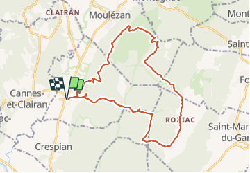
Randonnée Marche de 19,8 km à découvrir à Occitanie, Gard, Montmirat. Cette randonnée est proposée par v.rabot.
Description
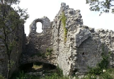
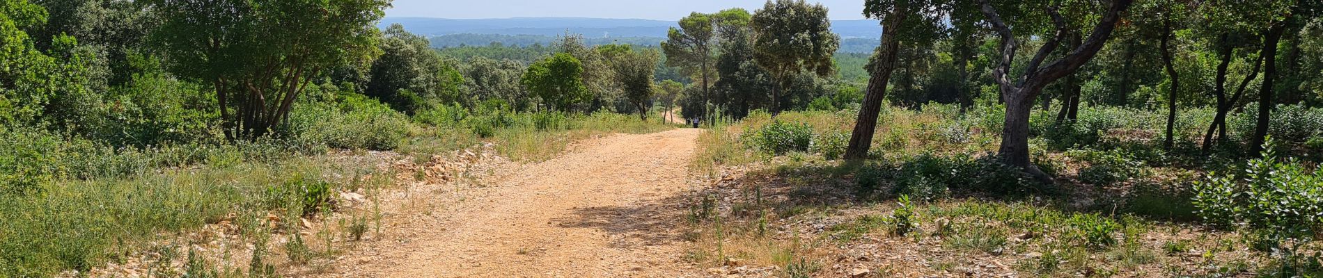
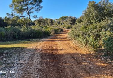
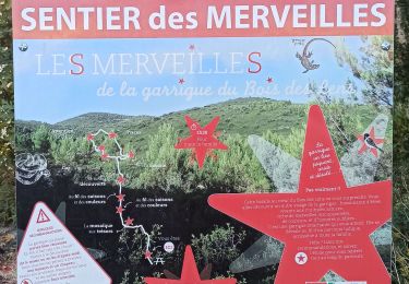
Partant de Montmirat, ce circut commence par une montée jusqu'à la ruine de la Chapelle, après elle alterne montée et descente au sein de la garrigue mais sans magnifiques paysages, c'est cependant une belle randonnée qui peut être réalisé en 6 heures, elle est déconseillée par forte chaleur même si on trouve des zones d'ombres assez importantes.Après un période de pluie, elle sera plus agréable si les ruisseaux coulent. S'il fait chaud, avec un départ à 8h00, vous êtes entre 12h et 13h aux grottes et l'entrée de la première permet de déjeuner au frais. (A éviter absolument le layon tout droit qui est parrallèle au chemin venant du coin Sud et légérement avant, Voir photo aérienne, progression difficile)
Localisation
Commentaires
Randonnées à proximité
![Randonnée Marche Orthoux-Sérignac-Quilhan - Sérignac - les Mazes - Bragassargues - Photo](https://media.geolcdn.com/t/375/260/ext.jpg?maxdim=2&url=https%3A%2F%2Fstatic1.geolcdn.com%2Fsiteimages%2Fupload%2Ffiles%2F1553511878bg_sport_marche.png)
![Marche Marche](https://static1.geolcdn.com/sitytour/trail-icons/101.png)
Marche
![](/images/other/stat-length.png)
![](https://static1.geolcdn.com/siteimages/upload/files/16400158638029165_repeat_loop_refresh_sync_direction_icon.png)
![Randonnée Marche Vic-le-Fesq - Viclefesc_ND_de_la_combe - Photo](https://media.geolcdn.com/t/375/260/255c5ac9-ddd4-4188-8efc-bd87460b25d5.jpg&format=jpg&maxdim=2)
![Marche Marche](https://static1.geolcdn.com/sitytour/trail-icons/101.png)
Marche
![](/images/other/stat-length.png)
![](https://static1.geolcdn.com/siteimages/upload/files/16400158638029165_repeat_loop_refresh_sync_direction_icon.png)
![Randonnée Marche Montmirat - Montmirat-les grottes - Photo](https://media.geolcdn.com/t/375/260/cb8675cb-cb9d-463f-8be5-40f2d8d5a71f.jpg&format=jpg&maxdim=2)
![Marche Marche](https://static1.geolcdn.com/sitytour/trail-icons/101.png)
Marche
![](/images/other/stat-length.png)
![](https://static1.geolcdn.com/siteimages/upload/files/16400158638029165_repeat_loop_refresh_sync_direction_icon.png)
![Randonnée Marche Combas - Combas - Photo](https://media.geolcdn.com/t/375/260/02dbc83b-be1c-4bf6-a717-854391d9e59e.jpg&format=jpg&maxdim=2)
![Marche Marche](https://static1.geolcdn.com/sitytour/trail-icons/101.png)
![Randonnée A pied Montmirat - Montmirat-2 - Photo](https://media.geolcdn.com/t/375/260/f40b731a-3854-4e2b-a239-008cef63a6a9.jpg&format=jpg&maxdim=2)
![A pied A pied](https://static1.geolcdn.com/sitytour/trail-icons/100.png)
![Randonnée Marche Vic-le-Fesq - Vic le Fesc Nd de prime Combe - Photo](https://media.geolcdn.com/t/375/260/840b12a4-b0cf-48bf-85ec-82d58c1dbfba.jpg&format=jpg&maxdim=2)
![Marche Marche](https://static1.geolcdn.com/sitytour/trail-icons/101.png)
Marche
![](/images/other/stat-length.png)
![](https://static1.geolcdn.com/siteimages/upload/files/16400158638029165_repeat_loop_refresh_sync_direction_icon.png)
![Randonnée Marche Vic-le-Fesq - 30 VIC-LE-FESQ - le VIDOURLE - LECQUES - FONTANES - ND de PRIME COMBE - Photo](https://media.geolcdn.com/t/375/260/ext.jpg?maxdim=2&url=https%3A%2F%2Fservices.sitytrail.com%2FGeolivesWS%2FDownloadMedia.ashx%3FTrailID%3D459675%26Media%3D20150816093235.jpg)
![Marche Marche](https://static1.geolcdn.com/sitytour/trail-icons/101.png)
Marche
![](/images/other/stat-length.png)
![](https://static1.geolcdn.com/siteimages/upload/files/16400158638029165_repeat_loop_refresh_sync_direction_icon.png)
![Randonnée Marche Vic-le-Fesq - Notre Dame de Prime Combe - Vic le Fesq - Photo](https://media.geolcdn.com/t/375/260/ext.jpg?maxdim=2&url=https%3A%2F%2Fservices.sitytrail.com%2FGeolivesWS%2FDownloadMedia.ashx%3FTrailID%3D318048%26Media%3D17518_6.jpg)
![Marche Marche](https://static1.geolcdn.com/sitytour/trail-icons/101.png)
Marche
![](/images/other/stat-length.png)
![](https://static1.geolcdn.com/siteimages/upload/files/16400158638029165_repeat_loop_refresh_sync_direction_icon.png)
![Randonnée Marche Montmirat - Montmirat - Photo](https://media.geolcdn.com/t/375/260/ext.jpg?maxdim=2&url=https%3A%2F%2Fservices.sitytrail.com%2FGeolivesWS%2FDownloadMedia.ashx%3FTrailID%3D217247%26Media%3Dfix__20130828123221.jpg)
![Marche Marche](https://static1.geolcdn.com/sitytour/trail-icons/101.png)