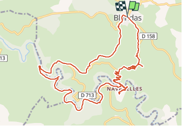
![](/images/other/stat-length.png)
![Randonnée Marche Blandas - Cirque de Navacelles par Blandas et le moulin du Foux - Photo](https://media.geolcdn.com/t/1900/400/b97baf26-0f4d-4413-9961-f420baa81139.jpg&format=pjpeg&maxdim=2)
Cirque de Navacelles par Blandas et le moulin du Foux
Bart2015
Utilisateur
![Longueur](/images/other/stat-length.png)
![Altitude max](https://static1.geolcdn.com/siteimages/upload/files/1508320355ic_sort_altitude_max_24dp.png)
![Dénivelé positif](https://static1.geolcdn.com/siteimages/upload/files/1508320355ic_sort_den_pos_24dp.png)
![Km-Effort](/images/other/stat-length.png)
![Altitude min](https://static1.geolcdn.com/siteimages/upload/files/1508320355ic_sort_altitude_min_24dp.png)
![Dénivelé négatif](https://static1.geolcdn.com/siteimages/upload/files/1508320355ic_sort_den_neg_24dp.png)
![Boucle](https://static1.geolcdn.com/siteimages/upload/files/16400158638029165_repeat_loop_refresh_sync_direction_icon.png)
![Marche](https://static1.geolcdn.com/sitytour/trail-icons/101.png)
5h16
Difficulté : Moyen
![Scannez ce code QR pour ouvrir la randonnée dans l'application SityTrail](https://capi.geolives.com/qq0zvz2zws4bq2lad0pu/sitytour/trails/2887895/qr.png?size=200)
Application GPS de randonnée GRATUITE
À propos
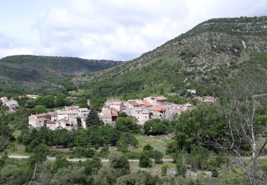
Randonnée Marche de 15,3 km à découvrir à Occitanie, Gard, Blandas. Cette randonnée est proposée par Bart2015.
Description
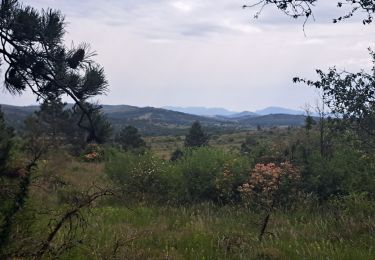
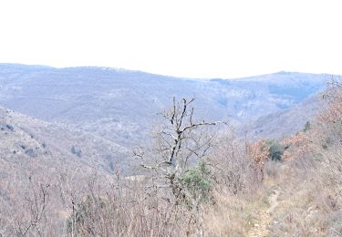
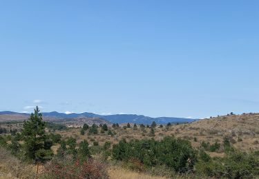
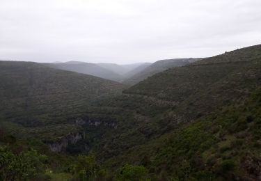
Le Cirque de Navacelles est impressionnant, c'est une merveille de la nature ! Le départ depuis Blandas permet d'avoir un magnifique panorama à l'aller et au retour. Prenez-en plein les yeux ...
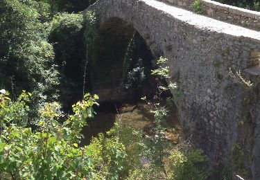
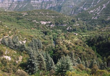
La randonnée vous emmène tout d'abord au moulin de la Foux construit il y a plus de 900 ans. Une merveille également. Ensuite vous remonterez la rivière de la Vis pour rejoindre Navacelles. Vous trouverez sûrement un endroit pour vous arrêter au bord de l'eau.
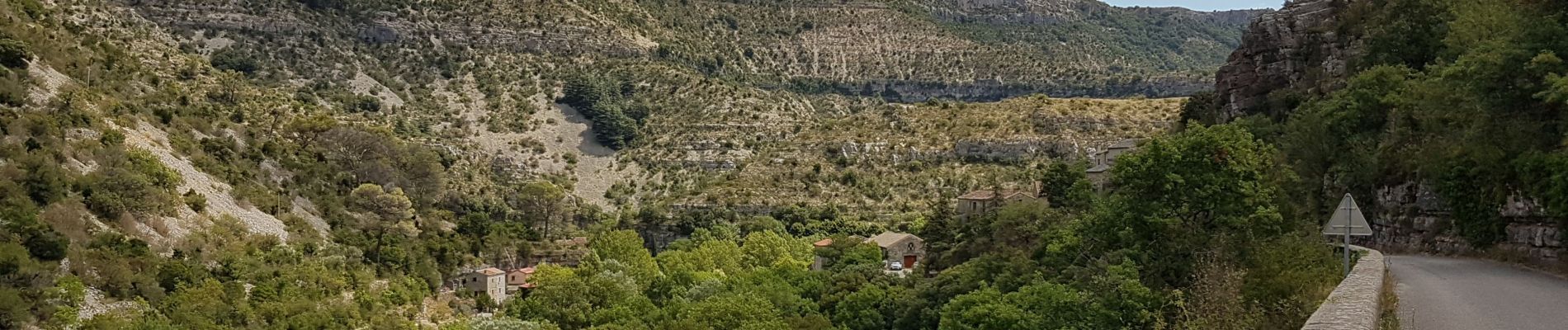
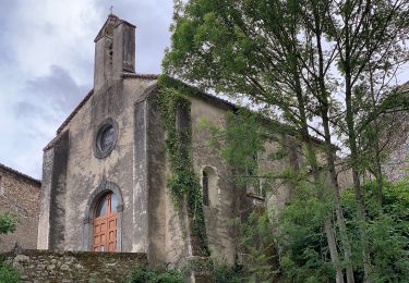
Le village de Navacelles est typique de la région, à découvrir sa cascade, le sentier de la vierge qui offre une belle vue, ...
Bonne randonnée ...
Localisation
Commentaires
Randonnées à proximité
![Randonnée Marche Saint-Maurice-Navacelles - cirque de Navacelles - Photo](https://media.geolcdn.com/t/375/260/ext.jpg?maxdim=2&url=https%3A%2F%2Fservices.sitytrail.com%2FGeolivesWS%2FDownloadMedia.ashx%3FTrailID%3D331316%26Media%3D20140805152414.jpg)
![Marche Marche](https://static1.geolcdn.com/sitytour/trail-icons/101.png)
Marche
![](/images/other/stat-length.png)
![](https://static1.geolcdn.com/siteimages/upload/files/16400158638029165_repeat_loop_refresh_sync_direction_icon.png)
![Randonnée Marche Vissec - sentier du Regagnas - Photo](https://media.geolcdn.com/t/375/260/da6617d7-2a0d-4d03-9eaa-131f37014f58.jpg&format=jpg&maxdim=2)
![Marche Marche](https://static1.geolcdn.com/sitytour/trail-icons/101.png)
Marche
![](/images/other/stat-length.png)
![](https://static1.geolcdn.com/siteimages/upload/files/16400158638029165_repeat_loop_refresh_sync_direction_icon.png)
![Randonnée A pied Saint-Maurice-Navacelles - Navacelles Vissec par le chemin du facteur - Photo](https://media.geolcdn.com/t/375/260/5eb51299-e303-4e2d-9d78-ac9fc254c62c.jpeg&format=jpg&maxdim=2)
![A pied A pied](https://static1.geolcdn.com/sitytour/trail-icons/100.png)
A pied
![](/images/other/stat-length.png)
![](https://static1.geolcdn.com/siteimages/upload/files/16400158638029165_repeat_loop_refresh_sync_direction_icon.png)
![Randonnée A pied Blandas - Randonnée Cirque de Navacelles - Causse de Blandas - Vissec - Moulin de la Foux - Photo](https://media.geolcdn.com/t/375/260/8ddb3d2c-f886-47a1-a994-79ae500f0ce8.jpeg&format=jpg&maxdim=2)
![A pied A pied](https://static1.geolcdn.com/sitytour/trail-icons/100.png)
A pied
![](/images/other/stat-length.png)
![](https://static1.geolcdn.com/siteimages/upload/files/16400158638029165_repeat_loop_refresh_sync_direction_icon.png)
![Randonnée Marche Blandas - Causse de Blandas et Vallée de la Vis - Photo](https://media.geolcdn.com/t/375/260/63d6e02c-c419-4b36-9d67-d9ec414c30bc.jpg&format=jpg&maxdim=2)
![Marche Marche](https://static1.geolcdn.com/sitytour/trail-icons/101.png)
Marche
![](/images/other/stat-length.png)
![](https://static1.geolcdn.com/siteimages/upload/files/16400158638029165_repeat_loop_refresh_sync_direction_icon.png)
![Randonnée Marche Blandas - Vissec / Moulin de la Foux - Photo](https://media.geolcdn.com/t/375/260/10a13c13-90e1-488e-8e53-bc3d65b1bc36.jpg&format=jpg&maxdim=2)
![Marche Marche](https://static1.geolcdn.com/sitytour/trail-icons/101.png)
Marche
![](/images/other/stat-length.png)
![](https://static1.geolcdn.com/siteimages/upload/files/16400158638029165_repeat_loop_refresh_sync_direction_icon.png)
![Randonnée Marche Blandas - Bois de calot rouge - Photo](https://media.geolcdn.com/t/375/260/a9a713a3-ac0f-45b3-9482-9c5a24bfa783.jpg&format=jpg&maxdim=2)
![Marche Marche](https://static1.geolcdn.com/sitytour/trail-icons/101.png)
Marche
![](/images/other/stat-length.png)
![](https://static1.geolcdn.com/siteimages/upload/files/16400158638029165_repeat_loop_refresh_sync_direction_icon.png)
![Randonnée Marche Blandas - Sentier du Belvédère de Blandas 2 - Photo](https://media.geolcdn.com/t/375/260/ext.jpg?maxdim=2&url=https%3A%2F%2Fstatic1.geolcdn.com%2Fsiteimages%2Fupload%2Ffiles%2F1553511878bg_sport_marche.png)
![Marche Marche](https://static1.geolcdn.com/sitytour/trail-icons/101.png)
Marche
![](/images/other/stat-length.png)
![](https://static1.geolcdn.com/siteimages/upload/files/16400158638029165_repeat_loop_refresh_sync_direction_icon.png)
![Randonnée Marche Blandas - Blandas - Photo](https://media.geolcdn.com/t/375/260/edaf02ae-e2d8-401e-a5bc-a8ab7a7adc3c.jpg&format=jpg&maxdim=2)
![Marche Marche](https://static1.geolcdn.com/sitytour/trail-icons/101.png)