![](/images/other/stat-length.png)
![Randonnée Marche Crozon - CROZON - Photo](https://media.geolcdn.com/t/1900/400/3a12ea89-5aab-4def-b477-812a0dc55992.jpg&format=pjpeg&maxdim=2)
CROZON
RonanDAGORN
Utilisateur
![Longueur](/images/other/stat-length.png)
Longueur
15,5 km
![Altitude max](https://static1.geolcdn.com/siteimages/upload/files/1508320355ic_sort_altitude_max_24dp.png)
Altitude max
101 m
![Dénivelé positif](https://static1.geolcdn.com/siteimages/upload/files/1508320355ic_sort_den_pos_24dp.png)
Dénivelé positif
424 m
![Km-Effort](/images/other/stat-length.png)
Km-Effort
21 km
![Altitude min](https://static1.geolcdn.com/siteimages/upload/files/1508320355ic_sort_altitude_min_24dp.png)
Altitude min
0 m
![Dénivelé négatif](https://static1.geolcdn.com/siteimages/upload/files/1508320355ic_sort_den_neg_24dp.png)
Dénivelé négatif
422 m
![Boucle](https://static1.geolcdn.com/siteimages/upload/files/16400158638029165_repeat_loop_refresh_sync_direction_icon.png)
Boucle
Oui
Date de création :
2021-07-25 11:32:17.122
Dernière modification :
2022-09-29 17:29:25.35
![Marche](https://static1.geolcdn.com/sitytour/trail-icons/101.png)
4h01
Difficulté : Moyen
![Scannez ce code QR pour ouvrir la randonnée dans l'application SityTrail](https://capi.geolives.com/qq0zvz2zws4bq2lad0pu/sitytour/trails/2881060/qr.png?size=200)
Application GPS de randonnée GRATUITE
À propos
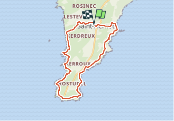
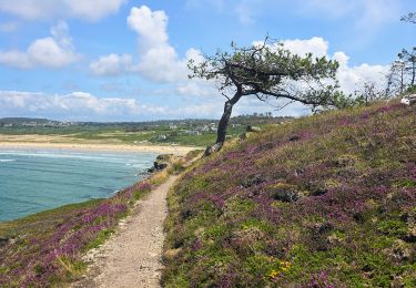
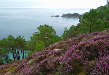
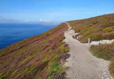
Randonnée Marche de 15,5 km à découvrir à Bretagne, Finistère, Crozon. Cette randonnée est proposée par RonanDAGORN.
Description
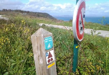
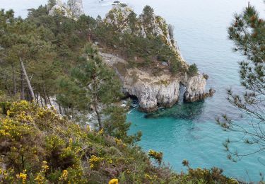
Le cap de la chèvre par le GR 34
Départ de Saint Hernot
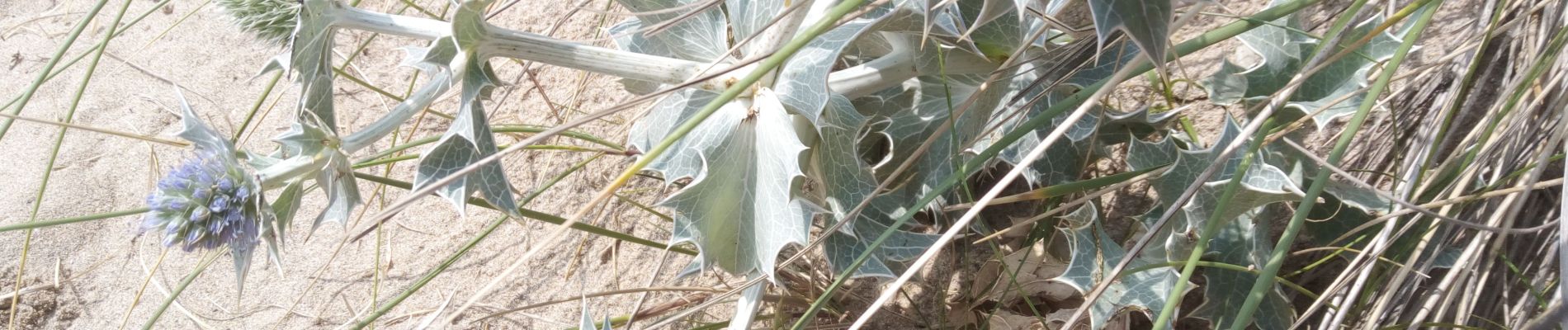
ATTENTION : Ne pas franchir la délimitation installée aux abords de l'Ile Vierge, dont l'accès est désormais interdit, sous peine d'amende
Localisation
Pays :
France
Région :
Bretagne
Département/Province :
Finistère
Commune :
Crozon
Localité :
Unknown
Départ:(Dec)
Départ:(UTM)
386225 ; 5340111 (30U) N.
Commentaires
Randonnées à proximité
![Randonnée Marche Crozon - Cap de La Chèvre - Morgat - Photo](https://media.geolcdn.com/t/375/260/ext.jpg?maxdim=2&url=https%3A%2F%2Fservices.sitytrail.com%2FGeolivesWS%2FDownloadMedia.ashx%3FTrailID%3D214931%26Media%3D15502_6.jpg)
![Marche Marche](https://static1.geolcdn.com/sitytour/trail-icons/101.png)
Cap de La Chèvre - Morgat
Marche
Difficile
(2)
Crozon,
Bretagne,
Finistère,
France
![](/images/other/stat-length.png)
24 km | 32 km-effort
8h 0min
![](https://static1.geolcdn.com/siteimages/upload/files/16400158638029165_repeat_loop_refresh_sync_direction_icon.png)
Oui
![Randonnée Marche Crozon - Plage de Goulien - Château de Dinan - Photo](https://media.geolcdn.com/t/375/260/a821a59d-1597-4c11-b324-eb8b31b346e3.jpg&format=jpg&maxdim=2)
![Marche Marche](https://static1.geolcdn.com/sitytour/trail-icons/101.png)
Plage de Goulien - Château de Dinan
Marche
Moyen
(1)
Crozon,
Bretagne,
Finistère,
France
![](/images/other/stat-length.png)
16,7 km | 21 km-effort
4h 36min
![](https://static1.geolcdn.com/siteimages/upload/files/16400158638029165_repeat_loop_refresh_sync_direction_icon.png)
Oui
![Randonnée Marche Crozon - cap de la chevre - Photo](https://media.geolcdn.com/t/375/260/ext.jpg?maxdim=2&url=https%3A%2F%2Fservices.sitytrail.com%2FGeolivesWS%2FDownloadMedia.ashx%3FTrailID%3D272619%26Media%3Dfix__20140501171602.jpg)
![Marche Marche](https://static1.geolcdn.com/sitytour/trail-icons/101.png)
cap de la chevre
Marche
Facile
(2)
Crozon,
Bretagne,
Finistère,
France
![](/images/other/stat-length.png)
5,5 km | 7,6 km-effort
1h 49min
![](https://static1.geolcdn.com/siteimages/upload/files/16400158638029165_repeat_loop_refresh_sync_direction_icon.png)
Oui
![Randonnée Marche Crozon - GR34 Morgat. -- Pentrez (St Nic) - Photo](https://media.geolcdn.com/t/375/260/9884770b-e302-44c0-98c0-95603b21b679.jpg&format=jpg&maxdim=2)
![Marche Marche](https://static1.geolcdn.com/sitytour/trail-icons/101.png)
GR34 Morgat. -- Pentrez (St Nic)
Marche
Très difficile
Crozon,
Bretagne,
Finistère,
France
![](/images/other/stat-length.png)
25 km | 32 km-effort
7h 11min
![](https://static1.geolcdn.com/siteimages/upload/files/16400158638029165_repeat_loop_refresh_sync_direction_icon.png)
Non
![Randonnée Marche Crozon - Boucle 18 km Morgat Pointe de Dinan - Photo](https://media.geolcdn.com/t/375/260/906c7f38-c7ac-4a9a-92a6-7db29e8ec6c3.jpg&format=jpg&maxdim=2)
![Marche Marche](https://static1.geolcdn.com/sitytour/trail-icons/101.png)
Boucle 18 km Morgat Pointe de Dinan
Marche
Facile
Crozon,
Bretagne,
Finistère,
France
![](/images/other/stat-length.png)
18,1 km | 23 km-effort
4h 29min
![](https://static1.geolcdn.com/siteimages/upload/files/16400158638029165_repeat_loop_refresh_sync_direction_icon.png)
Non
![Randonnée Marche Crozon - Boucle Crozon Morgat Cap de la chèvre 22 km - Photo](https://media.geolcdn.com/t/375/260/57409a5b-a25e-4728-8198-0ff202646598.jpg&format=jpg&maxdim=2)
![Marche Marche](https://static1.geolcdn.com/sitytour/trail-icons/101.png)
Boucle Crozon Morgat Cap de la chèvre 22 km
Marche
Très difficile
Crozon,
Bretagne,
Finistère,
France
![](/images/other/stat-length.png)
22 km | 29 km-effort
6h 39min
![](https://static1.geolcdn.com/siteimages/upload/files/16400158638029165_repeat_loop_refresh_sync_direction_icon.png)
Oui
![Randonnée A pied Crozon - Balade Sonore de l'Île Vierge - Photo](https://media.geolcdn.com/t/375/260/ac2c991a-5f82-4371-a8f3-9daafa6d6f4f.jpeg&format=jpg&maxdim=2)
![A pied A pied](https://static1.geolcdn.com/sitytour/trail-icons/100.png)
Balade Sonore de l'Île Vierge
A pied
Facile
Crozon,
Bretagne,
Finistère,
France
![](/images/other/stat-length.png)
3,4 km | 4,6 km-effort
1h 2min
![](https://static1.geolcdn.com/siteimages/upload/files/16400158638029165_repeat_loop_refresh_sync_direction_icon.png)
Non
![Randonnée Marche Crozon - Pointe de Morgat - Cap de la Chèvre Boucle GR34 - 19.7km 500m 6h00 - 2019 09 13 - Photo](https://media.geolcdn.com/t/375/260/d3296e61-dbfe-4a93-8009-ac34d44b4d59.jpg&format=jpg&maxdim=2)
![Marche Marche](https://static1.geolcdn.com/sitytour/trail-icons/101.png)
Pointe de Morgat - Cap de la Chèvre Boucle GR34 - 19.7km 500m 6h00 - 2019 09 13
Marche
Difficile
Crozon,
Bretagne,
Finistère,
France
![](/images/other/stat-length.png)
19,7 km | 26 km-effort
6h 0min
![](https://static1.geolcdn.com/siteimages/upload/files/16400158638029165_repeat_loop_refresh_sync_direction_icon.png)
Oui
![Randonnée Marche Crozon - Cap de la Chèvre - Pointe de Dinan Plage de Goulien - 26.4km 600m 7h50 (40mn) - 2019 09 08 - Photo](https://media.geolcdn.com/t/375/260/ae852dc1-96f2-47e4-ae8a-f2c506618a31.jpg&format=jpg&maxdim=2)
![Marche Marche](https://static1.geolcdn.com/sitytour/trail-icons/101.png)
Cap de la Chèvre - Pointe de Dinan Plage de Goulien - 26.4km 600m 7h50 (40mn)...
Marche
Moyen
Crozon,
Bretagne,
Finistère,
France
![](/images/other/stat-length.png)
26 km | 34 km-effort
7h 50min
![](https://static1.geolcdn.com/siteimages/upload/files/16400158638029165_repeat_loop_refresh_sync_direction_icon.png)
Oui