![](/images/other/stat-length.png)
![Randonnée Marche Audierne - GR34 réel Audierne (Esqibien) à Pointe du Van 25 320m +460m - Photo](https://media.geolcdn.com/t/1900/400/ext.pjpeg?maxdim=2&url=https%3A%2F%2Fstatic1.geolcdn.com%2Fsiteimages%2Fupload%2Ffiles%2F1553511878bg_sport_marche.png)
GR34 réel Audierne (Esqibien) à Pointe du Van 25 320m +460m
DanielROLLET
Utilisateur
![Longueur](/images/other/stat-length.png)
Longueur
25 km
![Altitude max](https://static1.geolcdn.com/siteimages/upload/files/1508320355ic_sort_altitude_max_24dp.png)
Altitude max
67 m
![Dénivelé positif](https://static1.geolcdn.com/siteimages/upload/files/1508320355ic_sort_den_pos_24dp.png)
Dénivelé positif
460 m
![Km-Effort](/images/other/stat-length.png)
Km-Effort
31 km
![Altitude min](https://static1.geolcdn.com/siteimages/upload/files/1508320355ic_sort_altitude_min_24dp.png)
Altitude min
0 m
![Dénivelé négatif](https://static1.geolcdn.com/siteimages/upload/files/1508320355ic_sort_den_neg_24dp.png)
Dénivelé négatif
398 m
![Boucle](https://static1.geolcdn.com/siteimages/upload/files/16400158638029165_repeat_loop_refresh_sync_direction_icon.png)
Boucle
Non
Date de création :
2021-07-31 06:52:12.816
Dernière modification :
2021-08-01 07:36:36.398
![Marche](https://static1.geolcdn.com/sitytour/trail-icons/101.png)
8h20
Difficulté : Très difficile
![Scannez ce code QR pour ouvrir la randonnée dans l'application SityTrail](https://capi.geolives.com/qq0zvz2zws4bq2lad0pu/sitytour/trails/2880557/qr.png?size=200)
Application GPS de randonnée GRATUITE
À propos
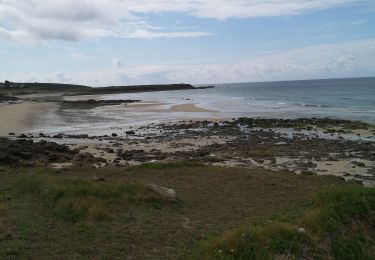
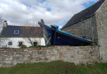
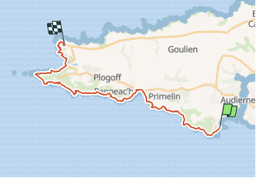
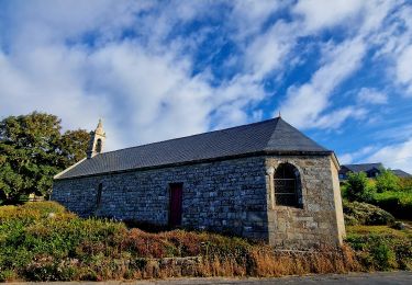
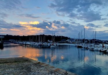
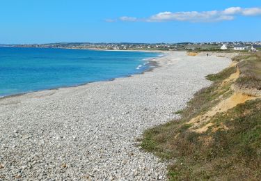
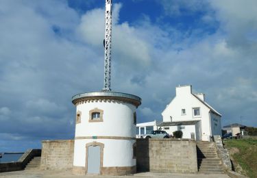
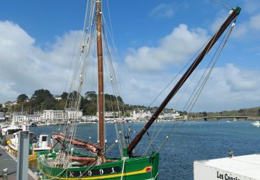
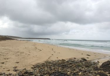
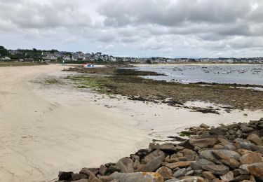
Randonnée Marche de 25 km à découvrir à Bretagne, Finistère, Audierne. Cette randonnée est proposée par DanielROLLET.
Description
2021 07 30 - 8h50 à 17h10
Départ de Douarnenez 7h50 en bus à Esqudient (embarquement) et retour depuis le parking de la Pointe du Van en bus à 17h20
Marquage trés mauvais (absent, déficient...)
Localisation
Pays :
France
Région :
Bretagne
Département/Province :
Finistère
Commune :
Audierne
Localité :
Esquibien
Départ:(Dec)
Départ:(UTM)
383866 ; 5318131 (30U) N.
Commentaires
Randonnées à proximité
![Randonnée Marche Audierne - TREK RCY GR34 2022 J5 Audierne - Du gite à l'embarcadère - Photo](https://media.geolcdn.com/t/375/260/c8ceb096-71a9-4fb0-a364-a75aaaad50cc.jpg&format=jpg&maxdim=2)
![Marche Marche](https://static1.geolcdn.com/sitytour/trail-icons/101.png)
TREK RCY GR34 2022 J5 Audierne - Du gite à l'embarcadère
Marche
Très facile
Audierne,
Bretagne,
Finistère,
France
![](/images/other/stat-length.png)
4,5 km | 5,4 km-effort
1h 0min
![](https://static1.geolcdn.com/siteimages/upload/files/16400158638029165_repeat_loop_refresh_sync_direction_icon.png)
Non
![Randonnée Marche Plouhinec - TREK RCY GR34 2022 Audierne sortie du soir - Photo](https://media.geolcdn.com/t/375/260/9c4fe132-0a7a-4a88-96fa-7615fd476d7b.jpg&format=jpg&maxdim=2)
![Marche Marche](https://static1.geolcdn.com/sitytour/trail-icons/101.png)
TREK RCY GR34 2022 Audierne sortie du soir
Marche
Facile
Plouhinec,
Bretagne,
Finistère,
France
![](/images/other/stat-length.png)
3,8 km | 4,8 km-effort
1h 13min
![](https://static1.geolcdn.com/siteimages/upload/files/16400158638029165_repeat_loop_refresh_sync_direction_icon.png)
Oui
![Randonnée Marche Plouhinec - GR34 Audierne -- Hôtel Breiz Armor (Penhors) - Photo](https://media.geolcdn.com/t/375/260/ff6b2cca-7803-413b-a829-456b8afa9c53.jpg&format=jpg&maxdim=2)
![Marche Marche](https://static1.geolcdn.com/sitytour/trail-icons/101.png)
GR34 Audierne -- Hôtel Breiz Armor (Penhors)
Marche
Très difficile
Plouhinec,
Bretagne,
Finistère,
France
![](/images/other/stat-length.png)
19 km | 21 km-effort
4h 50min
![](https://static1.geolcdn.com/siteimages/upload/files/16400158638029165_repeat_loop_refresh_sync_direction_icon.png)
Non
![Randonnée Marche Audierne - Audierne , Pointe du Raz - Photo](https://media.geolcdn.com/t/375/260/b1cf5526-8dea-48df-b3da-3e2322cb85ca.jpg&format=jpg&maxdim=2)
![Marche Marche](https://static1.geolcdn.com/sitytour/trail-icons/101.png)
Audierne , Pointe du Raz
Marche
Difficile
Audierne,
Bretagne,
Finistère,
France
![](/images/other/stat-length.png)
23 km | 27 km-effort
5h 22min
![](https://static1.geolcdn.com/siteimages/upload/files/16400158638029165_repeat_loop_refresh_sync_direction_icon.png)
Non
![Randonnée Marche Audierne - Audierne , Pont Croix,Audierne - Photo](https://media.geolcdn.com/t/375/260/7971b1fa-6d8e-431f-b3a1-18ec437e51ea.jpg&format=jpg&maxdim=2)
![Marche Marche](https://static1.geolcdn.com/sitytour/trail-icons/101.png)
Audierne , Pont Croix,Audierne
Marche
Moyen
Audierne,
Bretagne,
Finistère,
France
![](/images/other/stat-length.png)
17,7 km | 22 km-effort
3h 59min
![](https://static1.geolcdn.com/siteimages/upload/files/16400158638029165_repeat_loop_refresh_sync_direction_icon.png)
Oui
![Randonnée Marche Primelin - Primelin - Photo](https://media.geolcdn.com/t/375/260/e9bb4270-c545-4dc1-bef9-cc78994ac423.jpg&format=jpg&maxdim=2)
![Marche Marche](https://static1.geolcdn.com/sitytour/trail-icons/101.png)
Primelin
Marche
Très facile
Primelin,
Bretagne,
Finistère,
France
![](/images/other/stat-length.png)
8,3 km | 9,5 km-effort
2h 34min
![](https://static1.geolcdn.com/siteimages/upload/files/16400158638029165_repeat_loop_refresh_sync_direction_icon.png)
Oui
![Randonnée Marche Audierne - Audierne - Esquibien - Photo](https://media.geolcdn.com/t/375/260/436a95d4-8c2c-418c-a40b-e8085addf12b.jpg&format=jpg&maxdim=2)
![Marche Marche](https://static1.geolcdn.com/sitytour/trail-icons/101.png)
Audierne - Esquibien
Marche
Moyen
Audierne,
Bretagne,
Finistère,
France
![](/images/other/stat-length.png)
16,4 km | 18,8 km-effort
4h 28min
![](https://static1.geolcdn.com/siteimages/upload/files/16400158638029165_repeat_loop_refresh_sync_direction_icon.png)
Oui
![Randonnée Marche Audierne - custrein - Photo](https://media.geolcdn.com/t/375/260/d7985a5c-7fde-4541-afcb-b2d94a714eb9.jpg&format=jpg&maxdim=2)
![Marche Marche](https://static1.geolcdn.com/sitytour/trail-icons/101.png)
![Randonnée Marche Plouhinec - PLOUHINEC - Photo](https://media.geolcdn.com/t/375/260/a337ed1a-2a6d-44e3-ba47-36df95ef4161.jpg&format=jpg&maxdim=2)
![Marche Marche](https://static1.geolcdn.com/sitytour/trail-icons/101.png)