![](/images/other/stat-length.png)
![Randonnée Autre activité Arcachon - Arcachon - Ville d'hivers en train - Photo](https://media.geolcdn.com/t/1900/400/4e028493-ab15-4bc2-939a-aa95fe826031.jpg&format=pjpeg&maxdim=2)
Arcachon - Ville d'hivers en train
Sigmut
Utilisateur
![Longueur](/images/other/stat-length.png)
Longueur
5,3 km
![Altitude max](https://static1.geolcdn.com/siteimages/upload/files/1508320355ic_sort_altitude_max_24dp.png)
Altitude max
37 m
![Dénivelé positif](https://static1.geolcdn.com/siteimages/upload/files/1508320355ic_sort_den_pos_24dp.png)
Dénivelé positif
93 m
![Km-Effort](/images/other/stat-length.png)
Km-Effort
6,6 km
![Altitude min](https://static1.geolcdn.com/siteimages/upload/files/1508320355ic_sort_altitude_min_24dp.png)
Altitude min
6 m
![Dénivelé négatif](https://static1.geolcdn.com/siteimages/upload/files/1508320355ic_sort_den_neg_24dp.png)
Dénivelé négatif
93 m
![Boucle](https://static1.geolcdn.com/siteimages/upload/files/16400158638029165_repeat_loop_refresh_sync_direction_icon.png)
Boucle
Oui
Date de création :
2021-07-27 14:54:12.731
Dernière modification :
2023-01-22 13:55:29.352
![Autre activité](https://static1.geolcdn.com/sitytour/trail-icons/900.png)
41m
Difficulté : Très facile
![Scannez ce code QR pour ouvrir la randonnée dans l'application SityTrail](https://capi.geolives.com/qq0zvz2zws4bq2lad0pu/sitytour/trails/2876009/qr.png?size=200)
Application GPS de randonnée GRATUITE
À propos
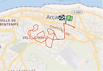
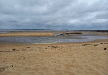
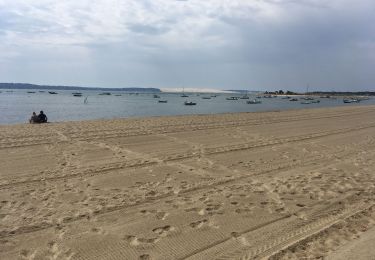
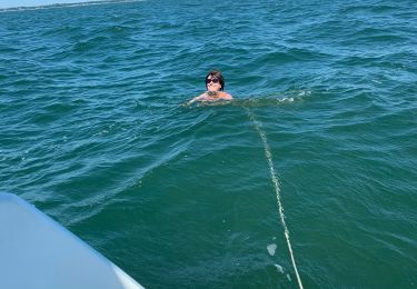
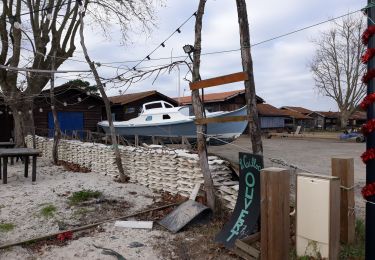
Randonnée Autre activité de 5,3 km à découvrir à Nouvelle-Aquitaine, Gironde, Arcachon. Cette randonnée est proposée par Sigmut.
Description
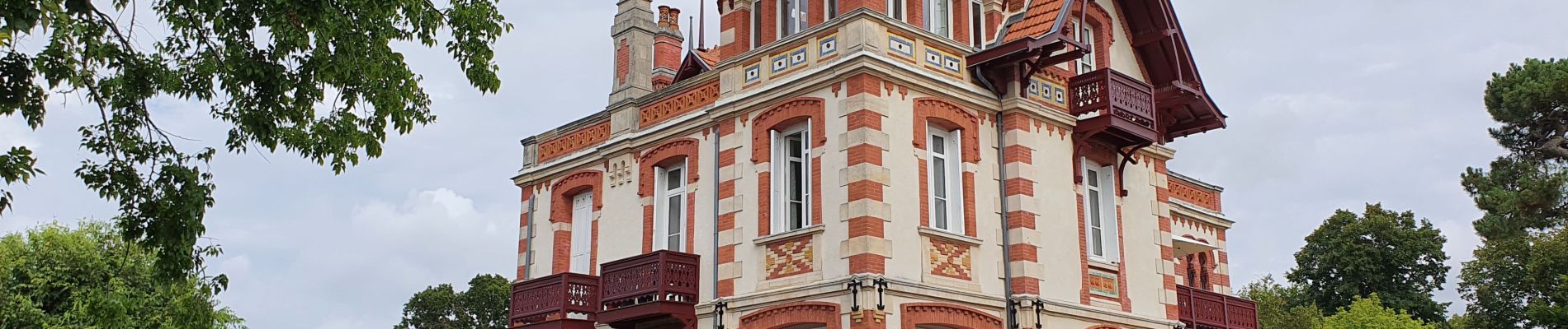
Balade en "petit train" très intéressante pour découvrir toutes les belles demeures d'Arcachon. Commentaires très riches sur la ville d'hivers. A faire...
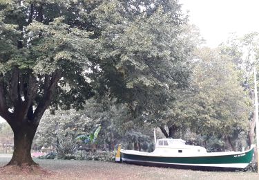
Localisation
Pays :
France
Région :
Nouvelle-Aquitaine
Département/Province :
Gironde
Commune :
Arcachon
Localité :
Unknown
Départ:(Dec)
Départ:(UTM)
645252 ; 4946817 (30T) N.
Commentaires
Randonnées à proximité
![Randonnée Marche La Teste-de-Buch - les prés salés La teste - Photo](https://media.geolcdn.com/t/375/260/86be3924-c0ab-4aef-aa85-26c1d81d9feb.jpg&format=jpg&maxdim=2)
![Marche Marche](https://static1.geolcdn.com/sitytour/trail-icons/101.png)
les prés salés La teste
Marche
Très facile
(1)
La Teste-de-Buch,
Nouvelle-Aquitaine,
Gironde,
France
![](/images/other/stat-length.png)
5,7 km | 6,1 km-effort
1h 20min
![](https://static1.geolcdn.com/siteimages/upload/files/16400158638029165_repeat_loop_refresh_sync_direction_icon.png)
Non
![Randonnée Vélo La Teste-de-Buch - Petit tour du lac de Cazaux - Photo](https://media.geolcdn.com/t/375/260/ext.jpg?maxdim=2&url=https%3A%2F%2Fstatic1.geolcdn.com%2Fsiteimages%2Fupload%2Ffiles%2F1524743154velo.jpg)
![Vélo Vélo](https://static1.geolcdn.com/sitytour/trail-icons/200.png)
Petit tour du lac de Cazaux
Vélo
Moyen
(2)
La Teste-de-Buch,
Nouvelle-Aquitaine,
Gironde,
France
![](/images/other/stat-length.png)
77 km | 85 km-effort
4h 52min
![](https://static1.geolcdn.com/siteimages/upload/files/16400158638029165_repeat_loop_refresh_sync_direction_icon.png)
Oui
![Randonnée Marche Arcachon - Arcachon la Ville d'hiver 12.4.23 - Photo](https://media.geolcdn.com/t/375/260/0f63231a-28b2-43af-9681-63c0b1170e0b.jpg&format=jpg&maxdim=2)
![Marche Marche](https://static1.geolcdn.com/sitytour/trail-icons/101.png)
Arcachon la Ville d'hiver 12.4.23
Marche
Facile
Arcachon,
Nouvelle-Aquitaine,
Gironde,
France
![](/images/other/stat-length.png)
4,7 km | 5,6 km-effort
1h 40min
![](https://static1.geolcdn.com/siteimages/upload/files/16400158638029165_repeat_loop_refresh_sync_direction_icon.png)
Non
![Randonnée Vélo de route Arcachon - Les 7 Ports de Gujan-Mestras 10.4.23 - Photo](https://media.geolcdn.com/t/375/260/213dfc89-ffa2-46b8-937f-c84c5fcea237.jpg&format=jpg&maxdim=2)
![Vélo de route Vélo de route](https://static1.geolcdn.com/sitytour/trail-icons/201.png)
Les 7 Ports de Gujan-Mestras 10.4.23
Vélo de route
Moyen
Arcachon,
Nouvelle-Aquitaine,
Gironde,
France
![](/images/other/stat-length.png)
39 km | 41 km-effort
5h 0min
![](https://static1.geolcdn.com/siteimages/upload/files/16400158638029165_repeat_loop_refresh_sync_direction_icon.png)
Oui
![Randonnée Marche Arcachon - Cap Ferret - Photo](https://media.geolcdn.com/t/375/260/4357a232-66f1-489d-8cf5-6ae07a45b22a.jpg&format=jpg&maxdim=2)
![Marche Marche](https://static1.geolcdn.com/sitytour/trail-icons/101.png)
Cap Ferret
Marche
Difficile
Arcachon,
Nouvelle-Aquitaine,
Gironde,
France
![](/images/other/stat-length.png)
12,5 km | 13,2 km-effort
2h 11min
![](https://static1.geolcdn.com/siteimages/upload/files/16400158638029165_repeat_loop_refresh_sync_direction_icon.png)
Non
![Randonnée Bateau à moteur Arcachon - Samedi 18/07 randobateau - Photo](https://media.geolcdn.com/t/375/260/e2d4611d-4530-46ac-8ef4-ac29eadd9a06.jpg&format=jpg&maxdim=2)
![Bateau à moteur Bateau à moteur](https://static1.geolcdn.com/sitytour/trail-icons/701.png)
Samedi 18/07 randobateau
Bateau à moteur
Arcachon,
Nouvelle-Aquitaine,
Gironde,
France
![](/images/other/stat-length.png)
5,7 km | 5,7 km-effort
26min
![](https://static1.geolcdn.com/siteimages/upload/files/16400158638029165_repeat_loop_refresh_sync_direction_icon.png)
Non
![Randonnée Marche La Teste-de-Buch - les prés salés ouest - Photo](https://media.geolcdn.com/t/375/260/8d55b261-46ee-4fee-b4e3-b587276c9c55.jpg&format=jpg&maxdim=2)
![Marche Marche](https://static1.geolcdn.com/sitytour/trail-icons/101.png)
les prés salés ouest
Marche
Très facile
La Teste-de-Buch,
Nouvelle-Aquitaine,
Gironde,
France
![](/images/other/stat-length.png)
5,2 km | 5,4 km-effort
2h 1min
![](https://static1.geolcdn.com/siteimages/upload/files/16400158638029165_repeat_loop_refresh_sync_direction_icon.png)
Oui
![Randonnée Marche Arcachon - ARCACHON Ville d'Hiver et Parc Mauresque - Photo](https://media.geolcdn.com/t/375/260/ext.jpg?maxdim=2&url=https%3A%2F%2Fstatic1.geolcdn.com%2Fsiteimages%2Fupload%2Ffiles%2F1553511878bg_sport_marche.png)
![Marche Marche](https://static1.geolcdn.com/sitytour/trail-icons/101.png)
ARCACHON Ville d'Hiver et Parc Mauresque
Marche
Facile
(1)
Arcachon,
Nouvelle-Aquitaine,
Gironde,
France
![](/images/other/stat-length.png)
6 km | 7 km-effort
1h 38min
![](https://static1.geolcdn.com/siteimages/upload/files/16400158638029165_repeat_loop_refresh_sync_direction_icon.png)
Oui
![Randonnée Marche Arcachon - circuit dans Arcachon - Photo](https://media.geolcdn.com/t/375/260/aa4688fb-0dc1-4a43-bdaa-c2684c95b547.jpg&format=jpg&maxdim=2)
![Marche Marche](https://static1.geolcdn.com/sitytour/trail-icons/101.png)
circuit dans Arcachon
Marche
Très facile
Arcachon,
Nouvelle-Aquitaine,
Gironde,
France
![](/images/other/stat-length.png)
4,9 km | 5,7 km-effort
1h 49min
![](https://static1.geolcdn.com/siteimages/upload/files/16400158638029165_repeat_loop_refresh_sync_direction_icon.png)
Oui