![](/images/other/stat-length.png)
![Randonnée Marche Puget-sur-Argens - Balade des trois lacs allongée - Photo](https://media.geolcdn.com/t/1900/400/ext.pjpeg?maxdim=2&url=https%3A%2F%2Fstatic1.geolcdn.com%2Fsiteimages%2Fupload%2Ffiles%2F1553511878bg_sport_marche.png)
Balade des trois lacs allongée
fabetfab
Utilisateur
![Longueur](/images/other/stat-length.png)
Longueur
8,7 km
![Altitude max](https://static1.geolcdn.com/siteimages/upload/files/1508320355ic_sort_altitude_max_24dp.png)
Altitude max
150 m
![Dénivelé positif](https://static1.geolcdn.com/siteimages/upload/files/1508320355ic_sort_den_pos_24dp.png)
Dénivelé positif
143 m
![Km-Effort](/images/other/stat-length.png)
Km-Effort
10,6 km
![Altitude min](https://static1.geolcdn.com/siteimages/upload/files/1508320355ic_sort_altitude_min_24dp.png)
Altitude min
55 m
![Dénivelé négatif](https://static1.geolcdn.com/siteimages/upload/files/1508320355ic_sort_den_neg_24dp.png)
Dénivelé négatif
144 m
![Boucle](https://static1.geolcdn.com/siteimages/upload/files/16400158638029165_repeat_loop_refresh_sync_direction_icon.png)
Boucle
Oui
Date de création :
2021-07-22 09:20:32.769
Dernière modification :
2021-07-22 09:32:17.466
![Marche](https://static1.geolcdn.com/sitytour/trail-icons/101.png)
2h24
Difficulté : Moyen
![Scannez ce code QR pour ouvrir la randonnée dans l'application SityTrail](https://capi.geolives.com/qq0zvz2zws4bq2lad0pu/sitytour/trails/2869759/qr.png?size=200)
Application GPS de randonnée GRATUITE
À propos
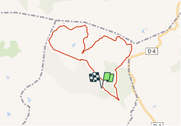
Randonnée Marche de 8,7 km à découvrir à Provence-Alpes-Côte d'Azur, Var, Puget-sur-Argens. Cette randonnée est proposée par fabetfab.
Description
Ballade en boucle, uniquement sur de larges pistes souvent légèrement ombragées qui font découvrir trois petits lacs d'altitude dans le bois du Defens. Parking aisé et coin pique-nique au départ, à l'entrée du Domaine de la Lieutenante.
Localisation
Pays :
France
Région :
Provence-Alpes-Côte d'Azur
Département/Province :
Var
Commune :
Puget-sur-Argens
Localité :
Unknown
Départ:(Dec)
Départ:(UTM)
313709 ; 4818544 (32T) N.
Commentaires
Randonnées à proximité
![Randonnée Marche Puget-sur-Argens - La Lieutenante Anc. Meulière Sce St Martin - Photo](https://media.geolcdn.com/t/375/260/f785d328-8629-4b96-81e2-754ca59456cd.jpg&format=jpg&maxdim=2)
![Marche Marche](https://static1.geolcdn.com/sitytour/trail-icons/101.png)
La Lieutenante Anc. Meulière Sce St Martin
Marche
Très facile
(1)
Puget-sur-Argens,
Provence-Alpes-Côte d'Azur,
Var,
France
![](/images/other/stat-length.png)
11,2 km | 14,2 km-effort
3h 32min
![](https://static1.geolcdn.com/siteimages/upload/files/16400158638029165_repeat_loop_refresh_sync_direction_icon.png)
Oui
![Randonnée V.T.T. Puget-sur-Argens - Forêt de la Colle du Rouet aux Gorges de Blavet - Fréjus - Photo](https://media.geolcdn.com/t/375/260/ext.jpg?maxdim=2&url=https%3A%2F%2Fservices.sitytrail.com%2FGeolivesWS%2FDownloadMedia.ashx%3FTrailID%3D191635%26Media%3D15278_6.jpg)
![V.T.T. V.T.T.](https://static1.geolcdn.com/sitytour/trail-icons/202.png)
Forêt de la Colle du Rouet aux Gorges de Blavet - Fréjus
V.T.T.
Difficile
(1)
Puget-sur-Argens,
Provence-Alpes-Côte d'Azur,
Var,
France
![](/images/other/stat-length.png)
23 km | 28 km-effort
3h 0min
![](https://static1.geolcdn.com/siteimages/upload/files/16400158638029165_repeat_loop_refresh_sync_direction_icon.png)
Oui
![Randonnée Marche Bagnols-en-Forêt - La Colle du Rouet par le Castel Diaou - Le Muy - Photo](https://media.geolcdn.com/t/375/260/ext.jpg?maxdim=2&url=https%3A%2F%2Fservices.sitytrail.com%2FGeolivesWS%2FDownloadMedia.ashx%3FTrailID%3D191579%26Media%3D15205_3.jpg)
![Marche Marche](https://static1.geolcdn.com/sitytour/trail-icons/101.png)
La Colle du Rouet par le Castel Diaou - Le Muy
Marche
Difficile
(2)
Bagnols-en-Forêt,
Provence-Alpes-Côte d'Azur,
Var,
France
![](/images/other/stat-length.png)
18,2 km | 27 km-effort
6h 0min
![](https://static1.geolcdn.com/siteimages/upload/files/16400158638029165_repeat_loop_refresh_sync_direction_icon.png)
Oui
![Randonnée Marche Fréjus - barage du malpasser - Photo](https://media.geolcdn.com/t/375/260/ext.jpg?maxdim=2&url=https%3A%2F%2Fservices.sitytrail.com%2FGeolivesWS%2FDownloadMedia.ashx%3FTrailID%3D232087%26Media%3Dfix__20131111135300.jpg)
![Marche Marche](https://static1.geolcdn.com/sitytour/trail-icons/101.png)
barage du malpasser
Marche
Très facile
(1)
Fréjus,
Provence-Alpes-Côte d'Azur,
Var,
France
![](/images/other/stat-length.png)
5,1 km | 7,6 km-effort
1h 55min
![](https://static1.geolcdn.com/siteimages/upload/files/16400158638029165_repeat_loop_refresh_sync_direction_icon.png)
Oui
![Randonnée A pied Puget-sur-Argens - PUGET SUR ARGENS- gazoduc-Terres Gastes DRI - Photo](https://media.geolcdn.com/t/375/260/ext.jpg?maxdim=2&url=https%3A%2F%2Fstatic1.geolcdn.com%2Fsiteimages%2Fupload%2Ffiles%2F1545311037marcheuse_200dpi.jpg)
![A pied A pied](https://static1.geolcdn.com/sitytour/trail-icons/100.png)
PUGET SUR ARGENS- gazoduc-Terres Gastes DRI
A pied
Facile
(1)
Puget-sur-Argens,
Provence-Alpes-Côte d'Azur,
Var,
France
![](/images/other/stat-length.png)
7,7 km | 8,9 km-effort
2h 1min
![](https://static1.geolcdn.com/siteimages/upload/files/16400158638029165_repeat_loop_refresh_sync_direction_icon.png)
Oui
![Randonnée A pied Bagnols-en-Forêt - BAGNOLS EN FORET- Bois du défens DRI - Photo](https://media.geolcdn.com/t/375/260/ext.jpg?maxdim=2&url=https%3A%2F%2Fstatic1.geolcdn.com%2Fsiteimages%2Fupload%2Ffiles%2F1545311037marcheuse_200dpi.jpg)
![A pied A pied](https://static1.geolcdn.com/sitytour/trail-icons/100.png)
BAGNOLS EN FORET- Bois du défens DRI
A pied
Facile
(2)
Bagnols-en-Forêt,
Provence-Alpes-Côte d'Azur,
Var,
France
![](/images/other/stat-length.png)
9,3 km | 12,7 km-effort
2h 52min
![](https://static1.geolcdn.com/siteimages/upload/files/16400158638029165_repeat_loop_refresh_sync_direction_icon.png)
Oui
![Randonnée Marche Bagnols-en-Forêt - Gorges du Blavet au col de la pierre du coucou - Photo](https://media.geolcdn.com/t/375/260/09e580ef-d921-4dee-80f6-a698afe27096.jpg&format=jpg&maxdim=2)
![Marche Marche](https://static1.geolcdn.com/sitytour/trail-icons/101.png)
Gorges du Blavet au col de la pierre du coucou
Marche
Difficile
Bagnols-en-Forêt,
Provence-Alpes-Côte d'Azur,
Var,
France
![](/images/other/stat-length.png)
15,8 km | 22 km-effort
4h 44min
![](https://static1.geolcdn.com/siteimages/upload/files/16400158638029165_repeat_loop_refresh_sync_direction_icon.png)
Oui
![Randonnée sport Bagnols-en-Forêt - Gorges de Blavet pays de Fayence - Photo](https://media.geolcdn.com/t/375/260/752b007a-5919-43b0-bdb0-68a447f575ab.jpg&format=jpg&maxdim=2)
Gorges de Blavet pays de Fayence
sport
Très facile
Bagnols-en-Forêt,
Provence-Alpes-Côte d'Azur,
Var,
France
![](/images/other/stat-length.png)
10,2 km | 16,9 km-effort
Inconnu
![](https://static1.geolcdn.com/siteimages/upload/files/16400158638029165_repeat_loop_refresh_sync_direction_icon.png)
Oui
![Randonnée sport Bagnols-en-Forêt - Bagnols en Forêt les meules - Photo](https://media.geolcdn.com/t/375/260/4bb66a92-f34f-4592-9bb4-da4e654f5bf9.jpg&format=jpg&maxdim=2)
Bagnols en Forêt les meules
sport
Très facile
Bagnols-en-Forêt,
Provence-Alpes-Côte d'Azur,
Var,
France
![](/images/other/stat-length.png)
14,3 km | 20 km-effort
Inconnu
![](https://static1.geolcdn.com/siteimages/upload/files/16400158638029165_repeat_loop_refresh_sync_direction_icon.png)
Oui